Warner Creek

Warner Creek Stream Assessment
Greene and Ulster Counties, New York
Ulster County Soil and Water Conservation District
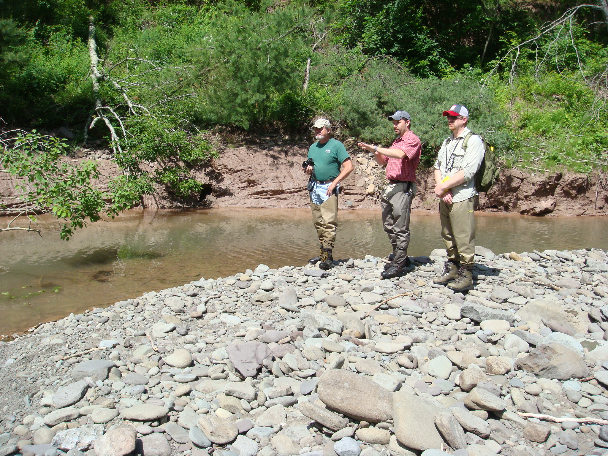
Warner Creek , a third order tributary to the Stony Clove Creek in the Esopus Creek and Ashokan Reservoir drainage basin, is located in the Catskill Mountain region of New York. The Warner Creek watershed is 8.68 square miles at the downstream end of the project reach. Clear Creeks Consulting was contracted by Ulster County Soil and Water Conservation District to conduct an assessment of and develop preliminary restoration design plans for 7,000 linear feet of Warner Creek. Mr. Powell served as Project Manager, Senior Scientist and Restoration Designer for the project. BayLand Consultants and Designers, Inc.; Daniel G. Loucks, P.E., Geotechnical Engineer; Foothills Consulting and Big Eagle Surveying provided engineering and surveying support services.
A Preliminary Design Report was prepared that included a narrative summary of the findings of the field studies, modeling and geotechnical investigations. Geomorphic and geotechnical recommendations were developed to address channel and slope stability problems. Preliminary Design Plans were developed for the restoration of five separate channel restoration project reaches and two specific slope failure sites. Cost estimates for final design and construction were developed for each project area. This work was completed in 2011.
PROJECT OBJECTIVES
New York City’s drinking water is supplied by a system of streams, reservoirs and interconnecting aqueducts located in the Catskill and Delaware watersheds. The United States Environmental Protection Agency (USEPA), in its December 31, 1993 Filtration Avoidance Determination pursuant to the federal Safe Drinking Water Act, stated that New York City must develop a strategy of best management practices (BMPs) to reduce turbidity in the Ashokan and Schoharie Reservoir basins. The New York City Department of Environmental Protection (NYCDEP) is responsible for developing and implementing the turbidity reduction strategy. Soil and Water Conservation Districts (SWCD) from several counties in the Catskill and Delaware watersheds have cooperated with NYCDEP on the implementation of projects focused on turbidity reduction.
Monitoring conducted by NYCDEP identified the Stony Clove Creek as a significant contributor to the turbidity problems in the Catskill watershed.
Warner Creek was identified as a significant contributor of turbidity in the Stony Clove basin. It is the intention of the Ulster County SWCD to correct the stream channel instability problems, improve water quality, enhance and/or restore natural floodplain characteristics, and reduce impacts to private property and public infrastructure by implementing an effective, long-term stream restoration plan for these reaches of Warner Creek.
Assessment
- Evaluation of Climate Data
- GIS Mapping and Analysis
- Evaluation of Historic Aerial Photographs
- Field-Run Topographic Survey for the channel, floodplain and terraces along the 7,000 LF project reach.
- Geomorphic Mapping including eroding banks, failing slopes, debris jams, sediment bars, head cuts, etc.
- Level II Morphological Survey and Level III Channel Stability Assessments
- Hydrologic Analysis of Peak Discharges and Developing Estimates of Bankfull Discharge.
- Geotechnical Investigations of Specific Slope Failure Sites.
- Developing Geomorphic Design Criteria and Conducting Sediment Entrainment Analysis.
PROJECT DETAILS
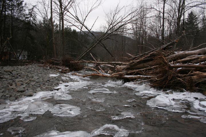
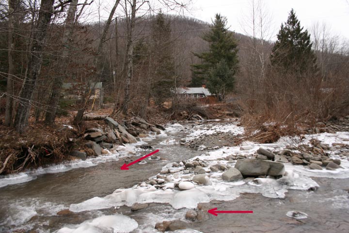
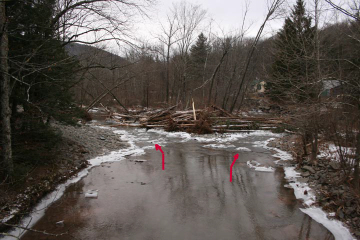
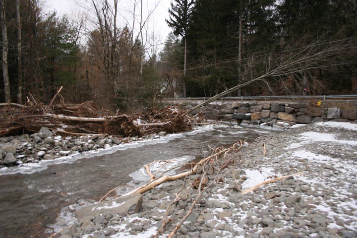
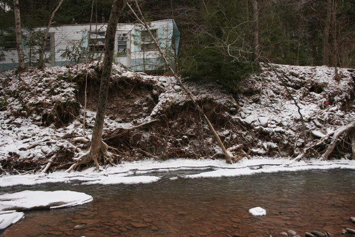
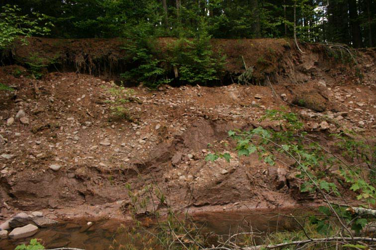
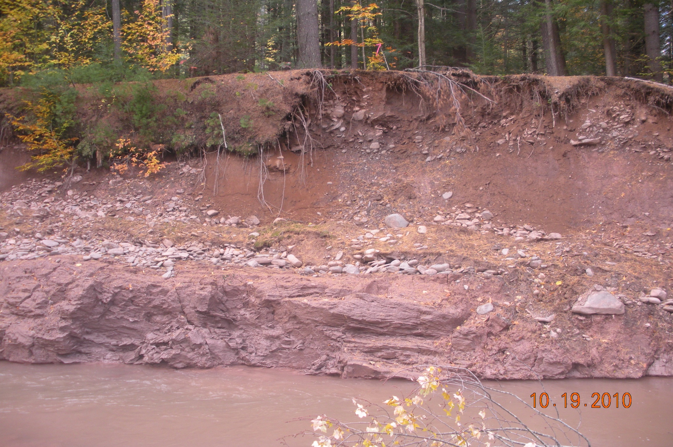
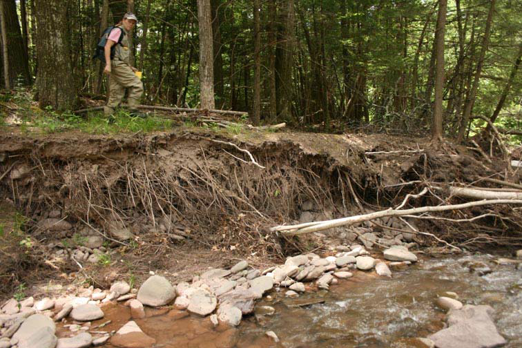
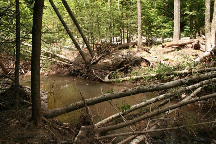
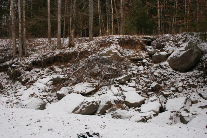
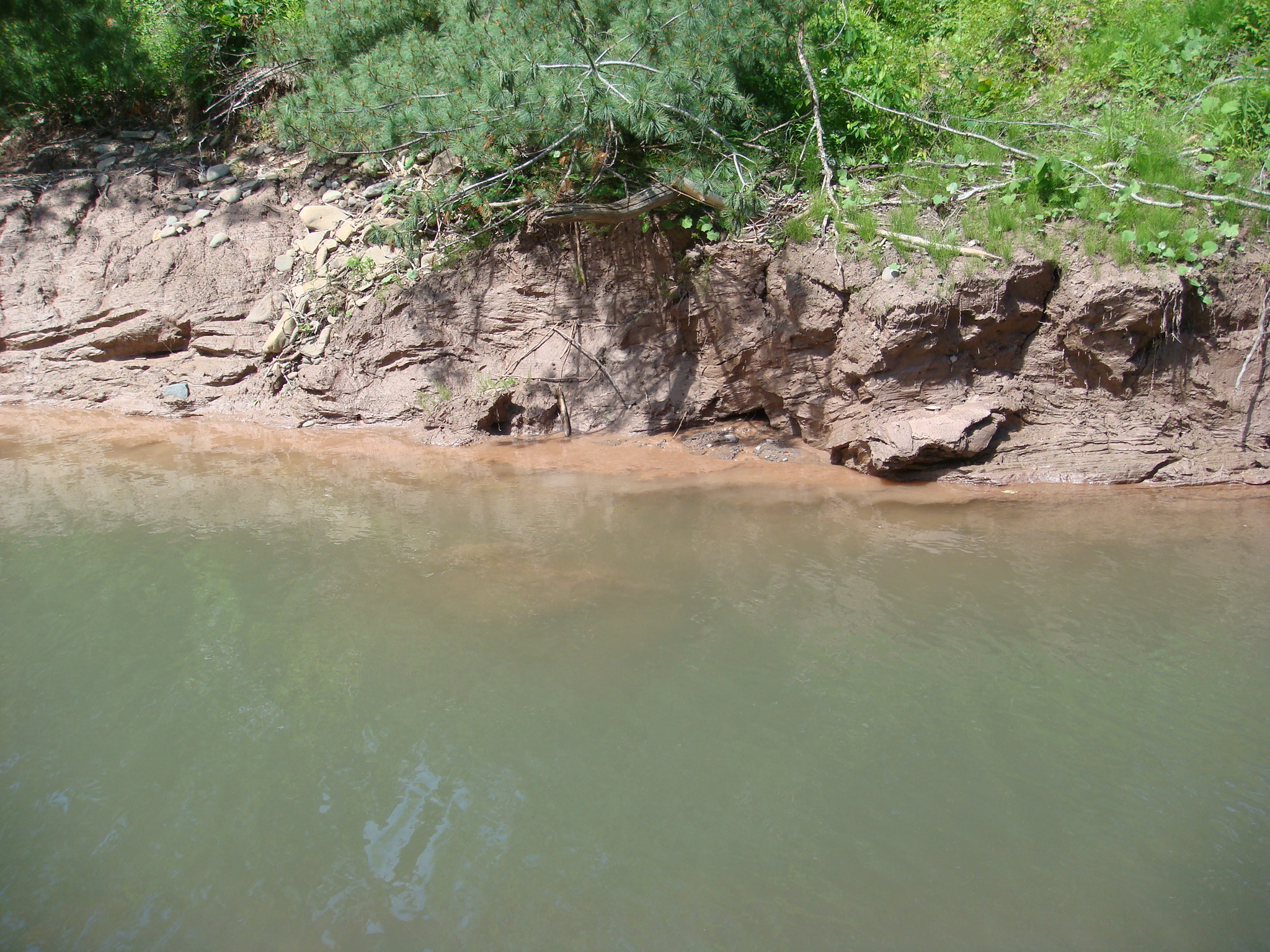
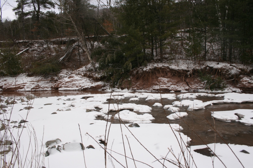
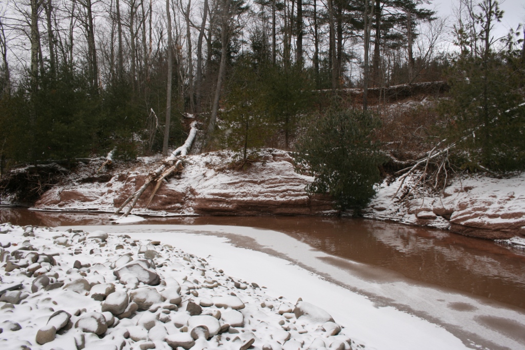
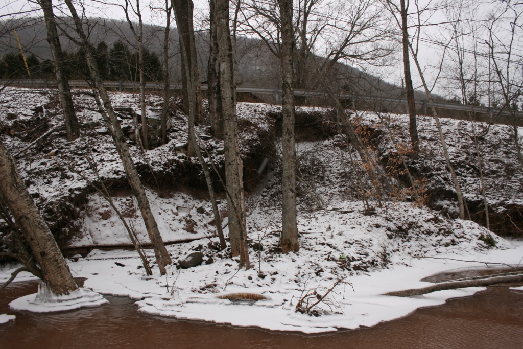
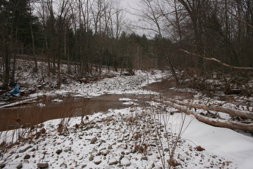
The assessment documented highly degraded conditions that included severe bank erosion, slope failures, exposed glacio-lacustrine silts and clays that contribute to continuous releases of fine sediments, high turbidity and degraded water quality. Compounding these problems, the channel is plagued by cycles of severe aggradation including channel avulsions, mid-channel and lateral bars followed by channel incision with multiple head-cuts actively migrating through large deposits of cobble, gravel and small boulders. Large debris jams as well as obstructions at private and public bridges contribute to the overall instability of the project reach.