Upper Knapps Creek
Upper Knapps Creek Watershed Assessment
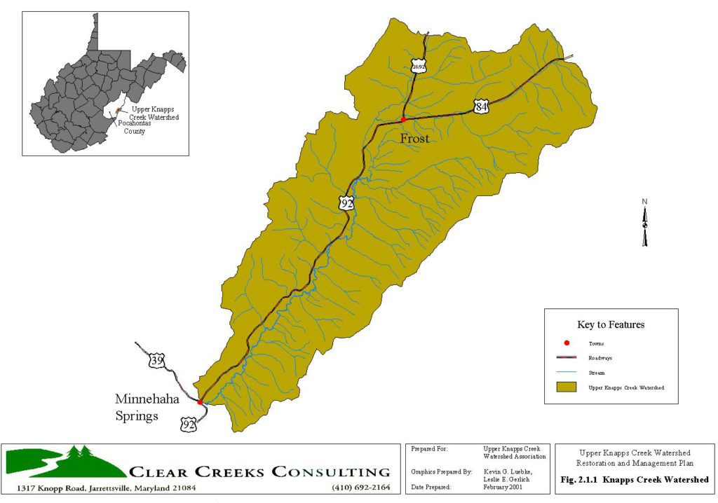
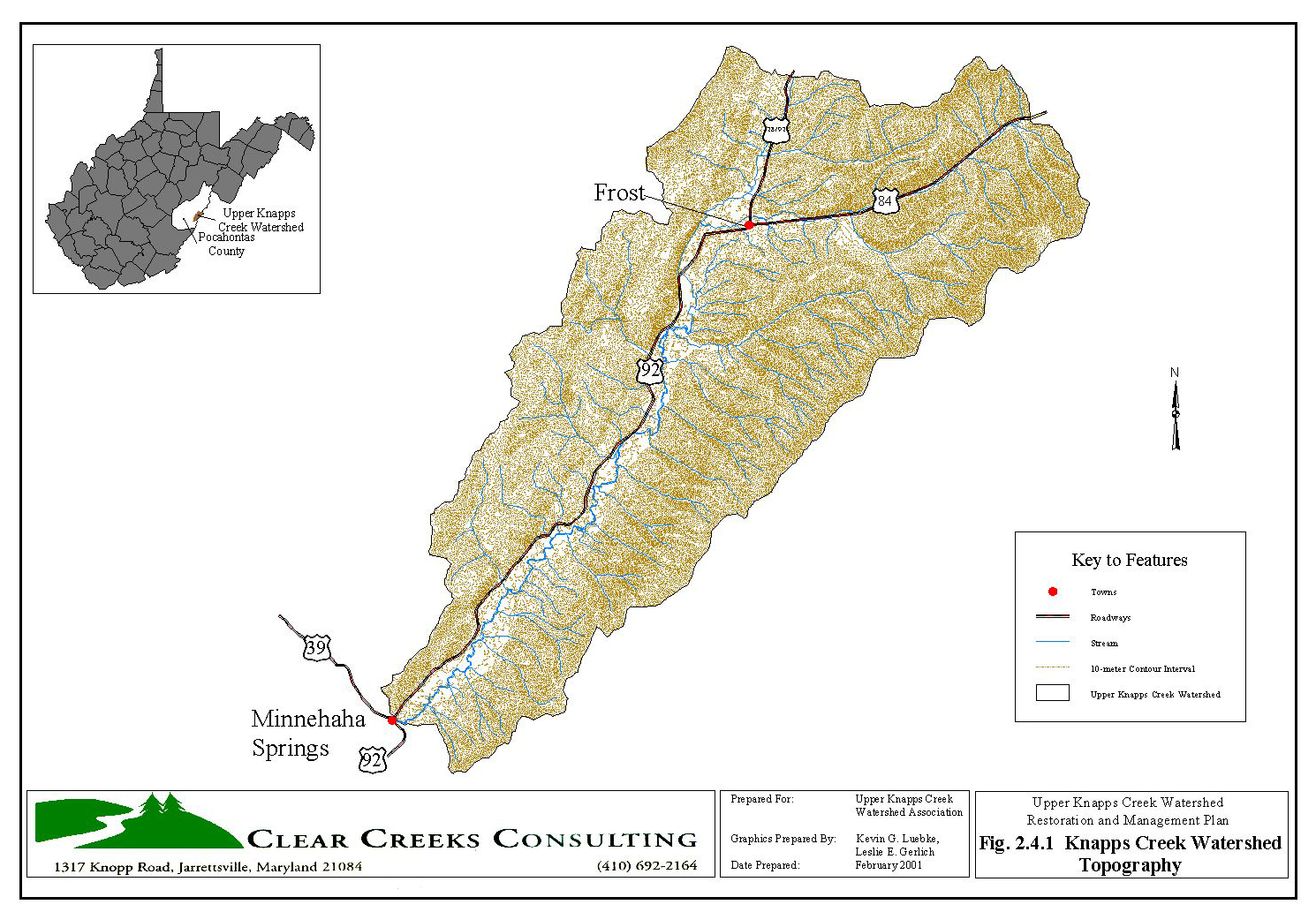
Frost, West Virginia
Upper Knapps Creek Watershed Association
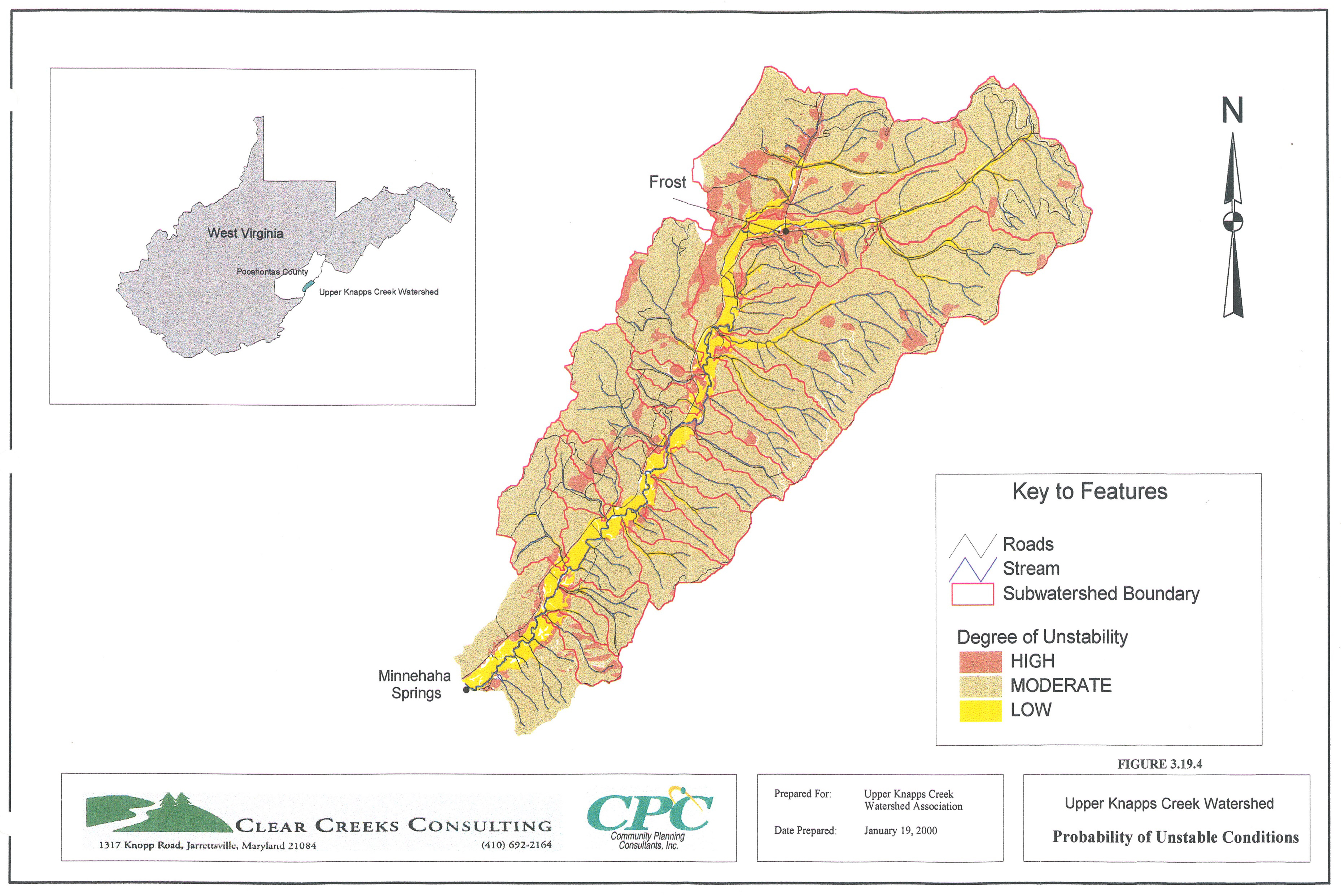
Upper Knapps Creek, a third order tributary to the Greenbriar River drains a 49 square mile rural watershed in the southeastern part of the state near Frost, West Virginia. The watershed and stream have been severely impacted by clear cut timber harvesting along the mountain slopes, livestock grazing along the valley floor, historic channel relocation and straightening, and periodic post-flood channel maintenance practices Beaver activity along the mainstem also contributes to stability problems.
Clear Creeks Consulting was contracted by the Pocahontas County S&WCD in cooperation with the Upper Knapps Creek Watershed Association. Mr. Powell served as Project Manager, Senior Scientist and Restoration Design Specialist. The fieldwork for this project was completed during the Fall 1998 and Spring 1999. The Restoration and Management Plan was completed Winter 2001.
The watershed assessment and Restoration and Management Plan completed for the Upper Knapps Creek Watershed was the first in the State to utilize a geomorphic approach.
PROJECT OBJECTIVES
- Restore and maintain a stable stream channel
- Eliminate or reduce the damage to and loss of property caused by the stream bank erosion, sedimentation and flooding problems along Upper Knapps Creek
- Implement restoration measures and management practices throughout the watershed that reduce the need for long-term maintenance and ensure the success of this effort
ASSESSMENT
- Evaluation of Climate and USGS Gage Record Data
- GIS Mapping and Probability of Unstable Conditions and Sensitivity to Disturbance Analysis
- Evaluation of Historic Aerial Photograph Overlays for Channel Migration and Sediment Loss Analysis
- Field Reconnaissance Surveys along 35 miles of Tributaries
- Gage Calibration Surveys at U.S.G.S. gage stations in the Appalachian Plateau Region
- Geomorphic Stream Assessments along 14 miles of Upper Knapps Creek
- In-Stream Habitat Evaluation
- Biological Surveys of Fish and Macroinvertebrate Communities
- Water Quality Monitoring
- Hydrologic Modeling of the Upper Knapps Creek watershed
WATERSHED
Evaluation of regional climate data and stream gage records indicate Upper Knapps Creek watershed
- Reliably generates at or near bankfull peak flows at least once a year.
- Rain-on-snow events historically most strongly correlated with peak flows
- Large rainstorms are occurring with greater frequency
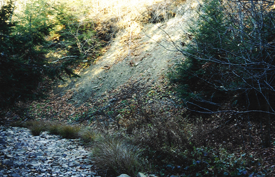
Due to basin morphometry, impervious nature of geologic formations and soils the Upper Knapps Creek subwatersheds are naturally sensitive to land use activities that concentrate runoff and expose the soils to active weathering or erosion.
Basin slope and drainage density are two key natural features contributing to high runoff and erosion rates in Upper Knapps Creek. Measurable differences in runoff and erosion rates between the eastern and western subwatersheds.
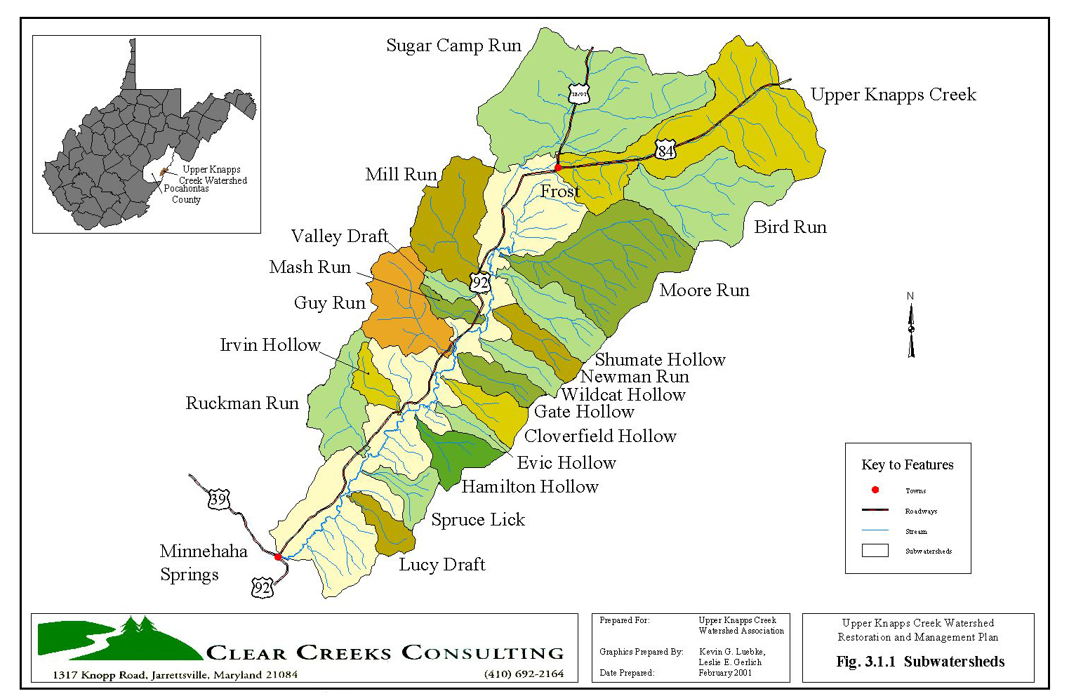
SUBWATERSHEDS
Eastern Subwatersheds
- Moderately steep to very steep tributaries
- Narrow, V-shaped Valleys
- Flow across alluvial fans onto the wide valley floor of the mainstem Upper Knapps
Creek.
Western Subwatersheds
- Low gradient to moderately steep tributaries
- Meander along U-shaped valleys parallel to main valley, turning to drop through
narrow V-notches - Flow across alluvial fans and join the mainstem Upper Knapps Creek.
Historic Impacts
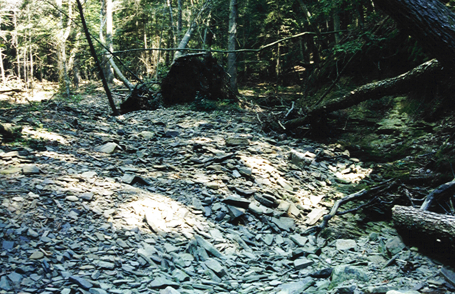
- Eastern subwatersheds still recovering from instability problems caused by historic
timber harvesting operations between the late 1870’s and early 1920’s - Resulting erosion of slopes and sedimentation of streams was widespread and
devastating. - Still evidence of the impacts – large alluvial/colluvial deposits are spaced at irregular
intervals along the valley profile - Remnants of the old logging railroad beds are still discernable
- During large storm events the lower reaches of some tributaries are overwhelmed by
the amount of material transported from their respective watersheds, completely
filling in and overflowing onto the adjacent alluvial fans.
Current Impacts
- Recent clear cuts, skid trails, landing areas and haul roads increasing and
concentrating runoff into ephemeral channels or directly over the steep, erodible
slopes. - Gullies and debris flow channels are developing along the slopes below a number of
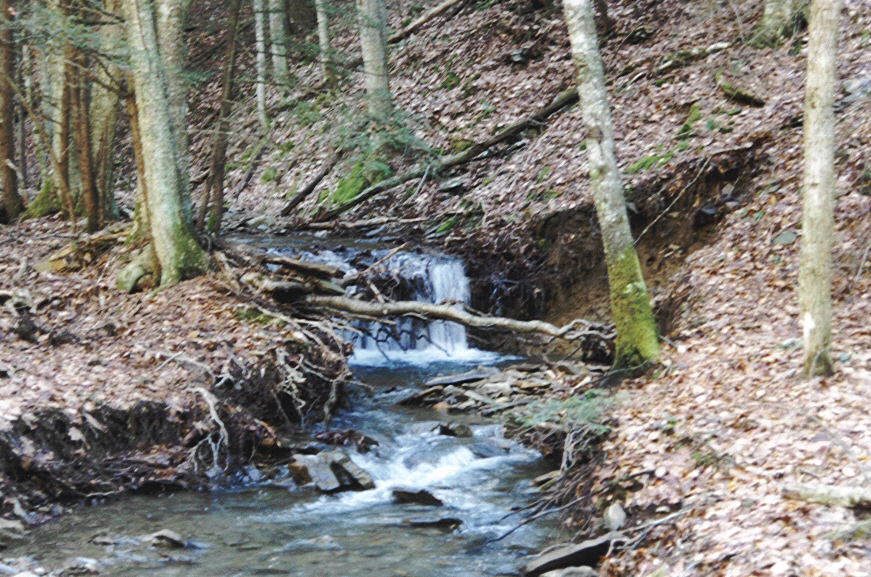
the areas that were disturbed by these logging operations. - Western tributaries are stable and in good condition. With an abundant baseflow
and stable habitat conditions, several of these tributaries support populations of
trout.
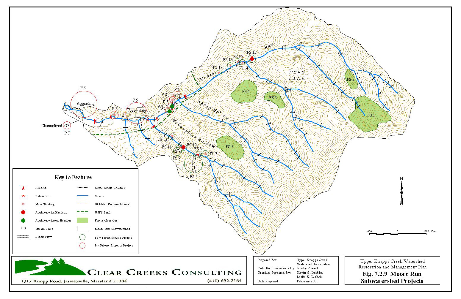
UPPER KNAPPS CREEK – TRIBUTARIES
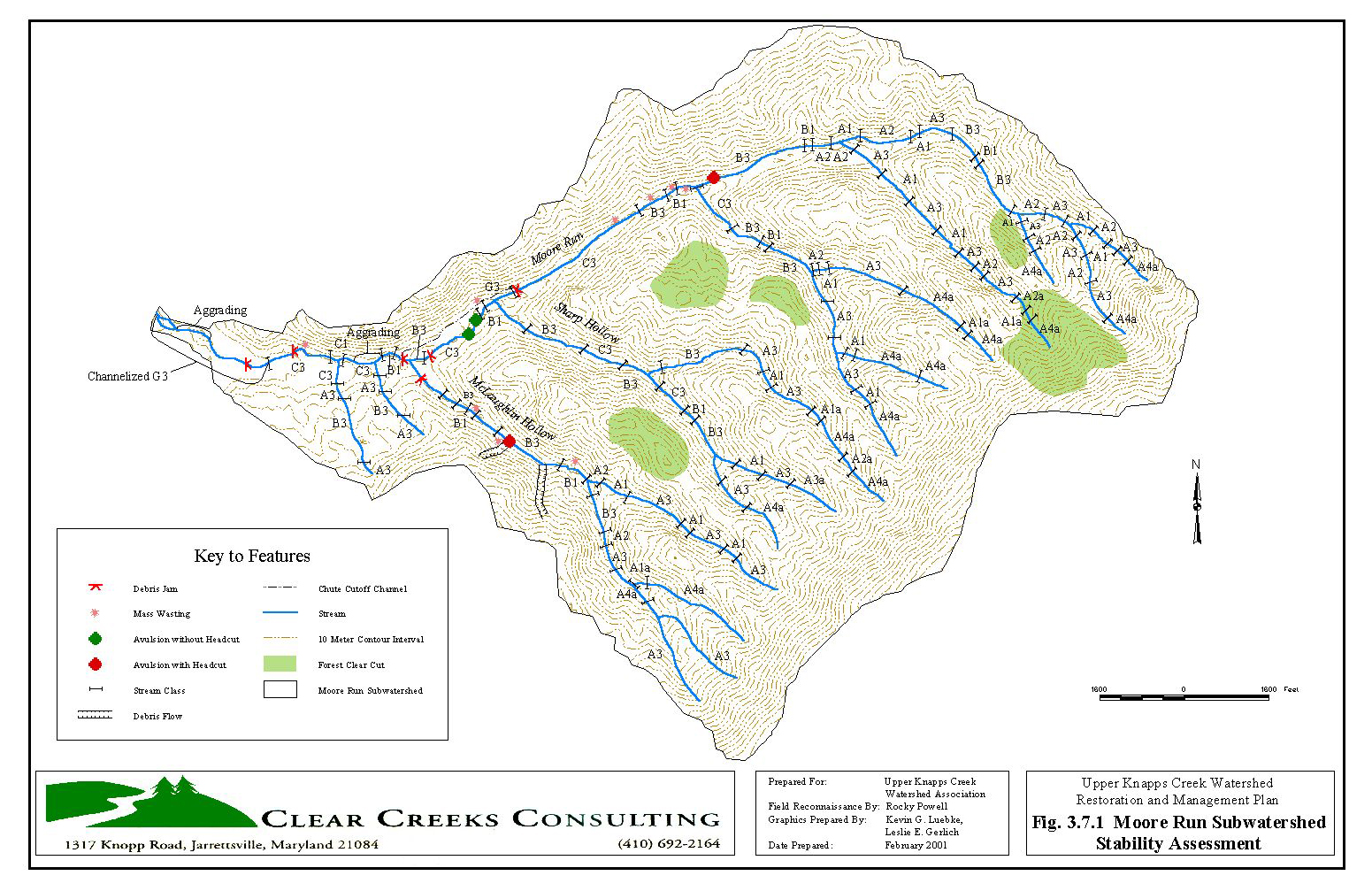
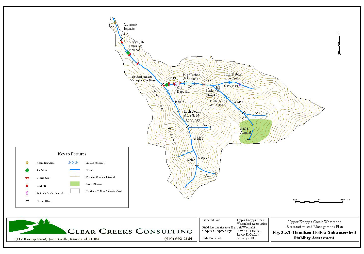
Subwatersheds were ranked relative to potential and existing problems identified during the study. Potential problems were identified using the mapped stream types from the Level I – Geomorphic Characterization and field reconnaissance and the stream response characteristics presented in Management Interpretations of Various Stream Types (Rosgen, 1994).

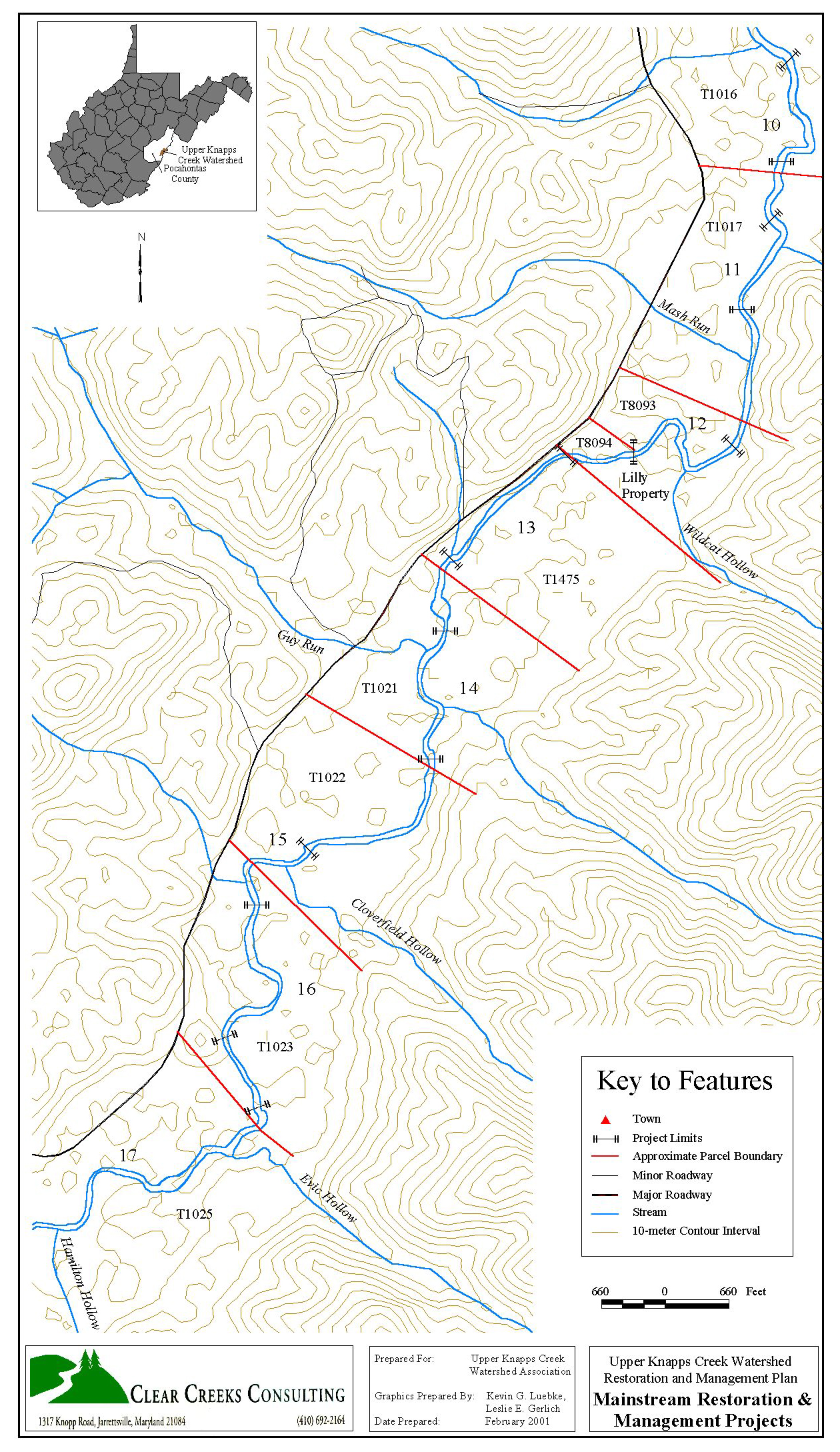
UPPER KNAPPS CREEK – MAINSTREAM
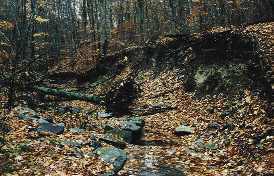
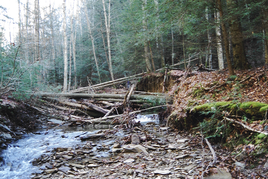
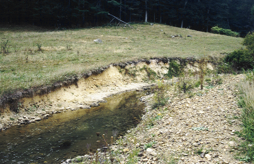
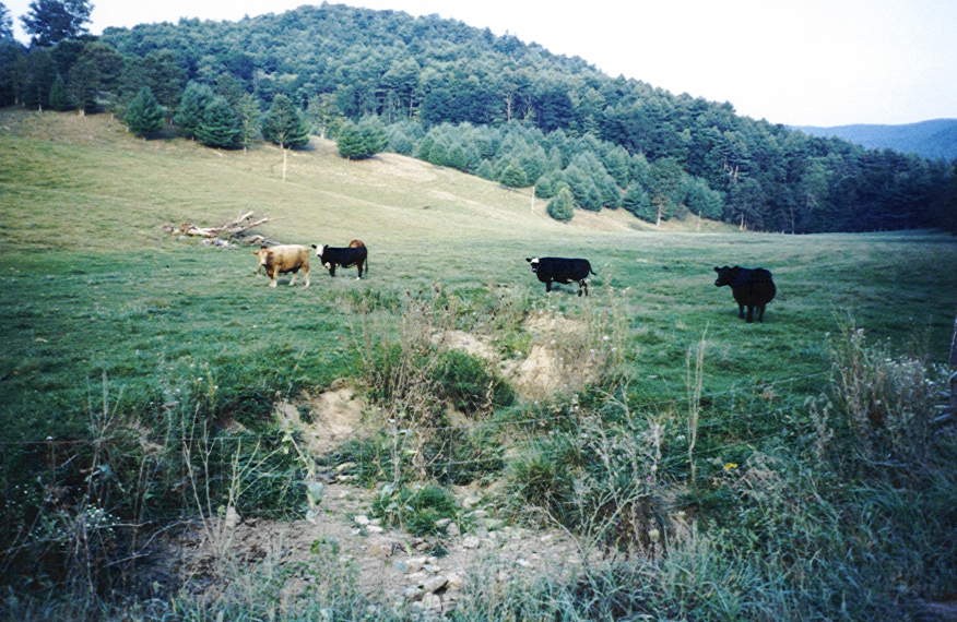
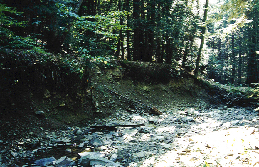
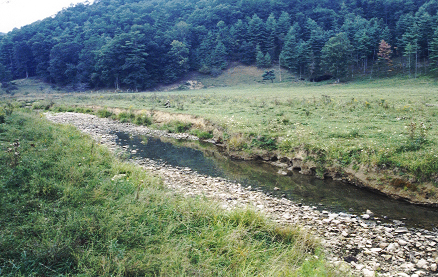
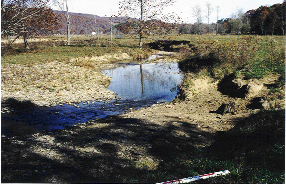
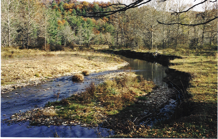
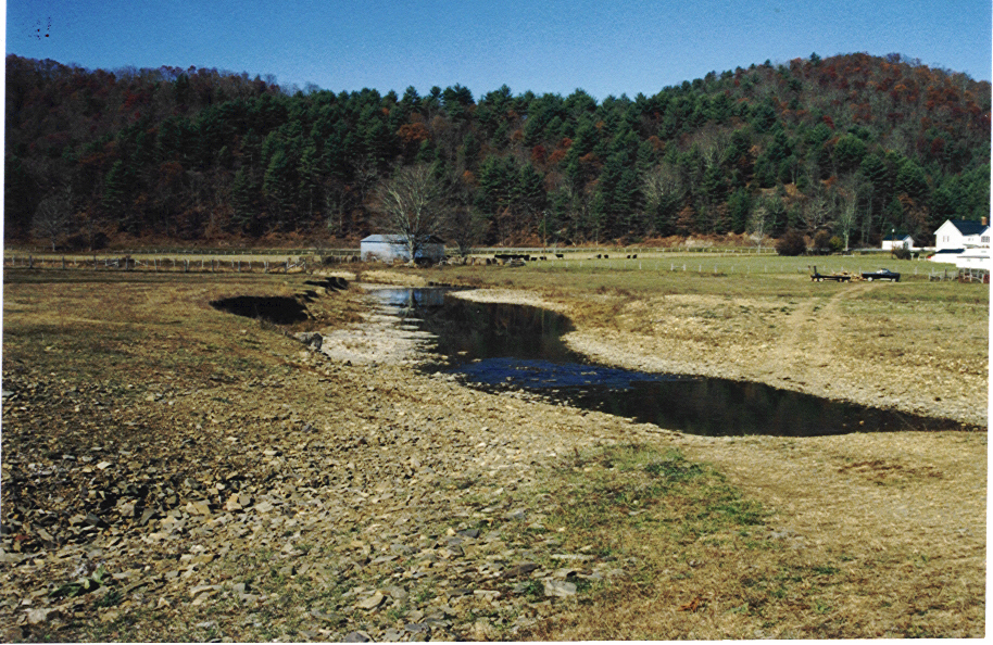
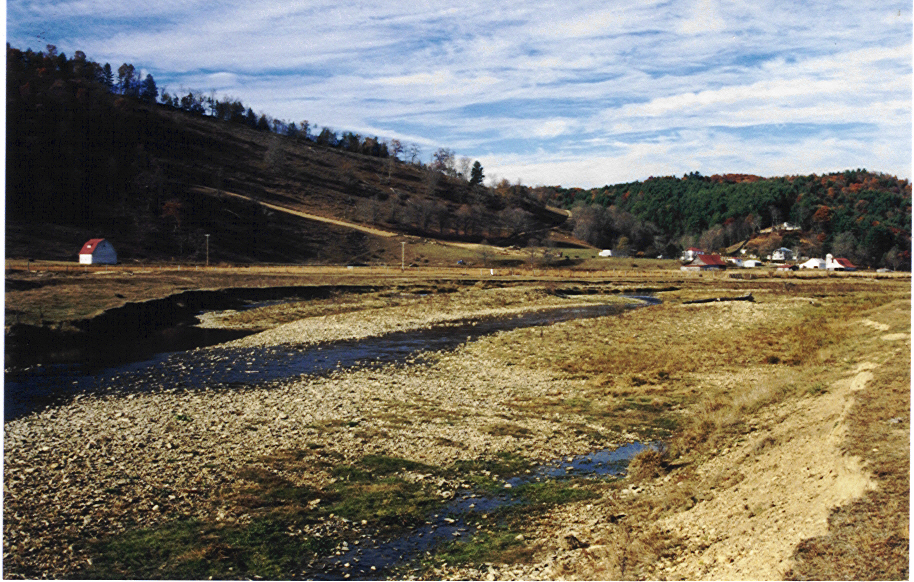
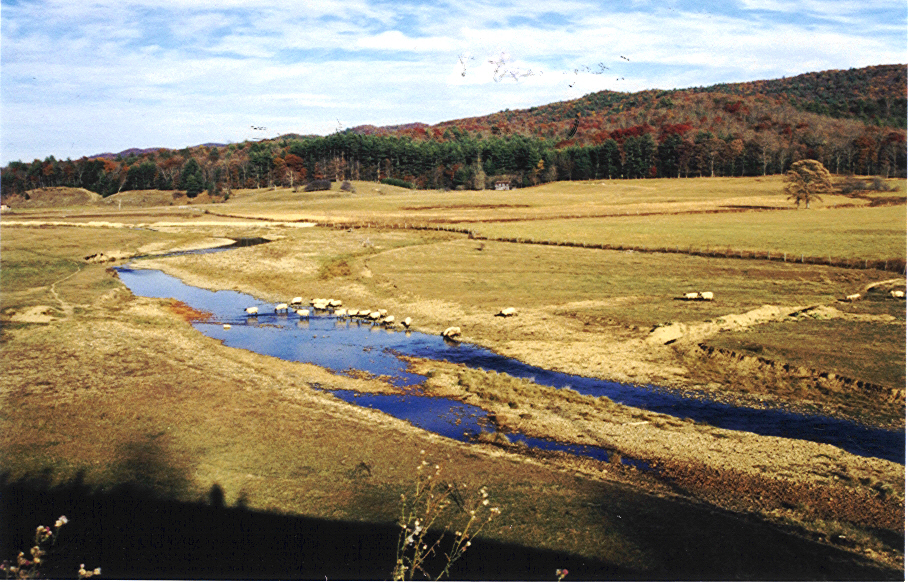
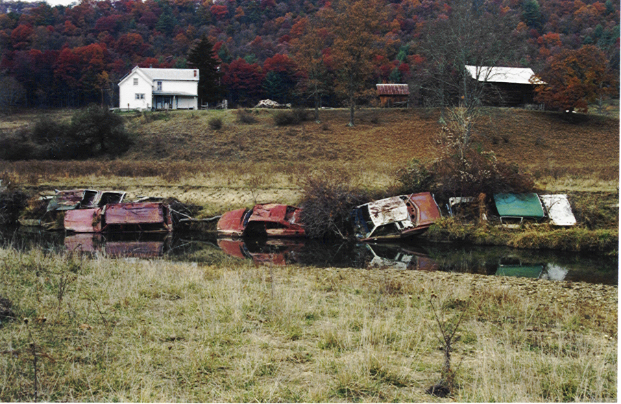
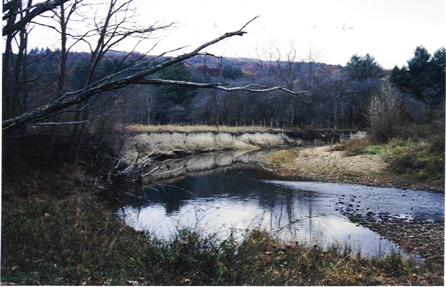
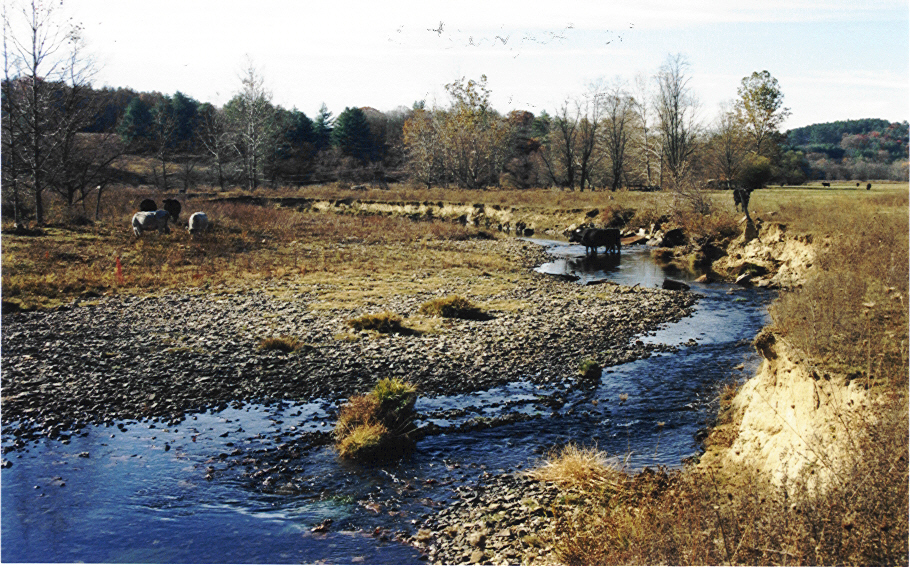
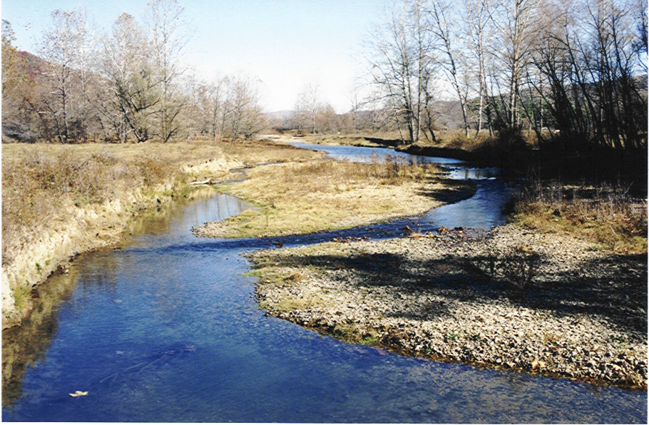
With exception of channelized reaches, the mainstem Upper Knapps Creek is a low gradient, meandering stream, with a well-developed floodplain. Dominant land use along the valley bottom is pasture, utilized for the grazing of cattle, sheep, and horses. Land ownership is almost totally private.
Current Conditions and Contributing Factors:
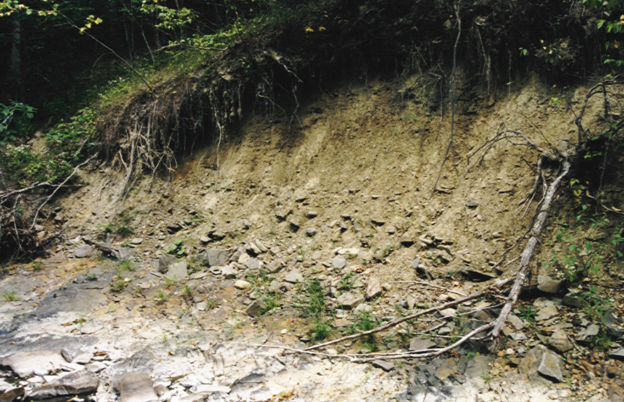
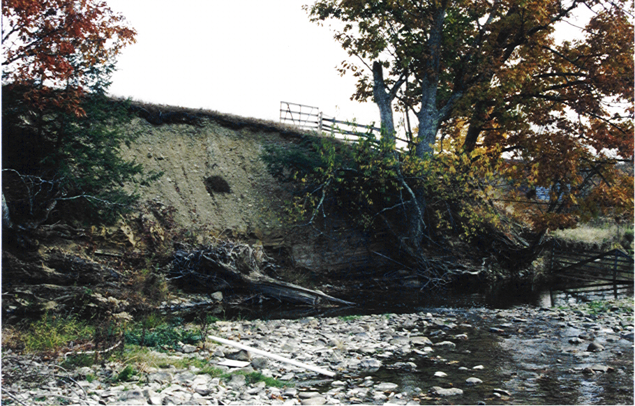
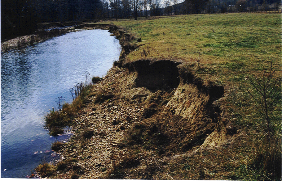
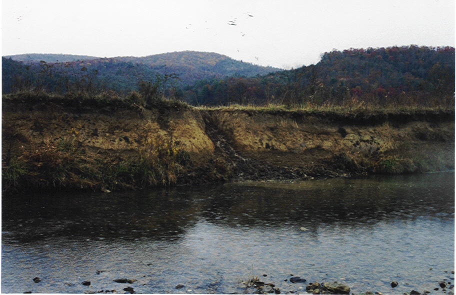
- Heavy sediment loads are contributed from eroding banks and beds, hillslope failures
along mainstem and unstable subwatersheds. This is contributing to widespread
aggradation. So severe along some reaches, braiding and rapid lateral migration are
occurring. Some aggradation is also occurring upstream of beaver dams. - Major portions of the mainstem exhibit width/depth ratios much higher than
normally observed along stable reaches. These over-wide conditions are likely the
result of historic and recent post-flood channelization work and trampling of stream
banks by livestock . - There is a general lack of woody vegetation along significant lengths of stream banks
resulting in a loss of lateral control. Annual channel migration rates of 12.5 – 44.5
feet were measured in some segments utilizing overlays of historic aerial
photographs. More stable , well vegetated reaches showed migration rates of 1.5 –
2.5 feet per year. - The most obvious departure from a stable form is altered meander geometry.
Historic channelization and straightening is evident on the USGS Topographic Maps
dated 1905 and 1929. This trend has continued throughout the years with periodic
post-flood channel work. The effects of these channel activities are clearly visible on
the 1948 – 1997 historic aerial photograph overlays. - Land management practices along the mainstem are probably the most significant
factors contributing to the current unstable conditions.- Unrestricted livestock grazing along the mainstem has directly impacted
channel morphology by trampling of the banks, widening of the channel, and
reducing sediment transport capacity. - Past vegetation control practices such as spraying and mechanical removal of
undesirable vegetation eliminated much of the woody vegetation from the
banks and riparian zone. - Current lack of woody vegetation and the subsequent loss of lateral control
for the banks is a direct result of the unrestricted grazing activities.
- Unrestricted livestock grazing along the mainstem has directly impacted
- The reaches along Upper Knapps Creek were ranked relative to potential and existing
problems identified during the study. Potential problems were identified using the
mapped stream types from the Level II – Morphologic Description and the stream
response characteristics presented in Management Interpretations of Various Stream
Types (Rosgen, 1994).

RESTORATION AND MANAGEMENT PLAN
The Plan employs two basic objectives:
- Management of resources by preventing or minimizing alteration of the slopes and ridges in the eastern and western subwatersheds and of the stream/floodplain corridor along the mainstem using all practical means.
- Restoration of resources by reestablishing natural characteristics and hydrologic and geomorphic functions of the slopes and ridges in the eastern and western subwatersheds and stream/floodplain corridor along the mainstem.
Management Strategies for the Subwatersheds
Given the findings of this study, the management strategies identified for the subwatersheds focus on reversing the effects historic land use activities have had, as well as minimizing the effects future land use activities could have on basin runoff characteristics.
- Forest Management Prescriptions for the Eastern Subwatersheds
- Land Use Management Zones
- Timber Harvest Permits and Best Management Practices
Management Strategies for the Upper Knapps Creek Mainstem
The unstable conditions in certain subwatersheds are exerting considerable influence on mainstem channel morphology and fluvial processes. However, as pointed out, land management practices along the mainstem are probably the most significant factors contributing to the current unstable conditions along the mainstem Upper Knapps Creek.
Given the findings of this study, the management strategies identified for the mainstem Upper Knapps Creek focus on limiting livestock access, reestablishing lateral control with woody vegetation on the stream banks and adjacent riparian areas, modifying channel maintenance practices, and utilizing beavers as a management tool for maintaining stream channel stability.
- Land Management Plans and Best Management Practices
- Channel Maintenance Procedures
- Beaver Management
- Watershed/Stream/Floodplain Corridor -Land Use Covenants
- Conservation Easements
- Land Acquisition
Restoration Strategies for the Upper Knapps Creek Mainstem and Tributaries
- Identifying Areas in Need of Restoration and Determining the Level of Intervention Required
- Stream Restoration utilizing a Geomorphic Approach
- Floodplain Restoration
- Stream Bank and Riparian Vegetation
Recommended Restoration and Management Projects
- Identified, Mapped and Prioritized Stream Restoration Projects
- Ninety (90) restoration projects along tributaries
- Twenty five (25) restoration projects along the mainstem
- Identified Agricultural and Forest Management Best Management Practices (BMPs)
- Developed Preliminary Cost Estimates for All Restoration Projects
Preliminary Design Plans, Construction Specifications, and Preliminary Cost Estimates were developed for Four Demonstration Stream Restoration Projects.