Quittapahilla Creek
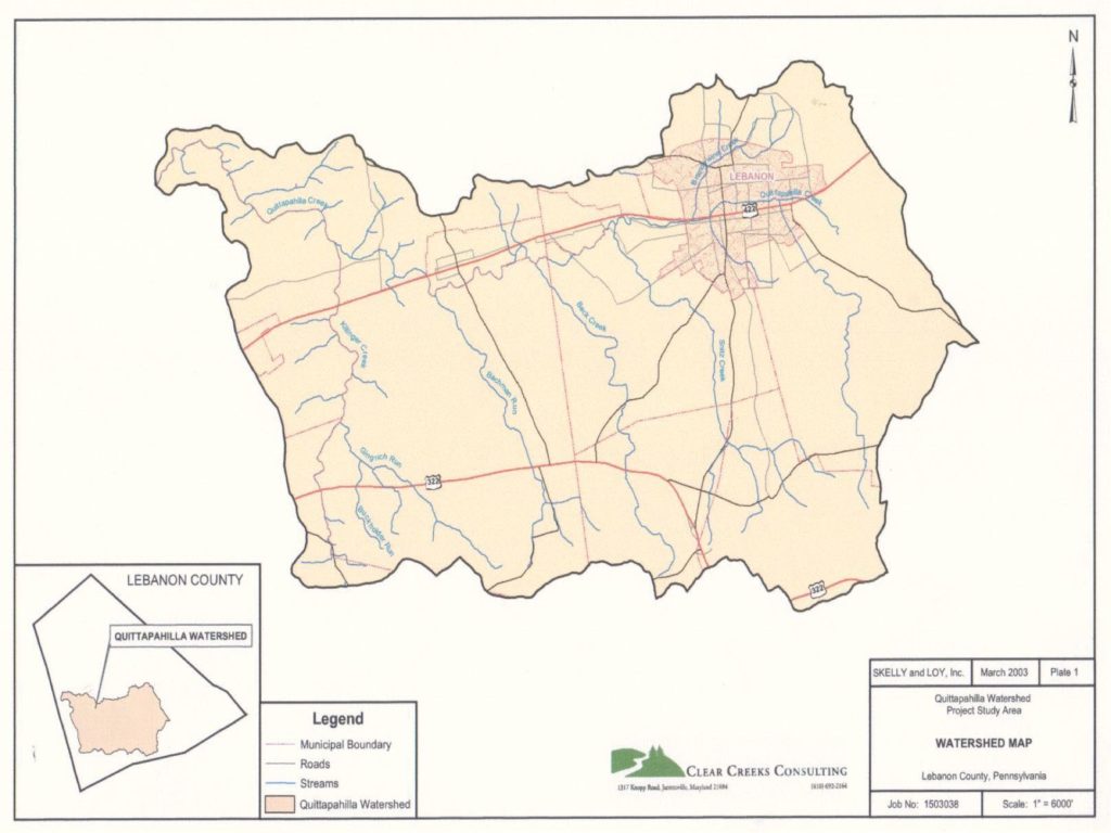
Quittapahilla Creek Watershed
Quittapahilla Creek is a tributary to Swatara Creek and is part of the Susquehanna River Basin. Its headwaters begin just southeast of Lebanon, Pennsylvania and it enters the Swatara Creek near North Annville, Pennsylvania. The major land use in the watershed is agricultural. There are significant areas of urbanization along the Route 422 corridor in the City of Lebanon, West Lebanon, Cleona, and Annville. In addition, new development in the watershed is replacing farms with suburban communities. Past and current land use and land management practices in the rural areas, suburban communities, and urban centers have resulted in degraded water quality, stream bank and bed erosion, sedimentation, flooding, and the loss of riparian and in-stream habitat throughout the Quittapahilla Creek Watershed.
Clear Creeks Consulting was contracted by the Swatara Creek Watershed Association to lead an interdisciplinary team that included Skelly & Loy, Inc.; U.S. Fish & Wildlife Service, Chesapeake Bay Field Office; Penn State Institutes of the Environment, Pennsylvania State University; Department of Biology, Lebanon Valley College; and U.S. Geological Survey, New Cumberland Field Office in conducting an assessment of the 77 square mile watershed. Clear Creeks also developed a restoration and management plan for the Quittapahilla Watershed Association. The Quittapahilla Creek Watershed Project was supported by Growing Greener Grants received from Pennsylvania DEP in 2001 and 2003. Mr. Powell served as Project Manager, Senior Scientist and Restoration Design Specialist.
The field work was completed between 2001 and 2004. A Findings Report summarizing and documenting the results of the assessment was completed in 2006.
PROJECT OBJECTIVES
The Quittapahilla Watershed Association (QWA), an all volunteer, not for profit organization has been working since 1997 with a number of private organizations and public agencies to improve the water quality and aquatic habitat of Quittapahilla Creek. However, there had been no comprehensive assessment, nor coordinated effort to identify and prioritize water quality, habitat and stream channel stability problems throughout the watershed. As a consequence, targeting of stream reaches for improvements had been on a project-by-project basis.
The QWA believed that their best chance for resolving the existing problems and avoiding future problems was to step back from the project-based approach and develop a comprehensive plan of action based on an assessment of the entire watershed. They believed that this approach would serve to focus funding and restoration and management efforts where they are most needed. They also believed that it is the approach that has the greatest chance for long-term success.
Their objectives for this project included:
- Establish benchmarks for evaluating and documenting changes in the watershed by assessing current hydrologic, water quality, biological communities, in-stream habitat, and channel stability conditions.
- Identify and prioritize restoration and management strategies to address existing hydrologic, water quality, in-stream habitat, and channel stability problems.
- Determine the potential for future hydrologic, water quality, in-stream habitat, and channel stability problems.
- Develop recommendations for management and protection strategies that will prevent and/or minimize future problems.
ASSESSMENT
- Compiling and analyzing existing Information and the Lebanon County GIS database on Regional Weather Patterns, Natural Watershed Characteristics and Land Use
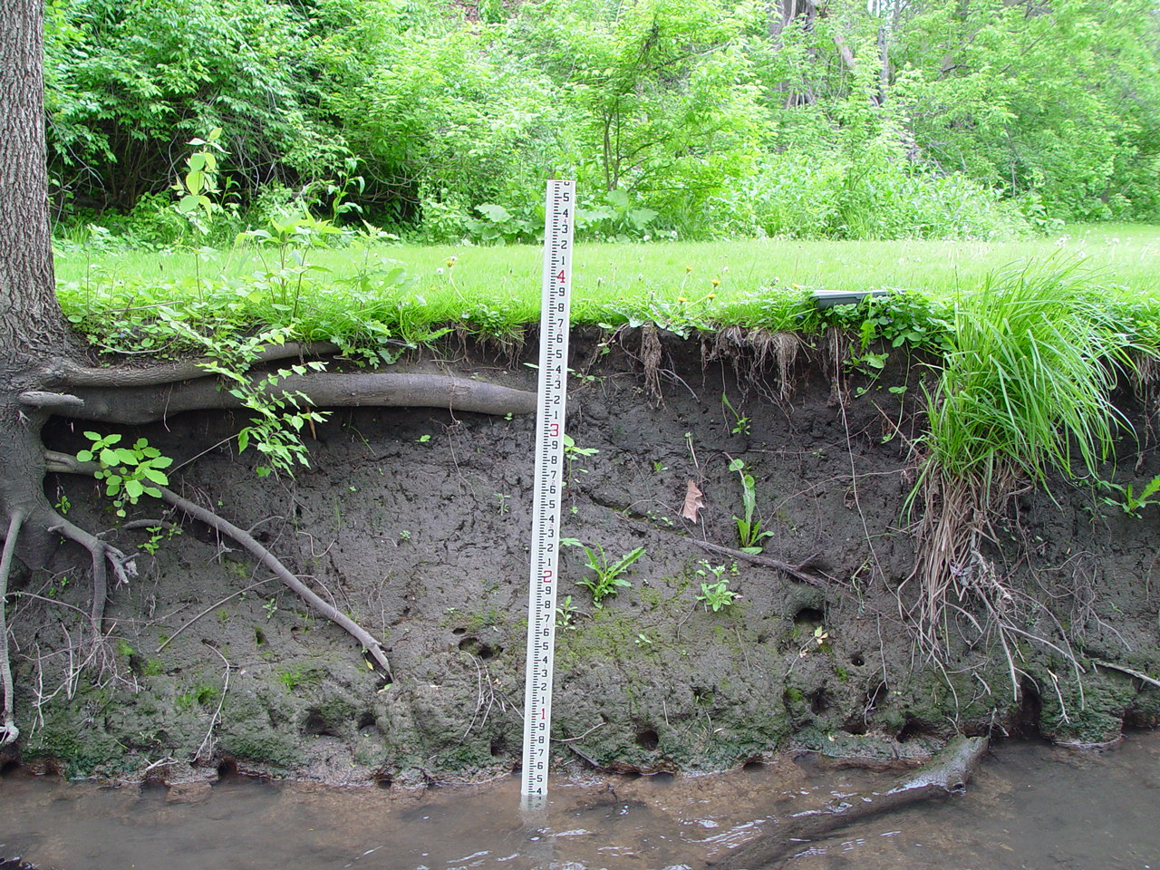
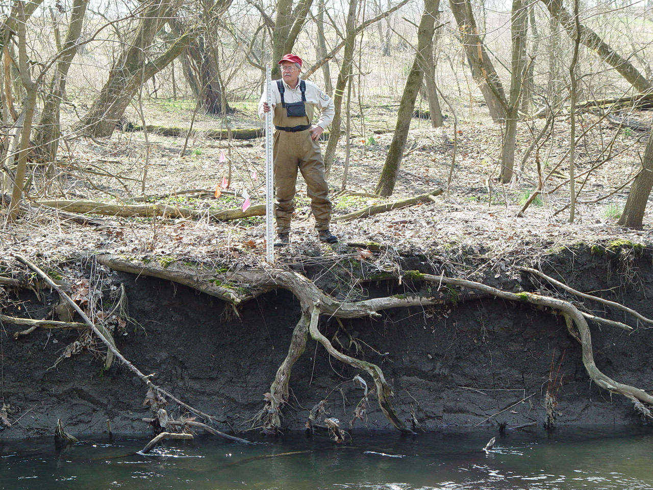
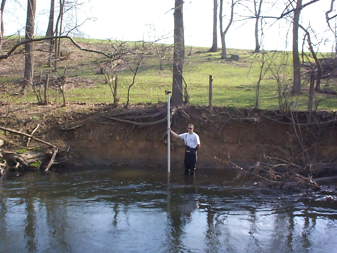
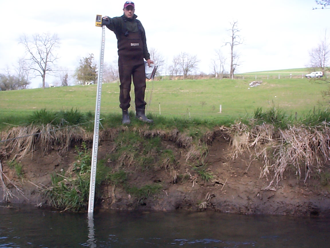
- Field Calibration of Bankfull Discharge and Bankfull Channel Field Indicators
- Hydrologic Modeling and Analysis of the Quittapahilla Creek Watershed
- Water Quality Modeling and Analysis of the Quittapahilla Creek Watershed
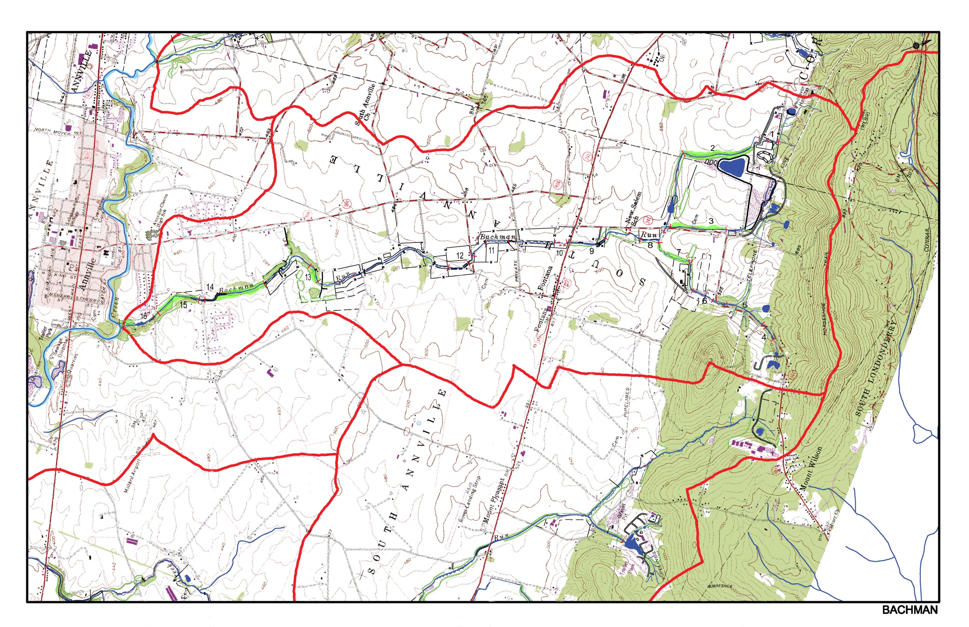
- Field Reconnaissance Surveys of 65 miles of Major Tributaries
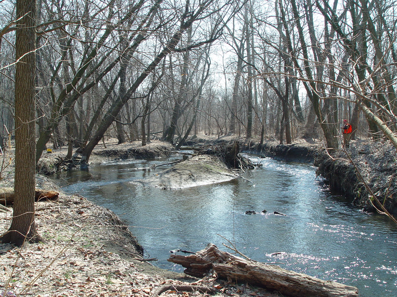
- Geomorphic Stream Assessment of 18 miles of mainstem Quittapahilla Creek
- Geomorphic Mapping
- Level II – Morphological Description
- Level III – Stability Assessment
- Level IV – Stream Stability Validation Monitoring
- Biological Stream Assessment
- Benthic Macroinvertebrate Communities and Fish Communities of Quittapahilla Creek and its Major Tributaries
- Evaluation of In-stream Habitat Quality of Quittapahilla Creek
- Water Quality Monitoring of Quittapahilla Creek and its Major Tributaries
- Baseflow Sampling
- Long-term Temperature Monitoring
- Storm Event Sampling
- Sediment-Discharge Study
- Problem Identification and Ranking
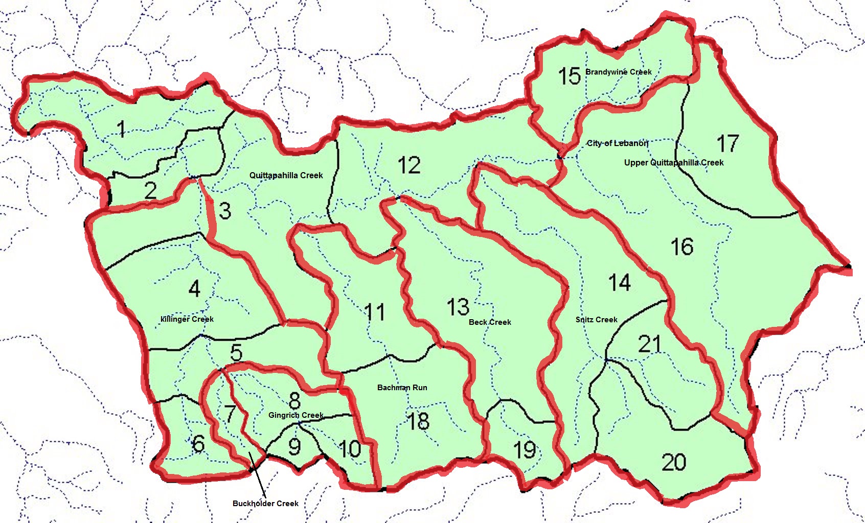
- Ranking Problems Within 9 Subwatersheds and Ranking Subwatersheds.
- Ranking 59 Reaches Along the Mainstem Quittapahilla Creek
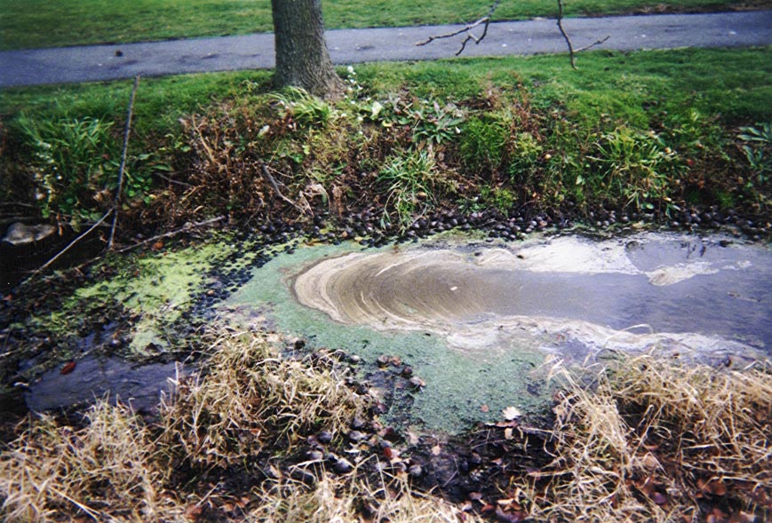
Land use activities throughout the watershed have affected water quality, habitat and channel stability along Quittapahilla Creek and its tributaries.
SUBWATERSHEDS
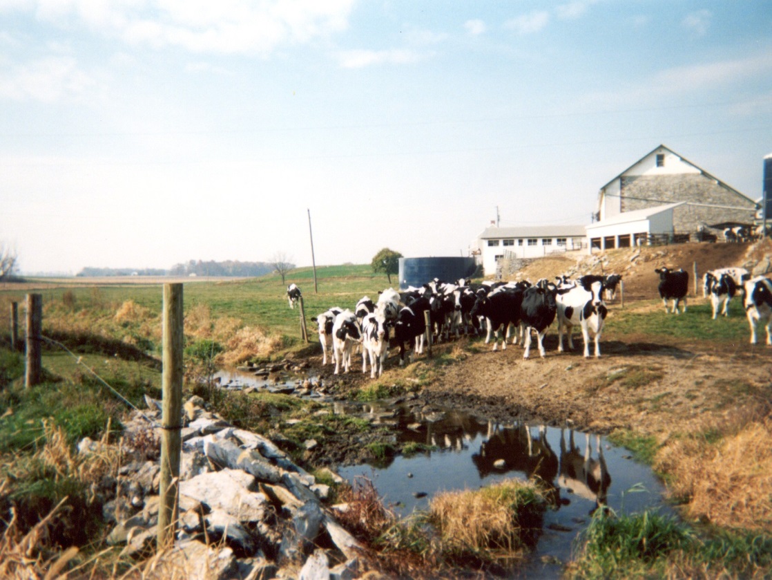
Most significant impacts in the subwatersheds are associated with agriculture. Unrestricted livestock grazing and historic vegetation control practices (spraying and mechanical removal).
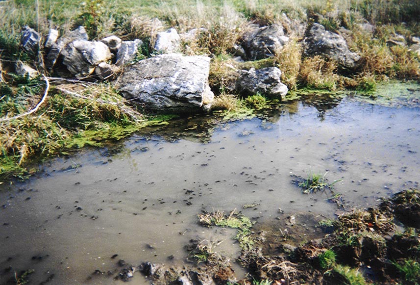
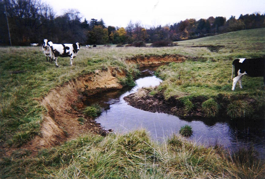
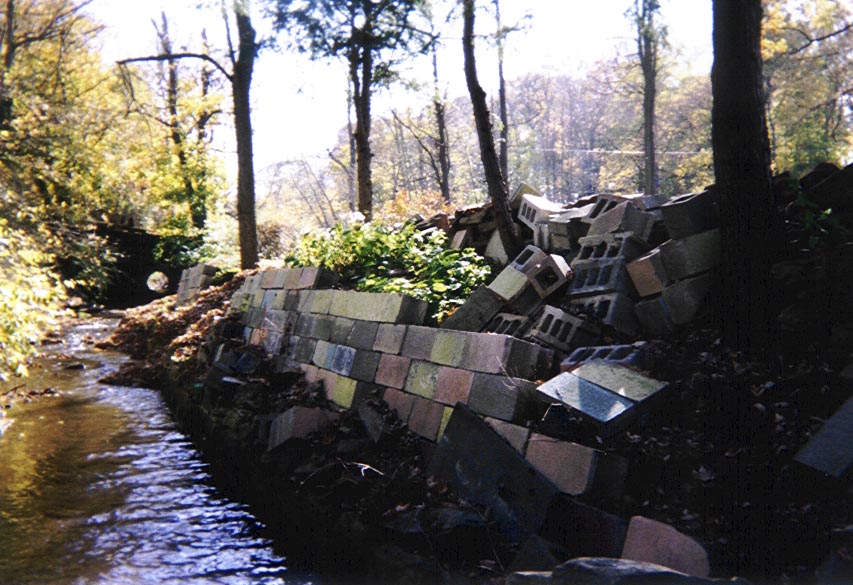
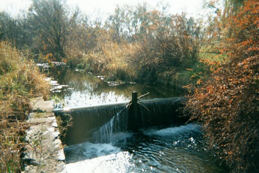
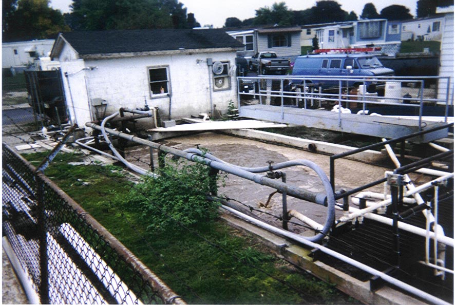
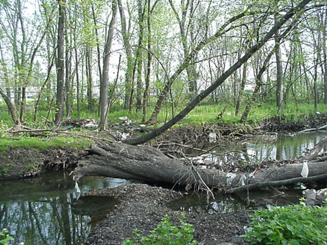
Residential and commercial development, logging operations, mining operations, channel alterations, water diversions for irrigation, low head dams, failed fish habitat structures, and discharges from public and private wastewater treatment plants have all affected channel stability, impaired the water quality and biological communities along the major tributaries.
QUITTAPAHILLA CREEK
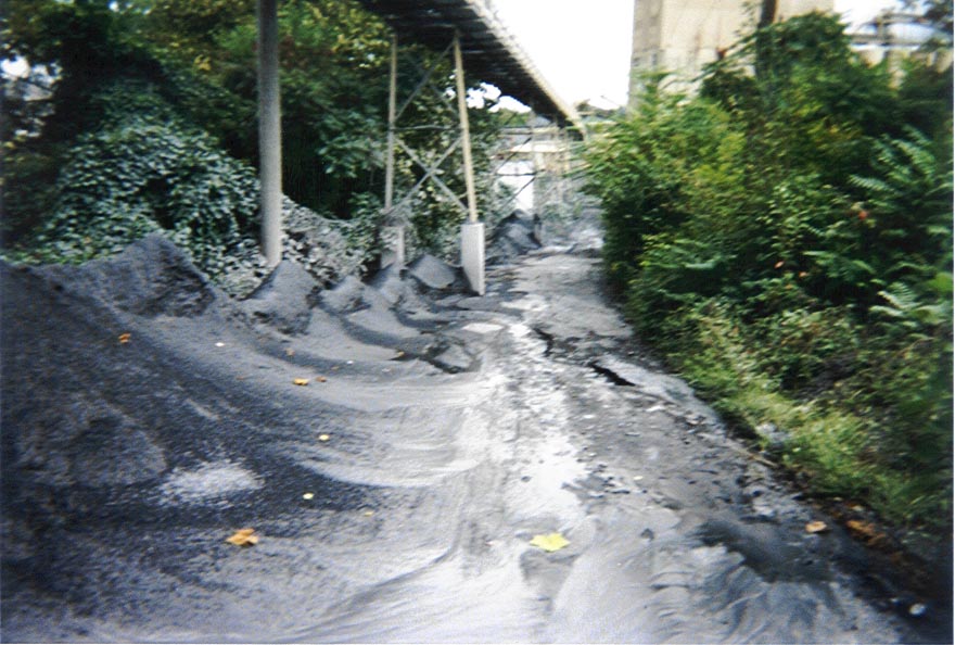
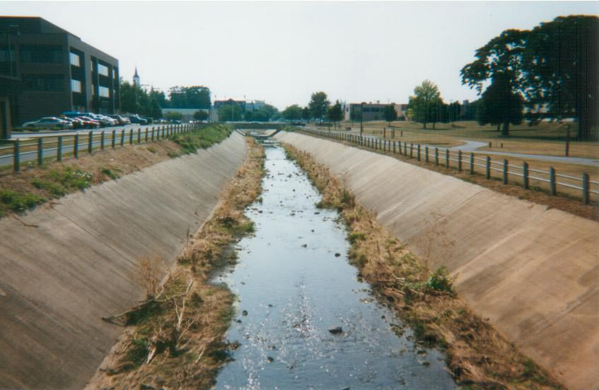
The most significant impacts along the mainstem Quittapahilla Creek are associated with channel alterations that have converted miles of stream channel to concrete flumes. These alterations, focused on flood mitigation, were initiated in the early 1900’s.
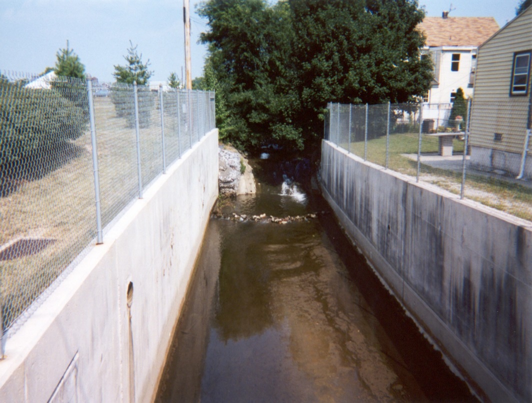
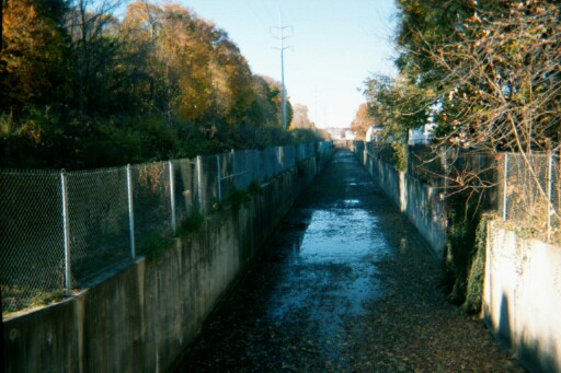
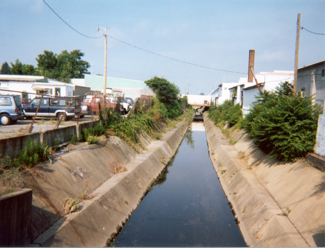
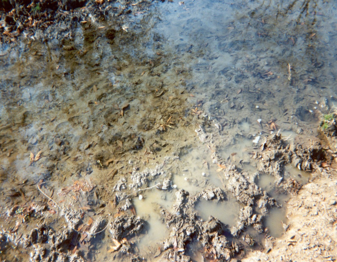
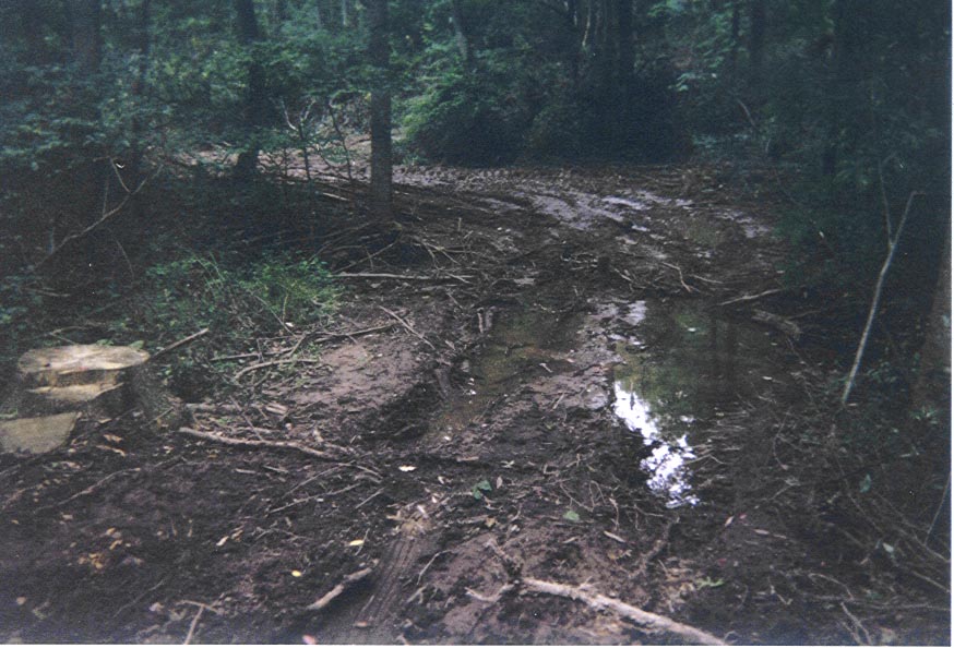
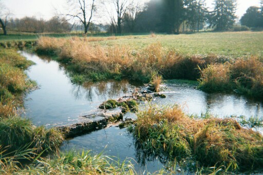
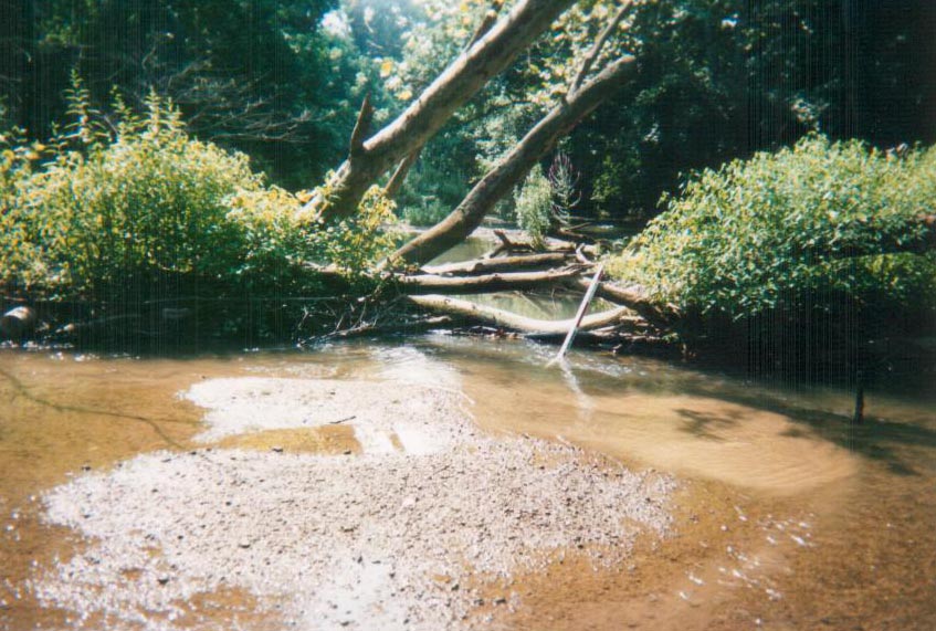
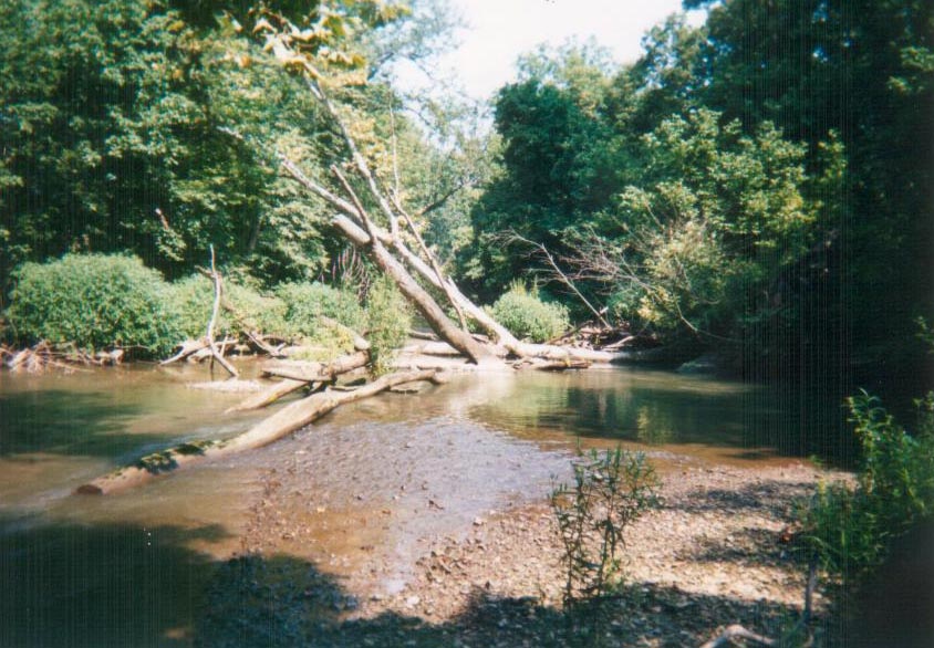
Conditions along the natural channel portions of the mainstem Quittapahilla Creek are characterized by lateral erosion, high sediment supply, and vertical instability (i.e., aggradation) with lateral and mid-channel bars, riffles embedded with fine sediments, and debris jams along many reaches.
RESTORATION AND MANAGEMENT PLAN
Stream Restoration Projects
- Identification and Prioritization of Potential Restoration Projects
- Ninety-eight (98)Stream Restoration Projects in the Priority Subwatersheds
- Twenty-nine (29) Stream Restoration Projects along the Mainstem Quittapahilla Creek
- Evaluation of the Feasibility of Restoration Projects
- Preliminary Cost Estimates for the Restoration Projects
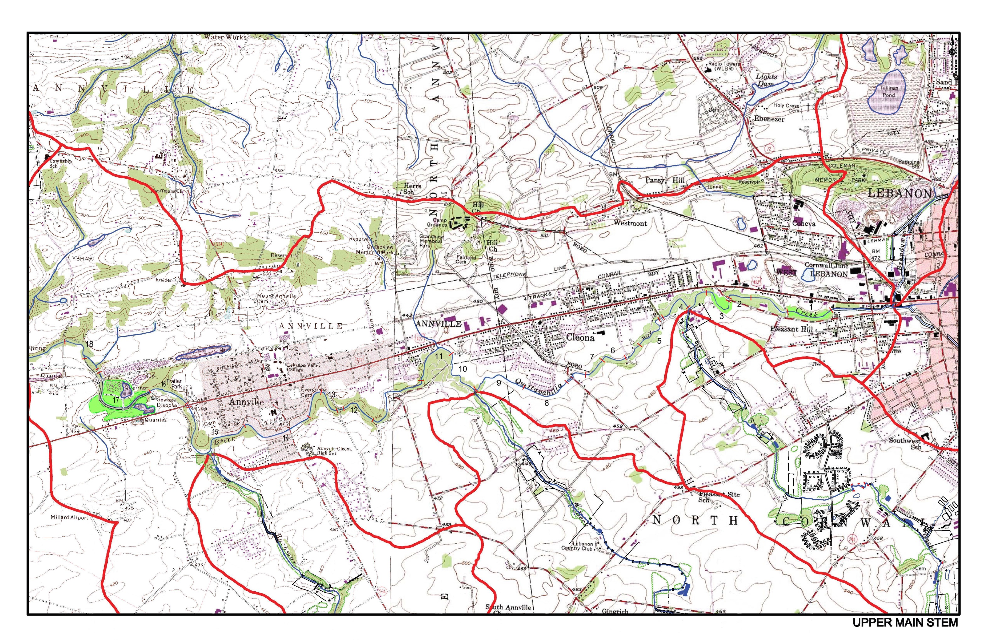
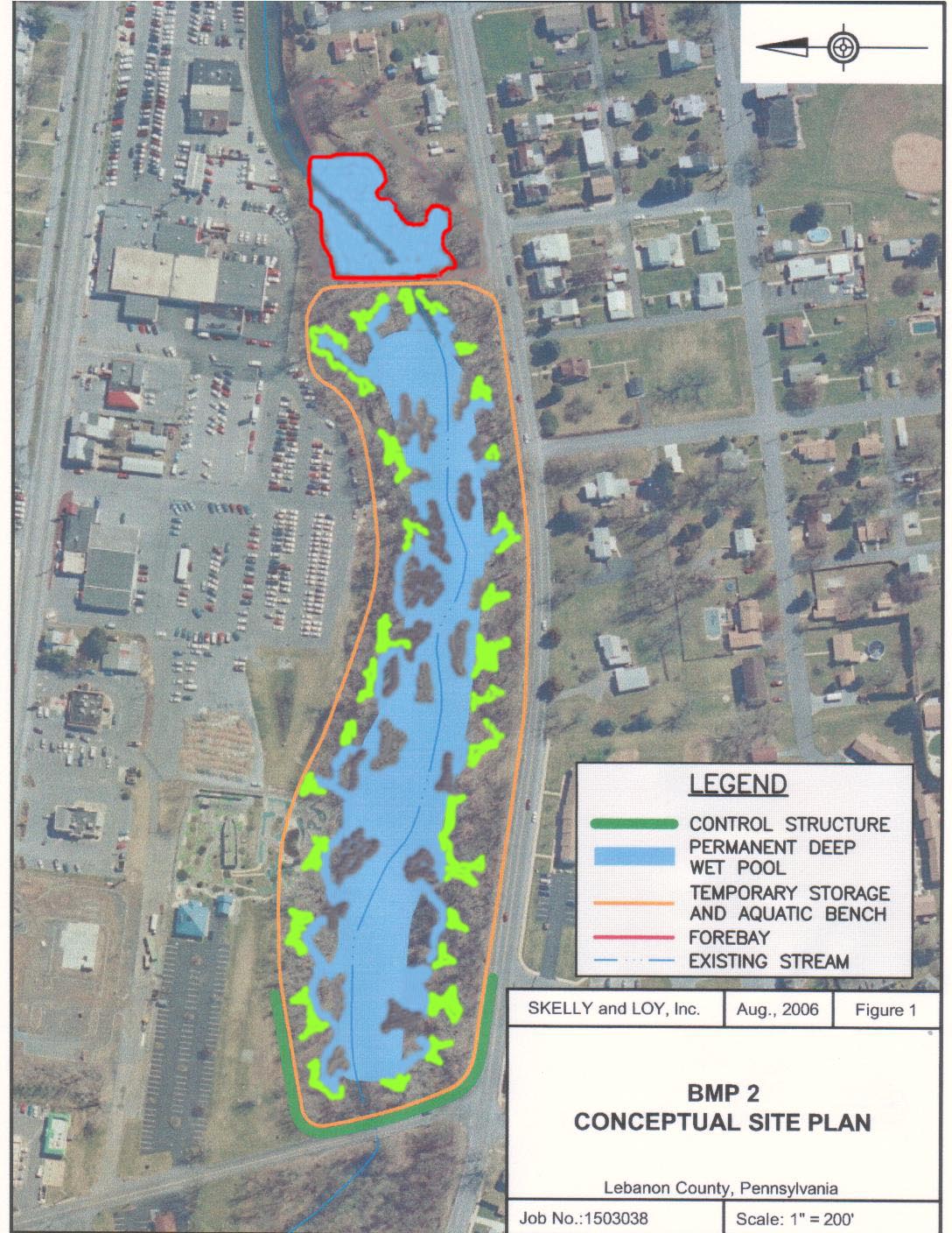
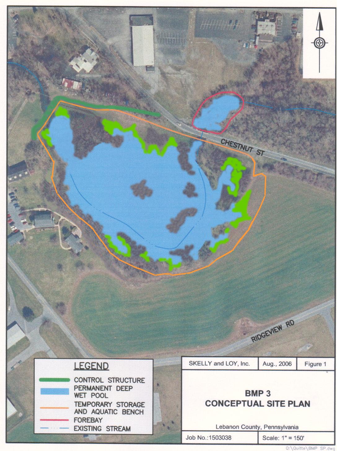
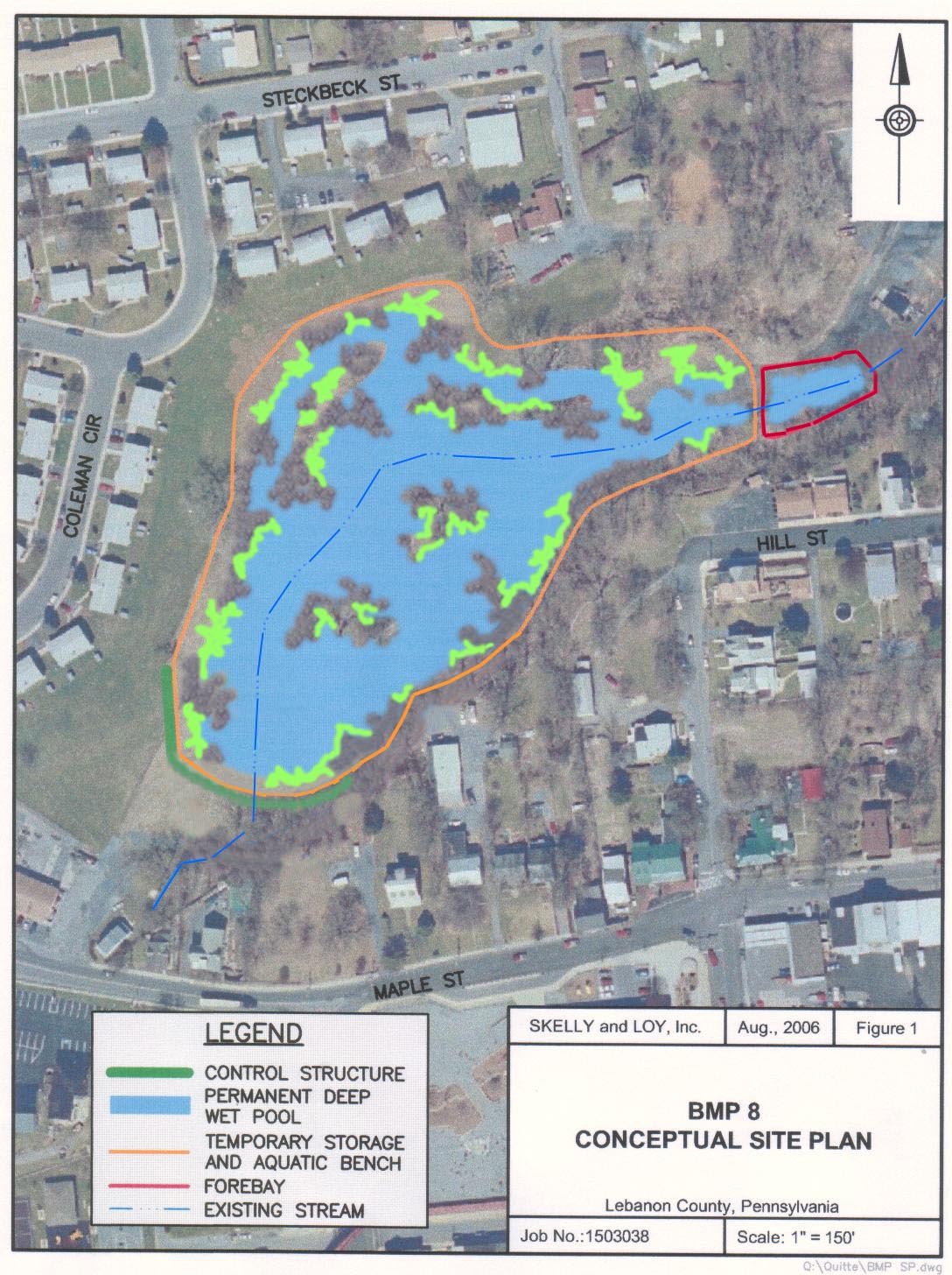
Stormwater Best Management Practices
- Identification and Prioritization of Stormwater Best Management Practices (BMPs)
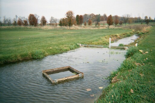
- Twelve (12) Potential Regional Stormwater Wetlands
- Concept Designs for Ten (10) Regional Stormwater Wetlands
- Preliminary Cost Estimates for the 10 Regional Stormwater Wetlands
Recommendations for Local Policies and Programs
- Focused on stream, wetland and floodplain protection and management.
The Restoration and Management Plan was completed in 2006.
WATERSHED IMPLEMENTATION PLAN (WIP)
- Prioritized 100 of the Restoration Projects identified during the watershed assessment.
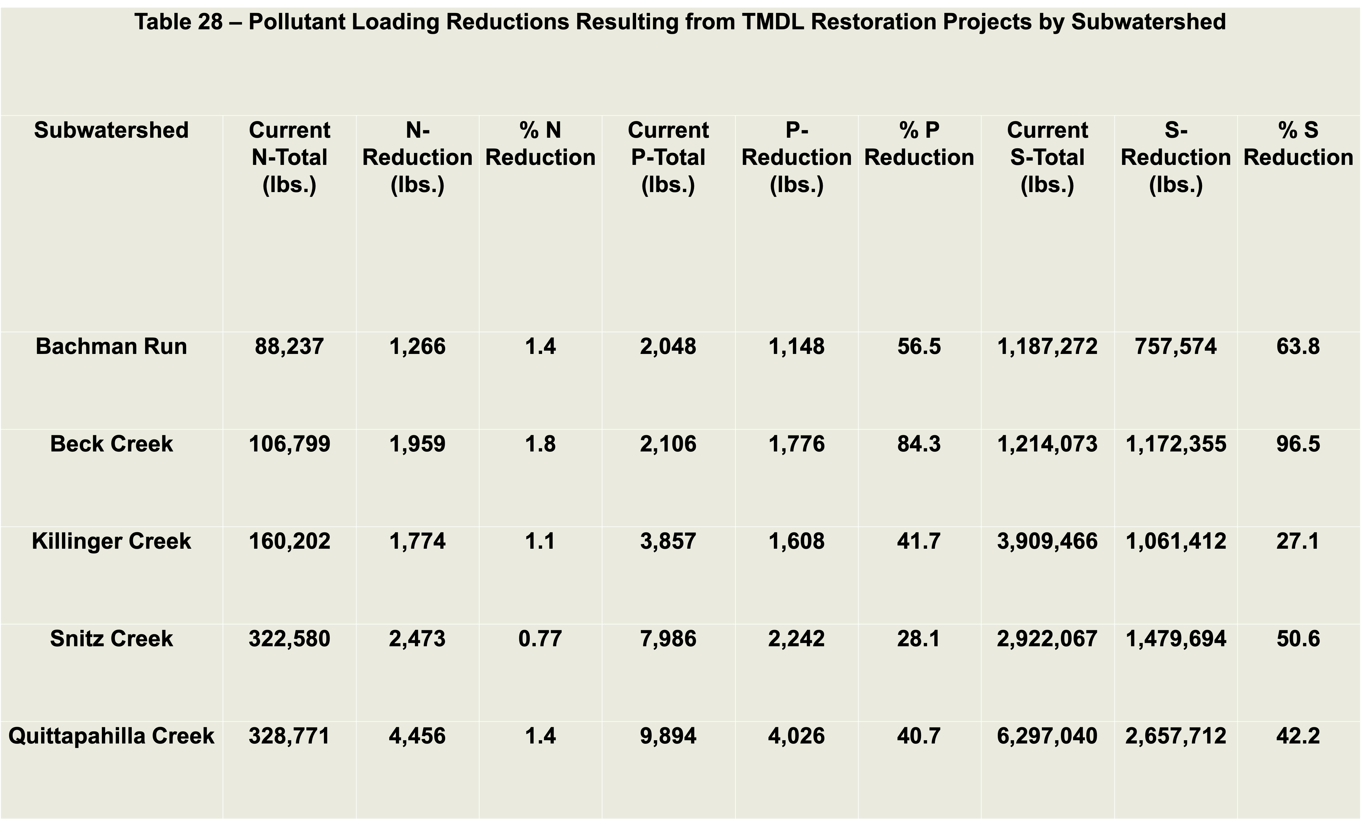
- Calculated pollutant loading reductions by priority subwatersheds and by restoration project reaches within subwatersheds.
- Developed criteria for evaluating water quality and biological improvements.
- Developed an implementation schedule for the prioritized projects.
- Developed cost estimates for a) survey, design and permitting and b) construction of the prioritized projects.
- Developed a public education, participation and outreach strategy.
Watershed Implementation Plan (WIP) was completed in 2018. This document will allow the QWA and their partners to obtain 319 funding for their restoration projects and guide their efforts through 2040.