Plumtree Run
Plumtree Run
Bel Air, MD
Harford County Department of Public Works
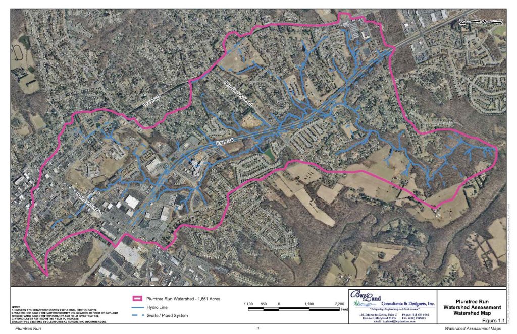
Plumtree Run is a tributary to Winters Run in the Bush River Basin. Clear Creeks Consulting teamed with BayLand Consultants and Designers to conduct a watershed assessment of the 2.6 square miles (1,664 acres) mixed land use watershed draining to Atkisson Reservoir. Mr. Powell served as Senior Scientist and Restoration Design Specialist for the assessment and stream restoration recommendations. He supervised and conducted the gage calibration surveys and field reconnaissance, conducted the geomorphic mapping and reach classifications, developed a methodology for and completed ranking of subwatershed segments and stream reaches by stream condition. He identified and prioritized potential restoration projects and developed cost estimates for those restoration projects.
A Report of Findings and Recommendations for stream restoration and stormwater BMPs was prepared. Conceptual designs and preliminary cost estimates were developed for the restoration and retrofit projects identified. The field work and report were completed in 2011.
PROJECT OBJECTIVES
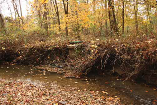
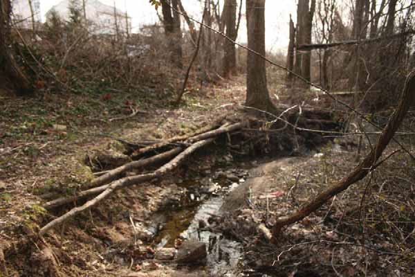
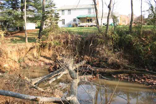
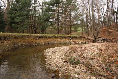
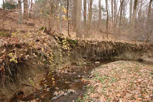
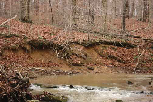
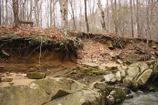
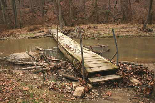
Over the last four decades the Bel Air area, as well as Harford County in general has experienced a rapid growth in population that has transformed this once rural area to suburban, residential and commercial land uses. These changes have had a tremendous effect on the natural resources of the County. In particular, increased sedimentation from construction activities, stream channel erosion in response to increased storm water runoff, and an overall increase in pollutant loadings due to the conversion from forest and cultivated land to residential and commercial uses have significantly degraded the water quality, reduced flood storage capacity, and damaged public infrastructure as well as public and private land along the County’s stream corridors. Of particular concern is the contribution unstable headwater streams make to sedimentation problems in tidal creeks that necessitate costly maintenance dredging.
In response to these concerns, the Harford County Department of Public Works, Water Resources Engineering have focused their efforts on identifying water quality problems and developing strategies for correcting those problems. In addition, the Department of Public Works initiated capital improvement programs focused on remediation of erosion and sedimentation problems caused by uncontrolled or inadequately controlled stormwater runoff.
It is the intention of the Harford County Department of Public Works, Water Resources Engineering to control runoff from developed areas, correct stream channel instability problems, reduce sediment loadings, and improve the overall water quality of Plumtree Run and the Atkisson Reservoir.
Assessment
- GIS Mapping and Analysis
- Evaluation of Historic Aerial Photographs
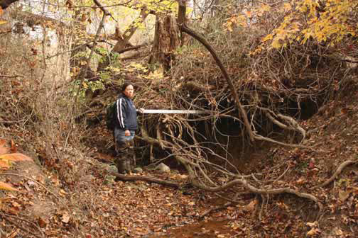
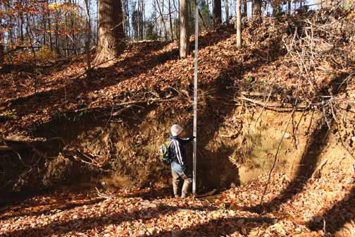
- Gage Calibration Survey at USGS Gage Station on Plumtree Run to develop estimates of bankfull dimensions and bankfull discharge
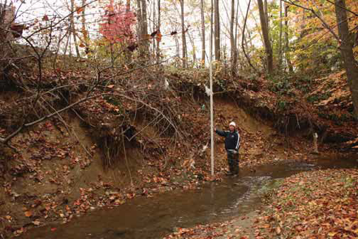
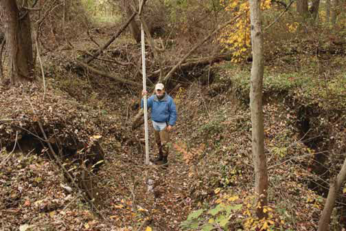
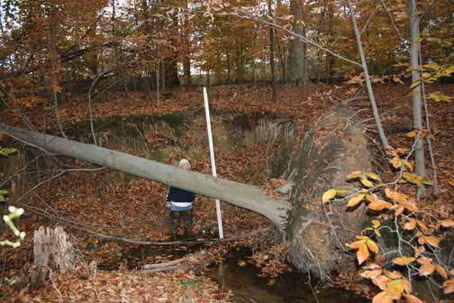
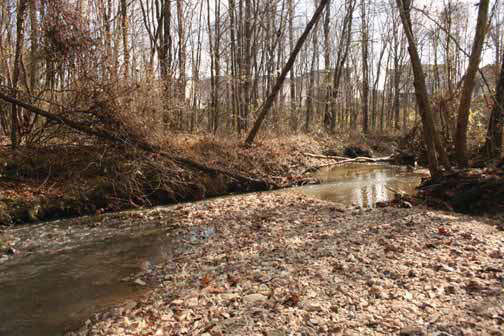
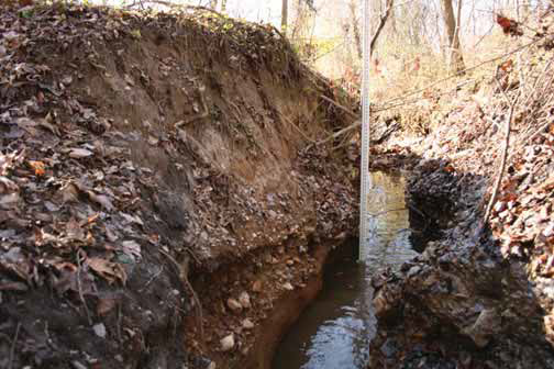
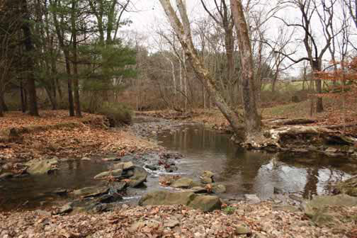
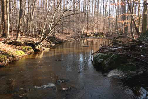
- Field Reconnaissance Survey of 8.84 mile (46,674 LF) of stream channels to identify problem areas with a special emphasis on channel condition and sediment sources;
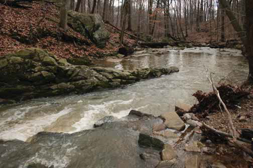
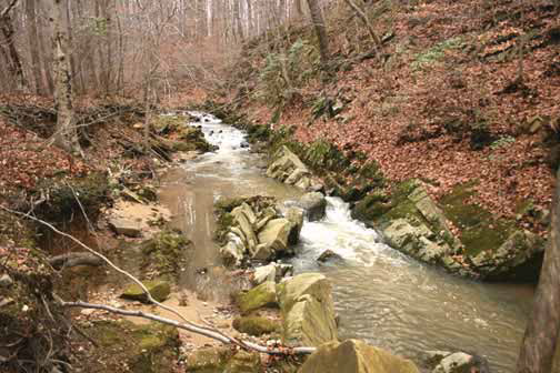
- Geomorphic Mapping and Level II Rosgen stream classifications of all channel reaches.
- Ranking of Subwatersheds, Stream Reaches and Stream Sections
- Preliminary Hydrologic Analyses
- Identification of Opportunities for Potential Stream Restoration Projects and Potential Stormwater BMPs
Ranking Watershed Segments and Stream Reaches by Stream Condition
- The Plumtree Run watershed was divided into four segments and 25 subsheds. To facilitate a more detailed evaluation of stream conditions, subsheds were further divided into stream reaches and stream sections. A total of 55 stream reaches/sections were evaluated.
- The evaluation process considered: 1) total length of stream channel that was unstable, 2) percentage of total length of stream channel that was unstable, and 3) percentage of stream length identified as unstable that rated as moderately to highly unstable.
- Determining degree of instability utilized a channel evolution model to determine whether the current conditions along a given unstable reach indicated it was evolving towards greater stability or greater instability.
- Using the evaluation criteria unstable stream reaches were categorized into Very Low, Low, Moderate, and High categories related to degree of instability.
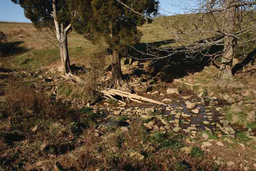
Potential Stream Restoration Projects
- Potential projects were identified from a list of main stem and tributary problem sites identified during the field reconnaissance.
- The feasibility of implementing specific restoration projects at the selected problem sites was evaluated. This included a planning level, qualitative analysis used to screen the projects for ease of implementation, project cost and long-term maintenance, and landowner acceptance.
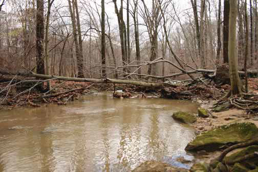
- Those projects determined to be feasible were prioritized based on their potential for correcting channel instability, reducing loadings of sediment and other pollutants to downstream reaches and Atkisson Reservoir. Another important consideration was public safety issues and the potential for damage to public or private infrastructure if a particular project was not implemented.
- Thirty six projects were determined to be feasible. Some of these projects were combined to form projects of 1,000 – 3,500 LF in length.
- Ten (10) large scale projects totaling 22,719 LF were identified.
Stormwater BMPs
- Thirty nine (39) existing SWM facilities and outfalls were assessed for retrofit opportunities.
- Pollutant loadings and BMP pollutant reductions were calculated for 17 Stormwater Management facilities.
- Design Concepts and cost estimated were developed for the 17 high priority SWM BMP sites
Preliminary Cost Estimates
- Preliminary cost estimates were developed for design, permitting and construction of the 10 large scale stream restoration projects and 17 high priority SWM BMP sites.