North Branch of Cypress Creek
North Branch of Cypress Creek Ecological Restoration,
Severna Park, MD
Anne Arundel County Department of Public Works
Cypress Creek is a tributary to the Magothy River located in Anne Arundel County in the east-central section of Maryland. Cypress Creek drains a 320 acre urban watershed. Clear Creeks teamed with BayLand Consultants and Designers and Underwood & Associates to develop a restoration design that would address the unique site conditions, control runoff from this watershed, maximize water quality treatment, correct stream channel erosion and sedimentation, reduce the need for future tidal dredging, restore natural floodplain functions, and improve in-stream and riparian habitat. Mr. Powell served as Senior Scientist, Stream and Floodplain Wetlands Restoration Designer and Construction Manager.
Technical Services:
- Coordinating with DPW and MDSHA
- A detailed assessment was conducted for a 2,700 foot reach of the North Branch of Cypress Creek immediately upstream of tidal waters
- Conducting field calibrations at U.S.G.S. stream gauging stations in the Coastal Plain region of Maryland
- Verifying the bankfull channel and developing estimates of bankfull discharge
- Level II and III Rosgen stream classification and channel stability assessments
- Hydrologic and hydraulic analysis
- Developing estimates of sediment loadings from stream channel erosion and upland sources
- Developing design criteria
- Preparing Findings and Design Reports
- Preparing Concept, Preliminary and Final Design Plans, Erosion and Sediment Control Plans and Construction Documents
- Preparing permit application packages and conducting pre-application meetings for local, state and federal permits
- Construction management services
Project Objectives
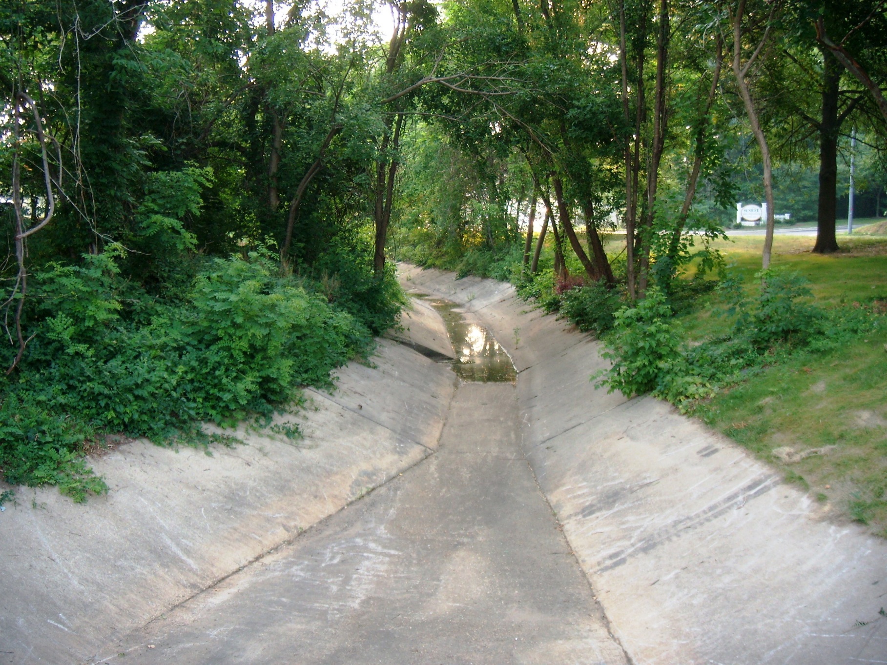
Over the last four decades the Severna Park area, as well as Anne Arundel County in general has experienced a rapid growth in population that has transformed this once rural area to suburban, residential and commercial land uses. These changes have had a tremendous effect on the natural resources of the Magothy River and its tributaries. In particular, increased sedimentation from construction activities, stream channel erosion in response to increased storm water runoff, and an overall increase in pollutant loadings due to the conversion from forest and cultivated land to residential and commercial uses have significantly degraded the water quality, reduced flood storage capacity, and damaged public infrastructure as well as public and private land along these stream corridors. Of particular concern is the contribution unstable headwater streams make to sedimentation problems in tidal creeks that necessitate costly maintenance dredging.
In response to these concerns, the Anne Arundel County Department of Public Works and Department of Planning and Zoning prepared Watershed Management Plans focused on identifying water quality problems and developing strategies for correcting those problems. In addition, the Department of Public Works initiated capital improvement programs focused on reducing erosion and sedimentation.
The Department of Public Works (DPW) initiated the Cypress Creek dredging project in 1999. The work completed by BayLand, Inc. as part of the project formulation for the proposed improvements to the Cypress Creek channel included a retrofit assessment of the Cypress Creek watershed. The assessment focused on identifying areas of erosion and proposing remediation that would minimize future siltation and the need for channel maintenance. The North Branch of Cypress Creek was one of four sites identified during this assessment.
It was the intention of the Anne Arundel County Department of Public Works to correct stream channel instability problems, restore natural floodplain functions, and control runoff from developed areas to reduce sediment loadings from channel and upland sources, improve the overall water quality of Cypress Creek, and reduce the need for future channel maintenance. These objectives were accomplished by implementing an effective, long-term restoration plan for the North Branch of Cypress Creek project area.
Unique Site Conditions
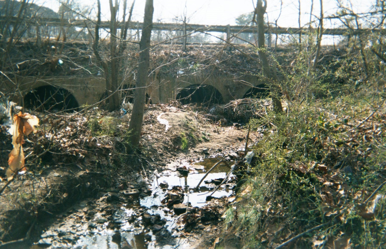
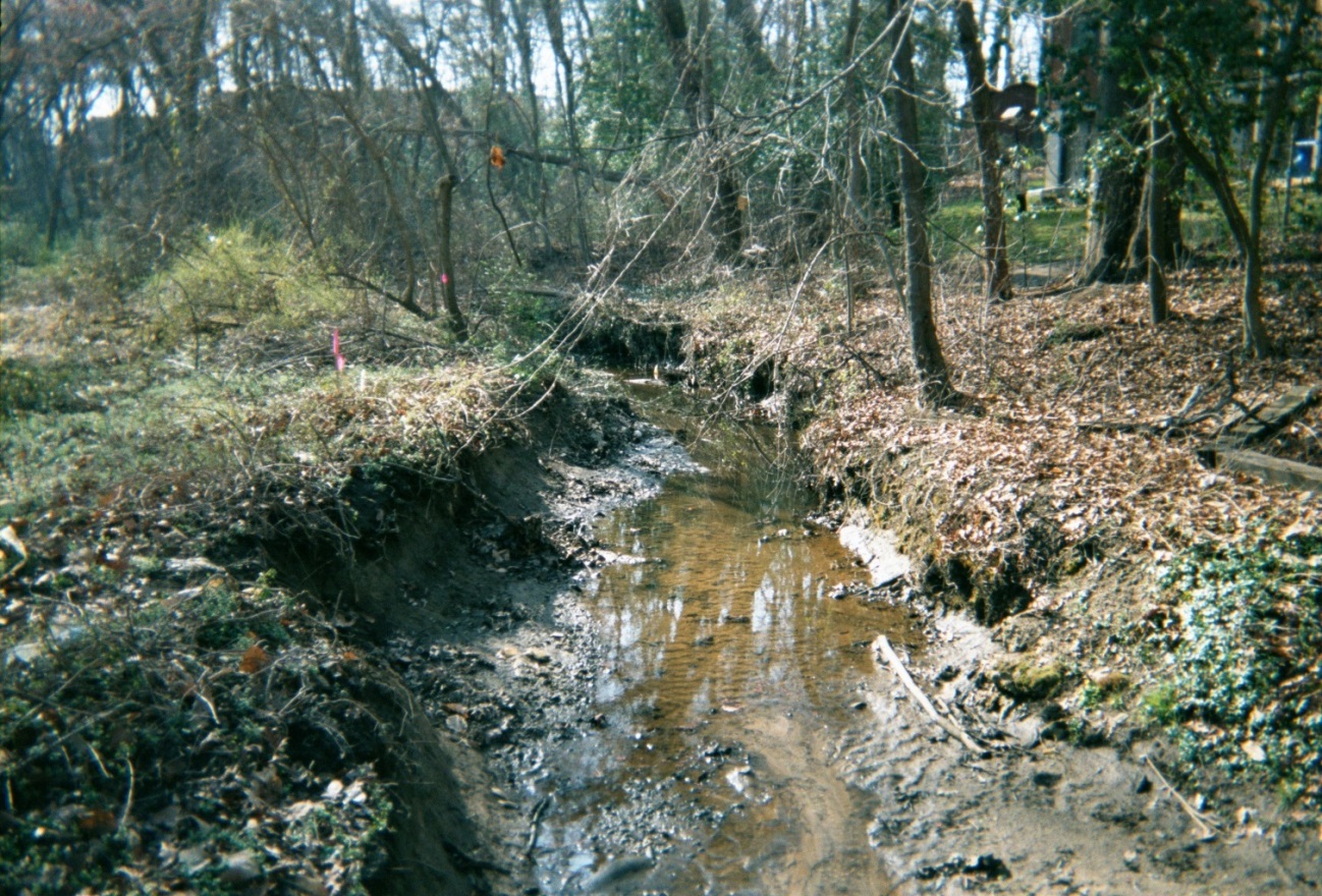
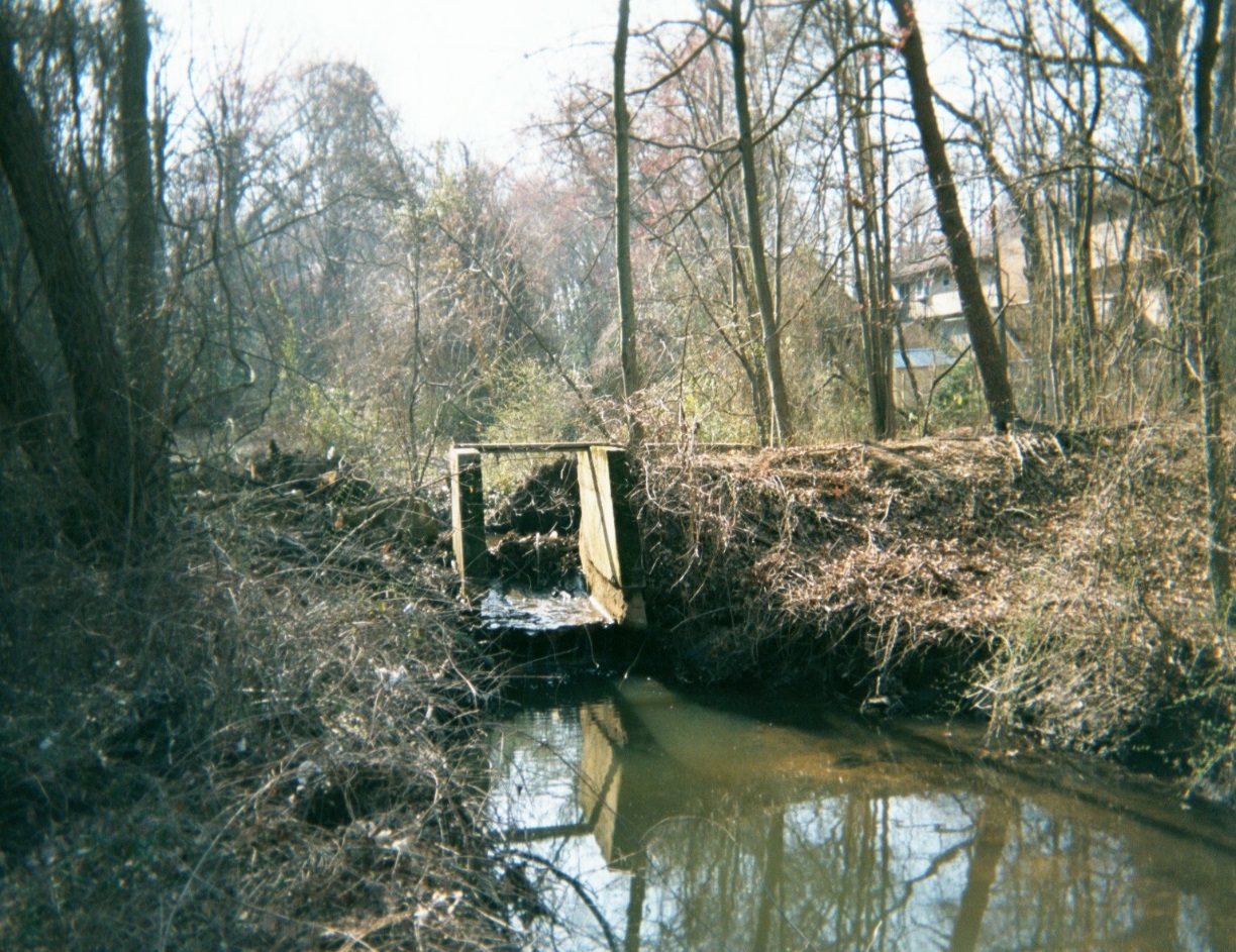
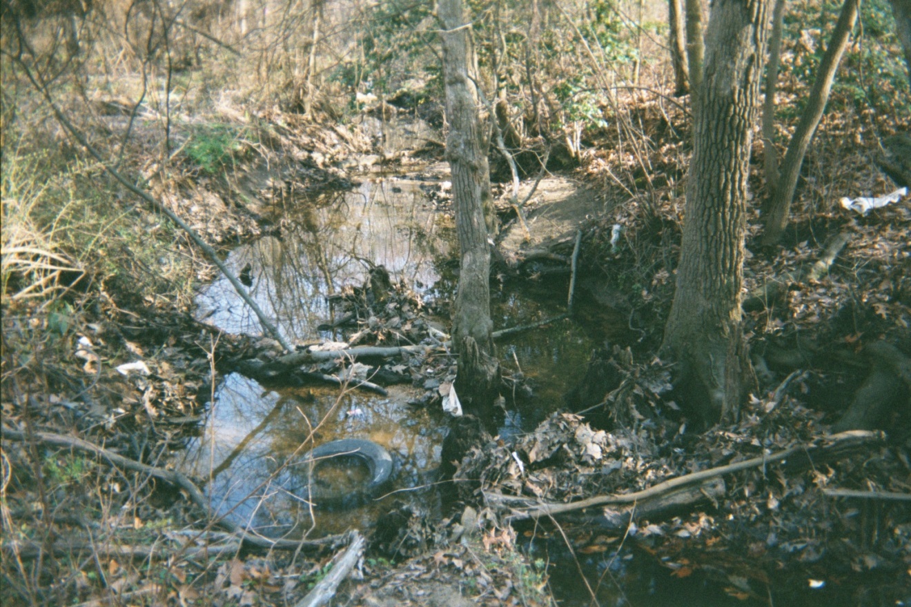
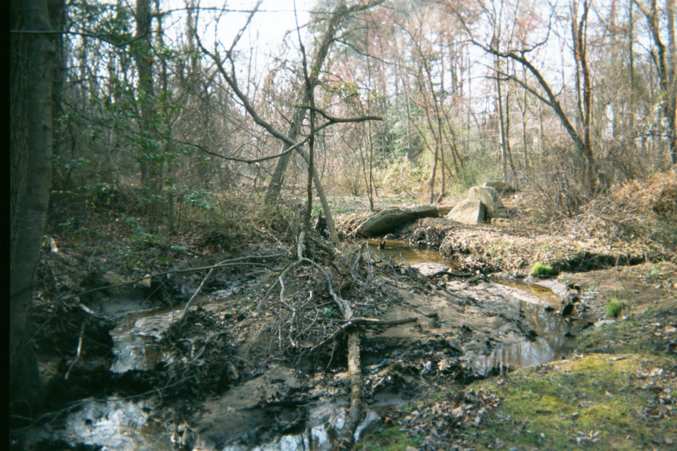
During the 1930’s, a series of on-line ponds were constructed along the North Branch of Cypress Creek. Urbanization during the 1960s increased sediment loadings to the creek causing sedimentation of the ponds. The resulting down-valley floodplain elevations varied significantly from one impoundment area to the next. When the dams breached in the 1970s, the stream down-cut through the sediments deposited in the old impoundments. By the 1990s, the creek was deeply incised, with active head-cuts and severe bank erosion. Downstream sedimentation was rapidly filling the tidal creek causing significant environmental impacts and necessitating extensive dredging to restore lost boating access.
Restoration Design Objectives
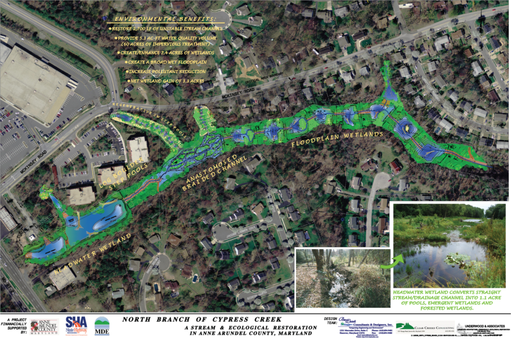
Design objectives for the restoration of the 2,700 LF of unstable stream channel along the North Branch main stem included 1) reducing sediment loadings transported to the tidal creek from streambed and stream bank erosion along upstream reaches; 2) restoring in-stream and riparian habitat along all reaches; and 3) maximizing pollutant removal by creating open water and wetland areas along the floodplain.
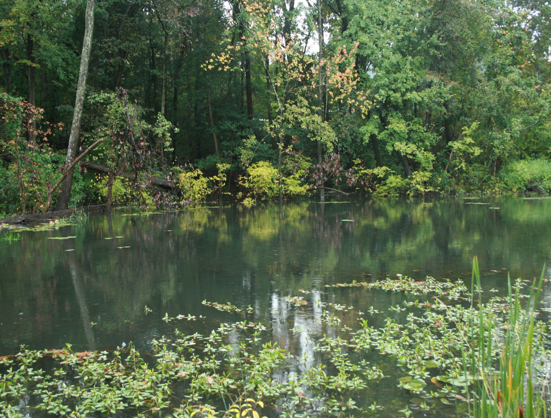
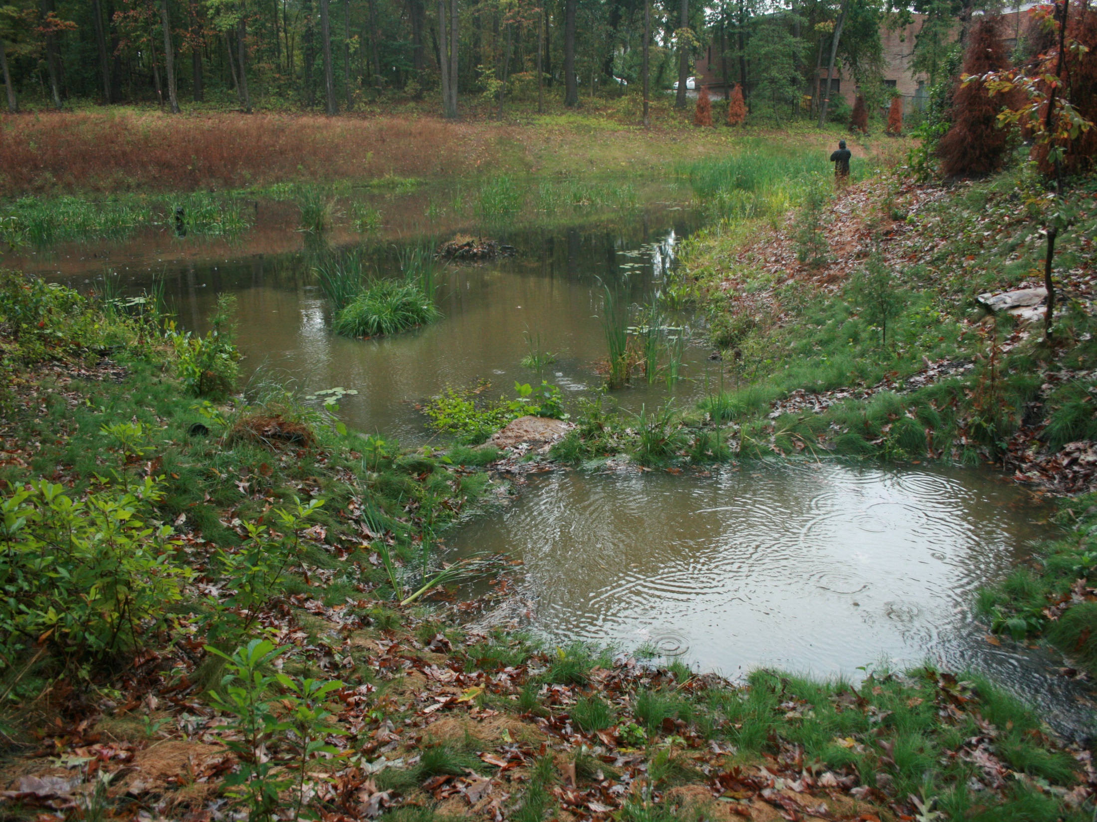
Headwater Wetland
Storm water management design objectives included 1) reducing peak discharge runoff rate for the 1 and 2-YR storm flows to allow soft techniques in the stream restoration; and 2) providing water quality management for the first flush of pollutants from upstream impervious areas. Three design alternatives were evaluated. The selected alternative included the creation of a 2.1 acre-feet storm water wetland impoundment.
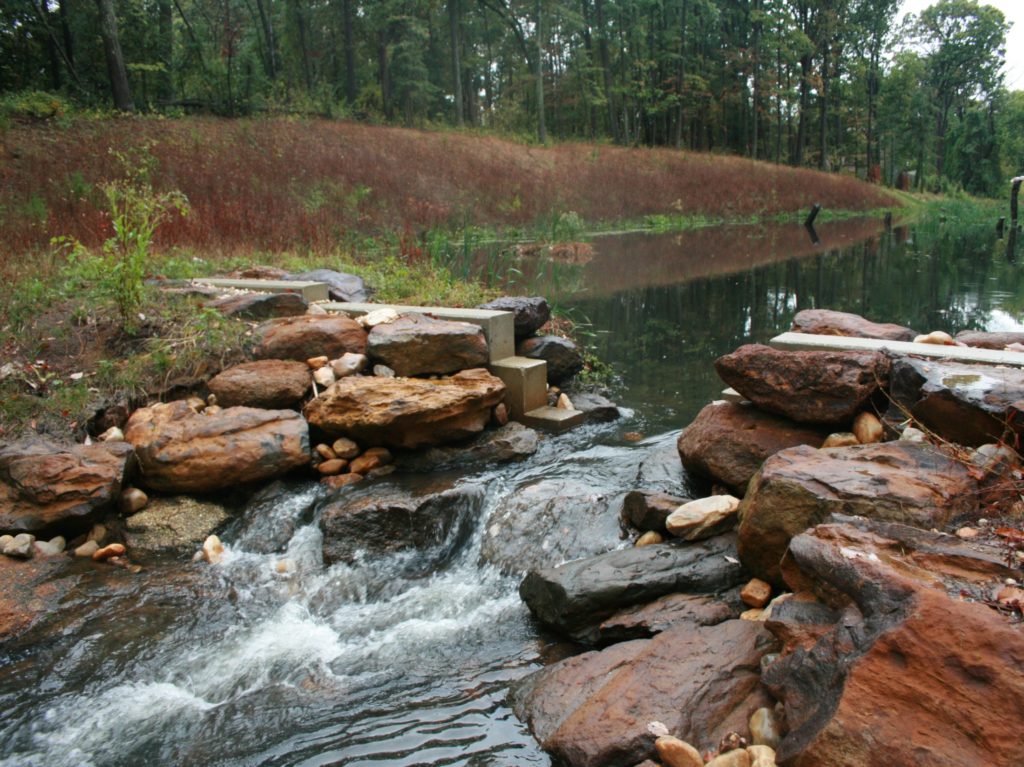
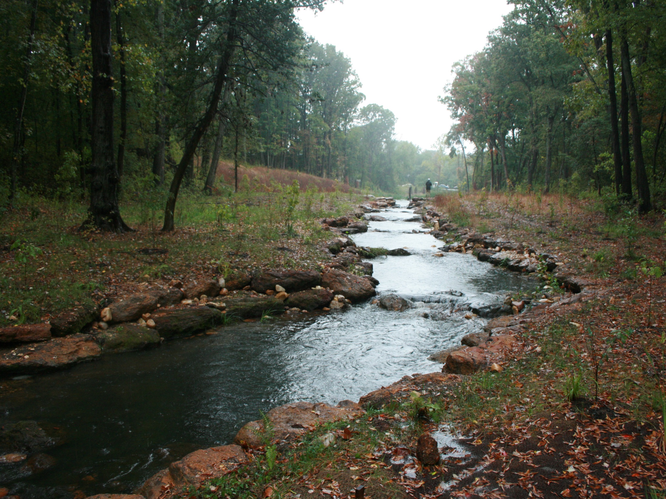
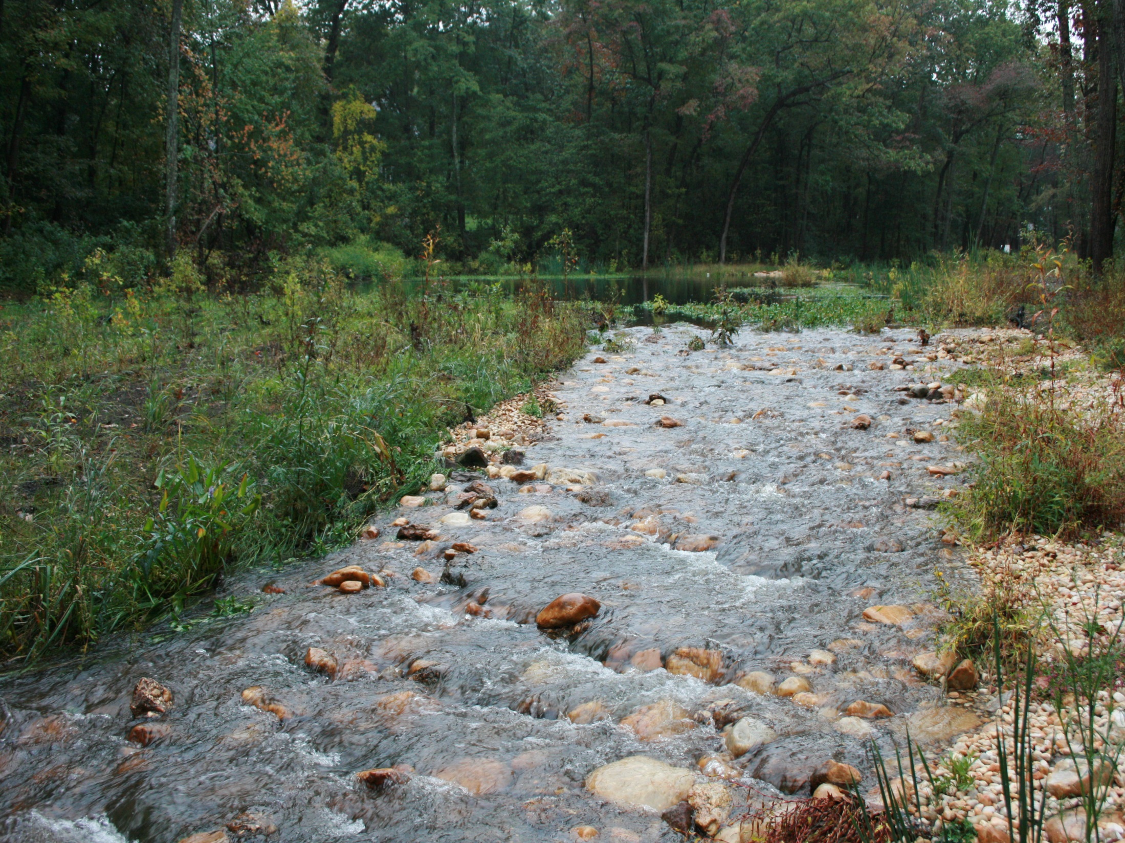
Upper Stream Section – Single Thread Channel
The outfall of the headwater wetland is several feet above the existing stream/floodplain elevation. The headwater wetland embankment and outfall are located in an area where the floodplain width is very narrow. Conveying storm flows from the headwater wetland to the downstream stream reaches in a non-erosive manner required a transition reach that could accommodate the relatively narrow width of the valley as well as the steep slope resulting from the significant change in elevation over a relatively short distance. This was accomplished by constructing the upper most reach of North Cypress Branch as a B-type channel with a series of log/boulder step pools. Construction of this reach required that the floodplain along the reconstructed channel be raised as well. Because the floodplain starts to widen and the valley gradient flattens downstream of the step pool reach, a transition E-type channel was constructed. This was accomplished by raising the existing streambed and stabilizing the stream banks.

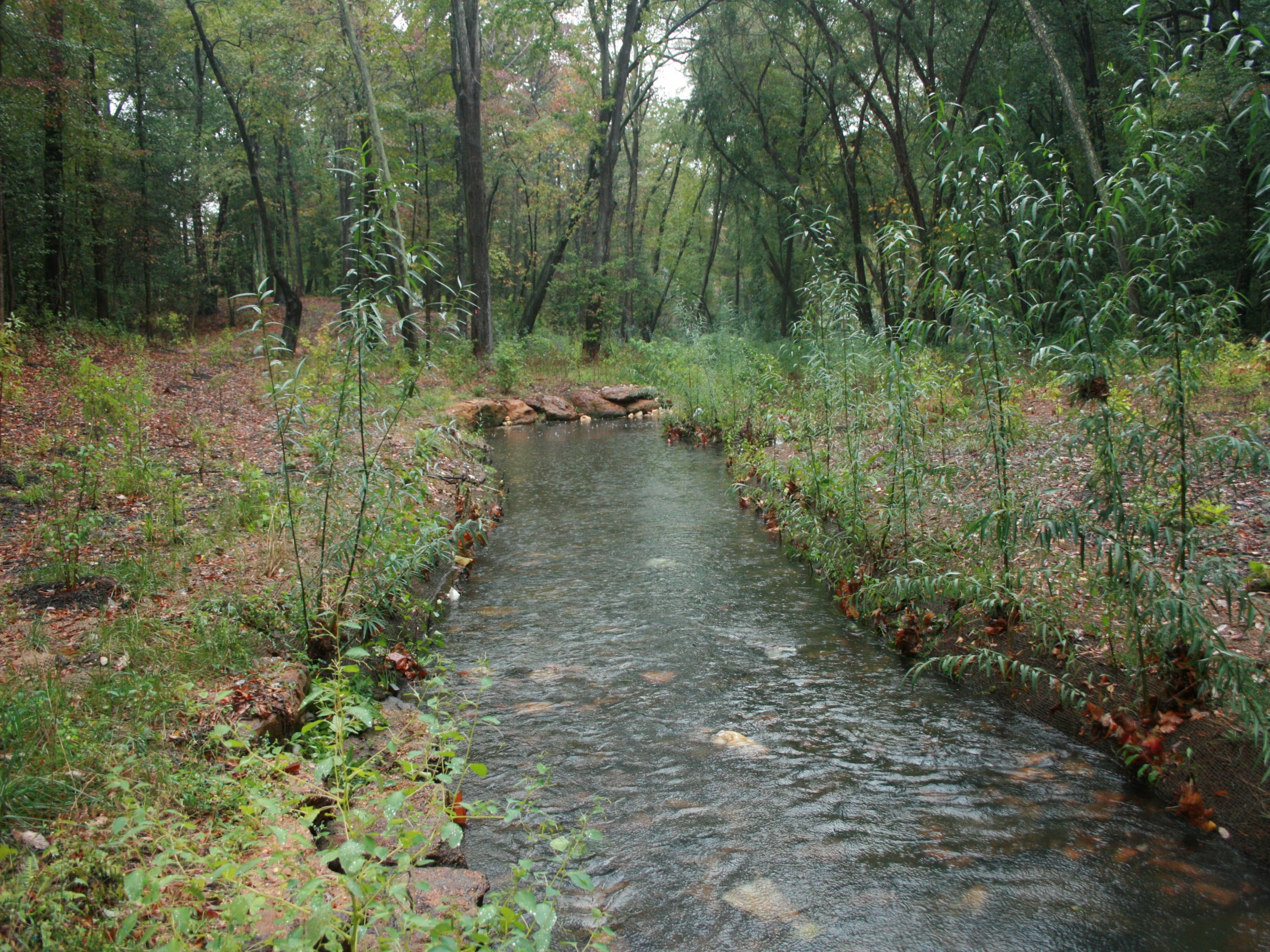
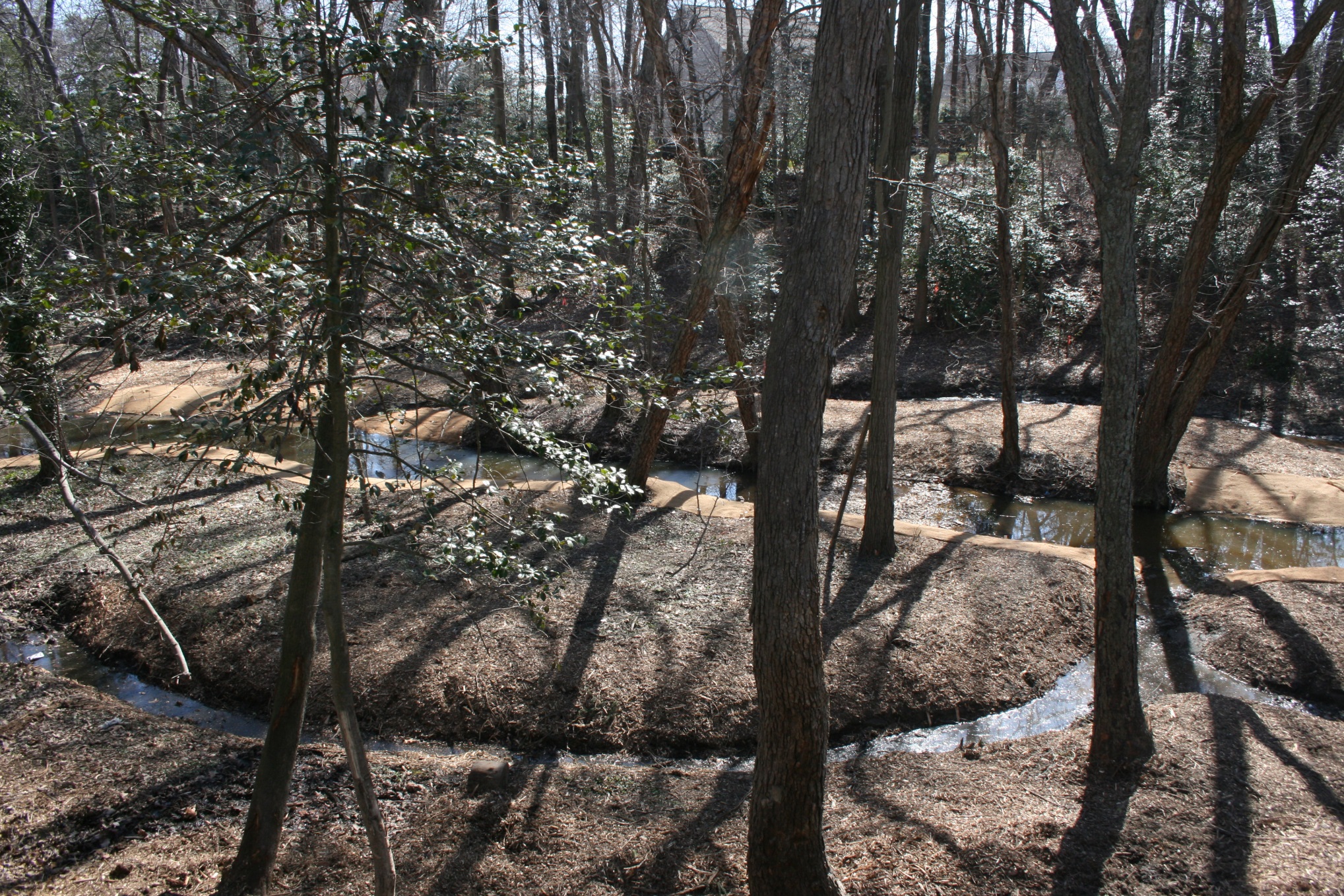
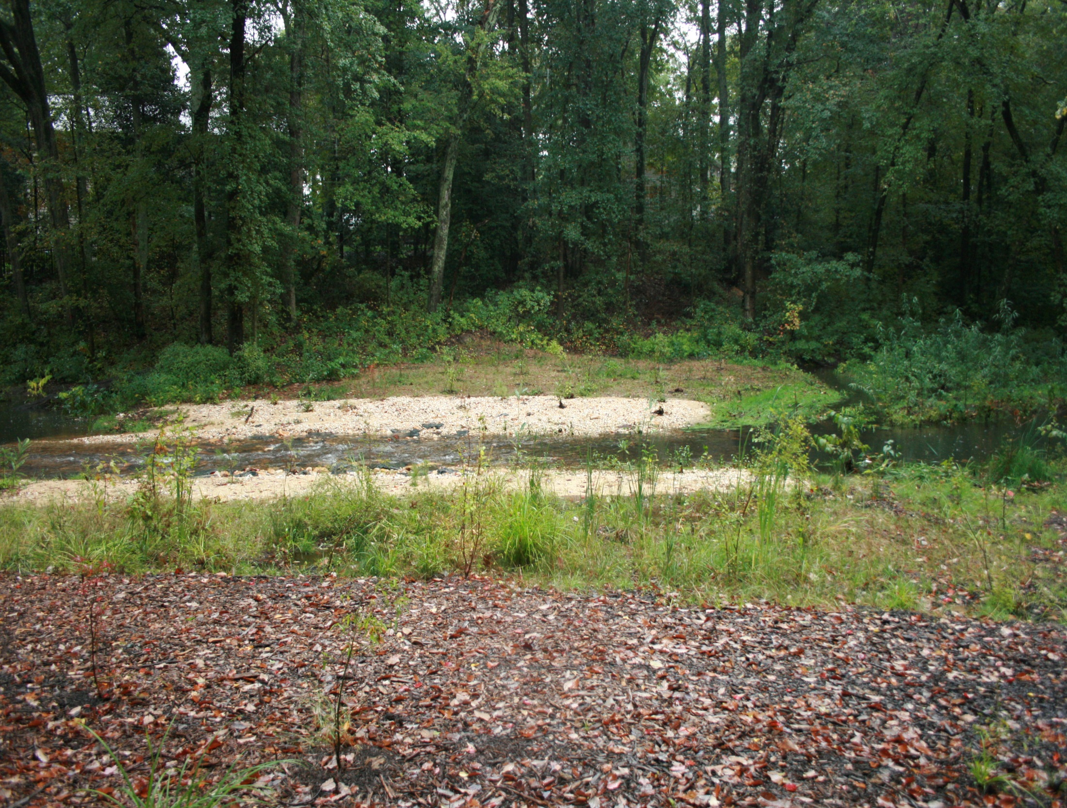
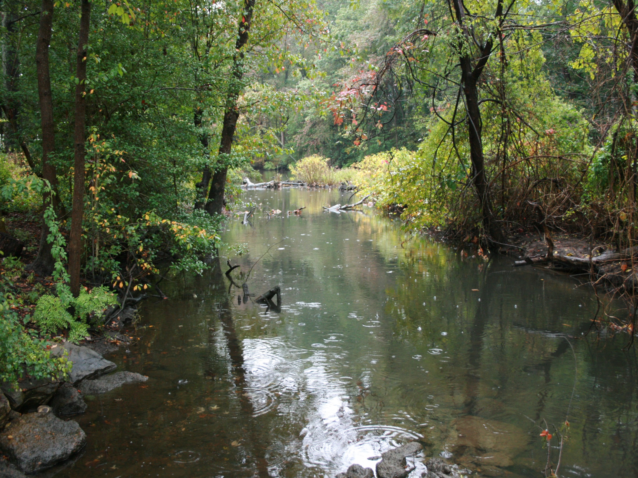
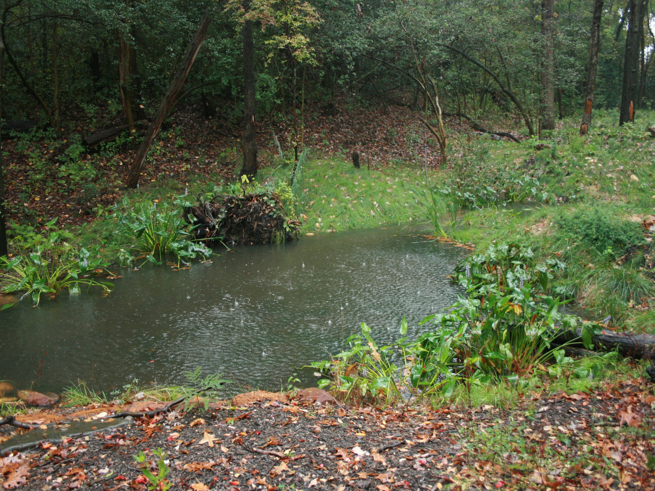
Anastomosed Stream Channel Section
Downstream of the E-type channel the floodplain is at its widest and the valley gradient is very flat. This area includes one of the old impoundments that existed along the main stem North Branch. In this area North Branch was reconstructed as an anastomosed or DA-type channel, a stream with multiple channels and islands. This was accomplished by excavating secondary channels along the existing floodplain thereby creating islands between the channels. The existing channel was maintained along its current alignment to function as the central or primary channel in the anastomosed system. The streambed along this channel was raised to reconnect the floodplain and the stream banks were stabilized.
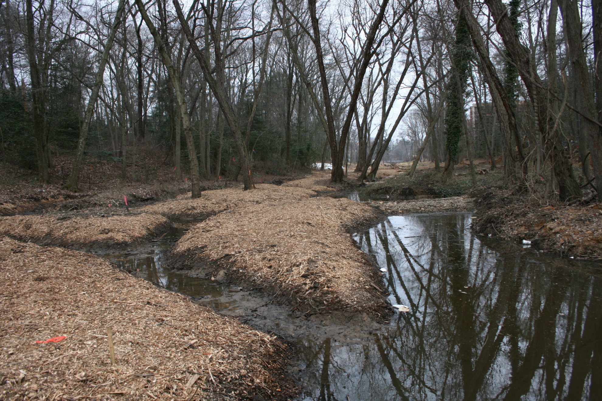
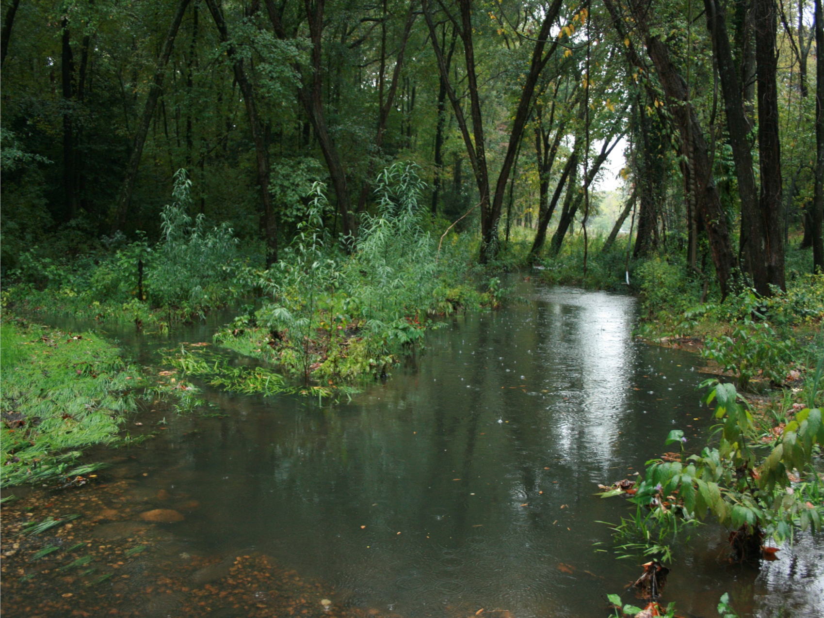
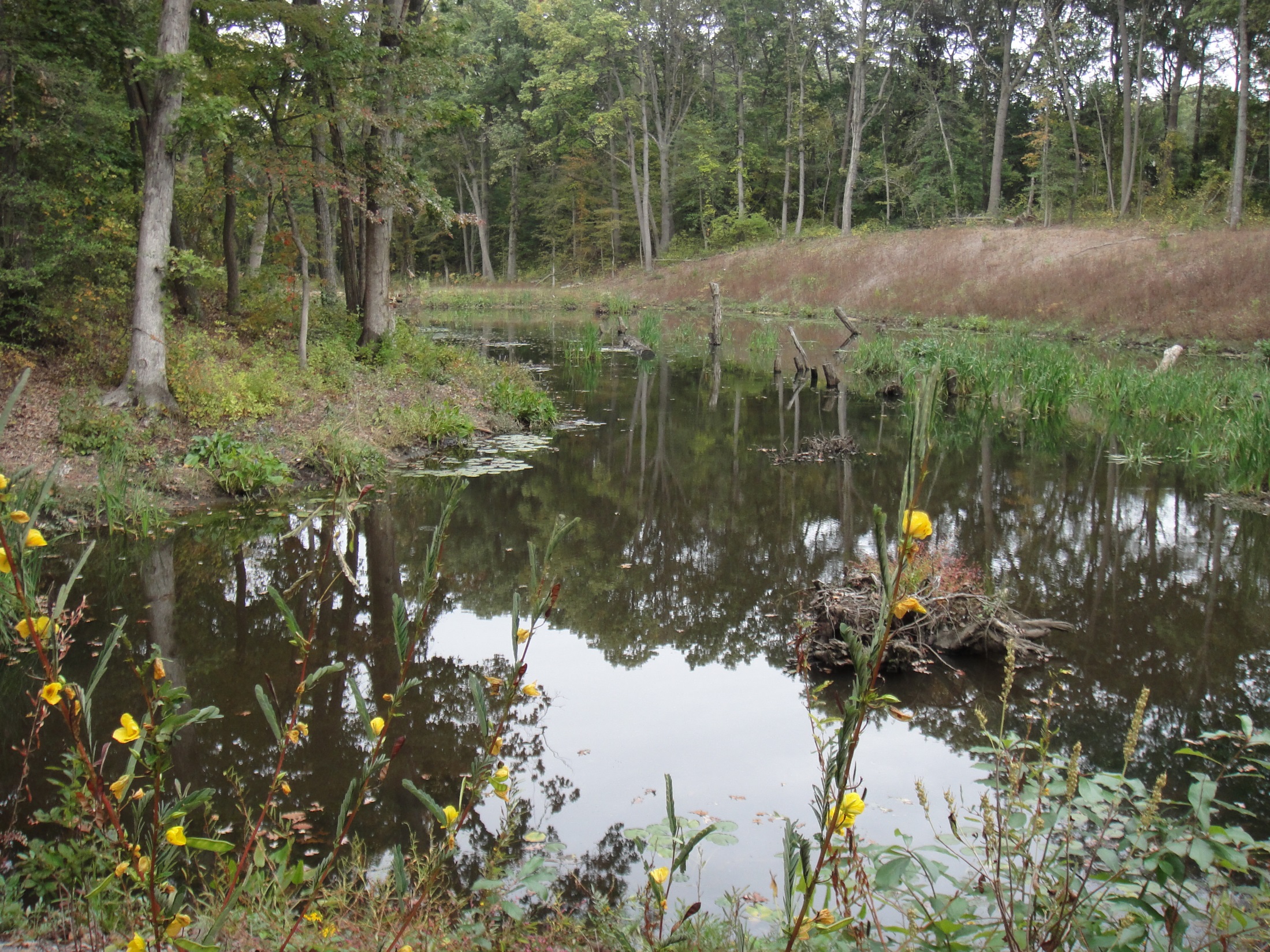
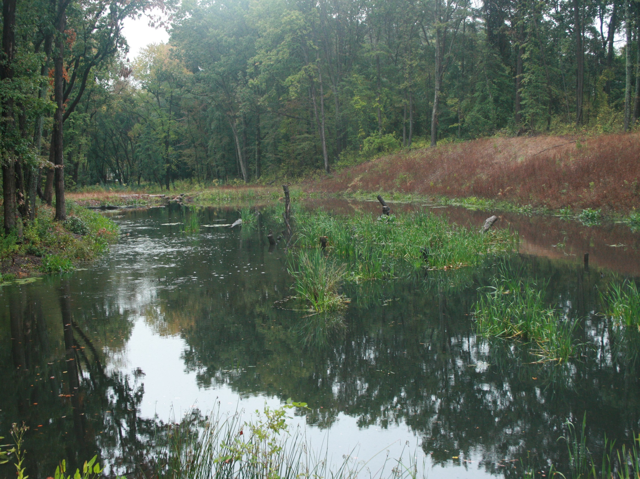
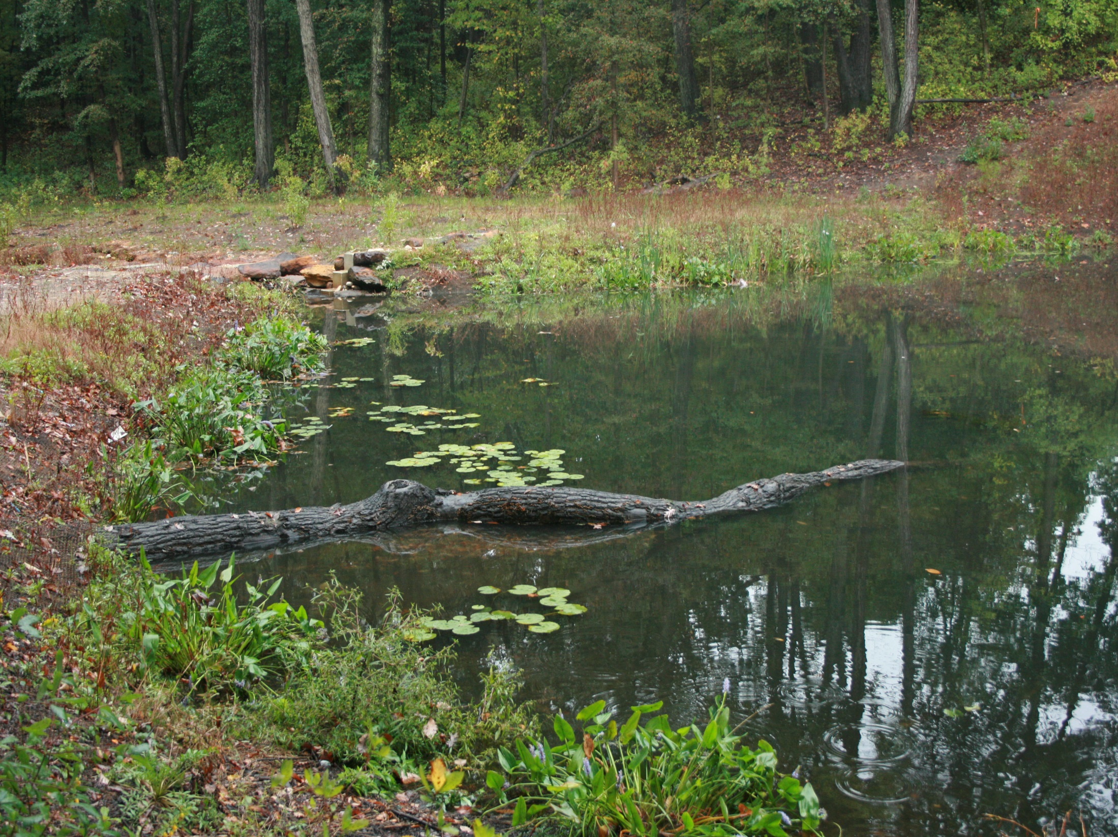
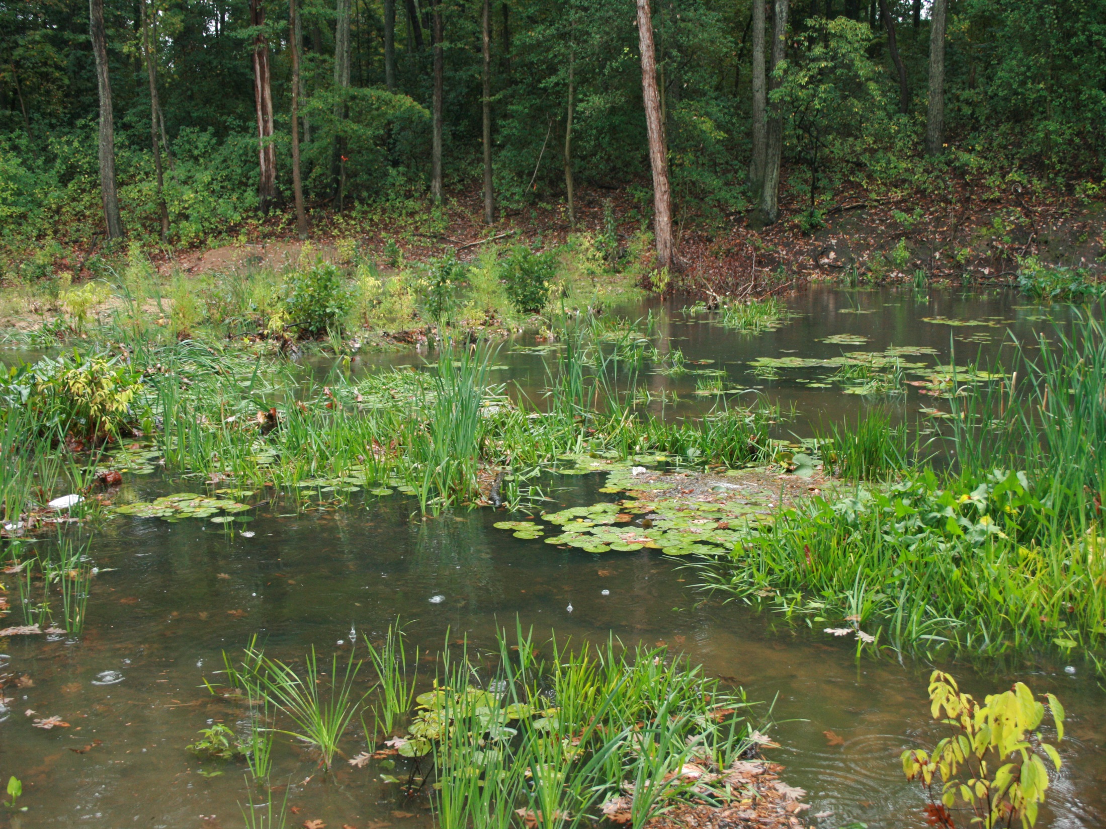
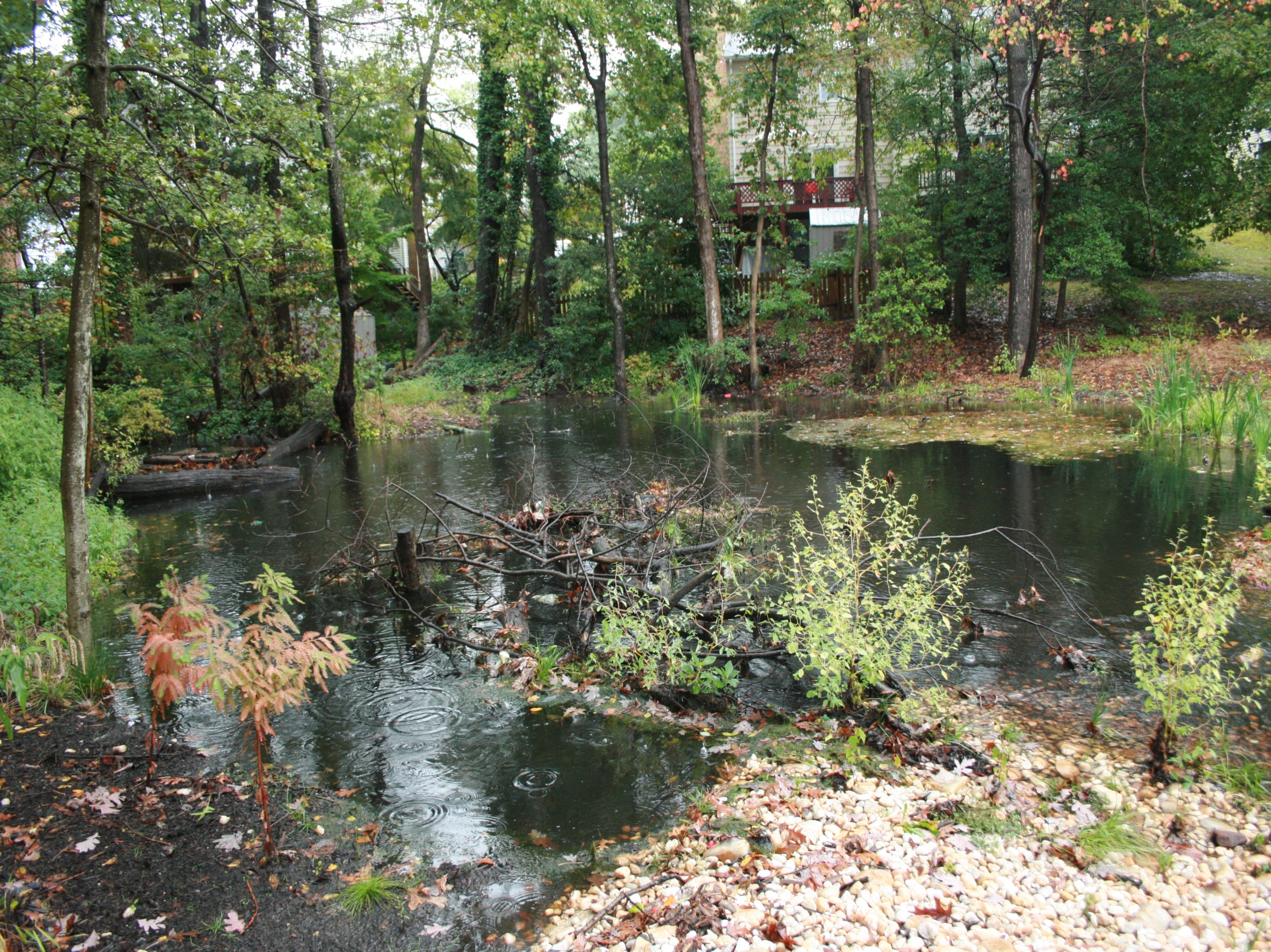
Floodplain Wetlands
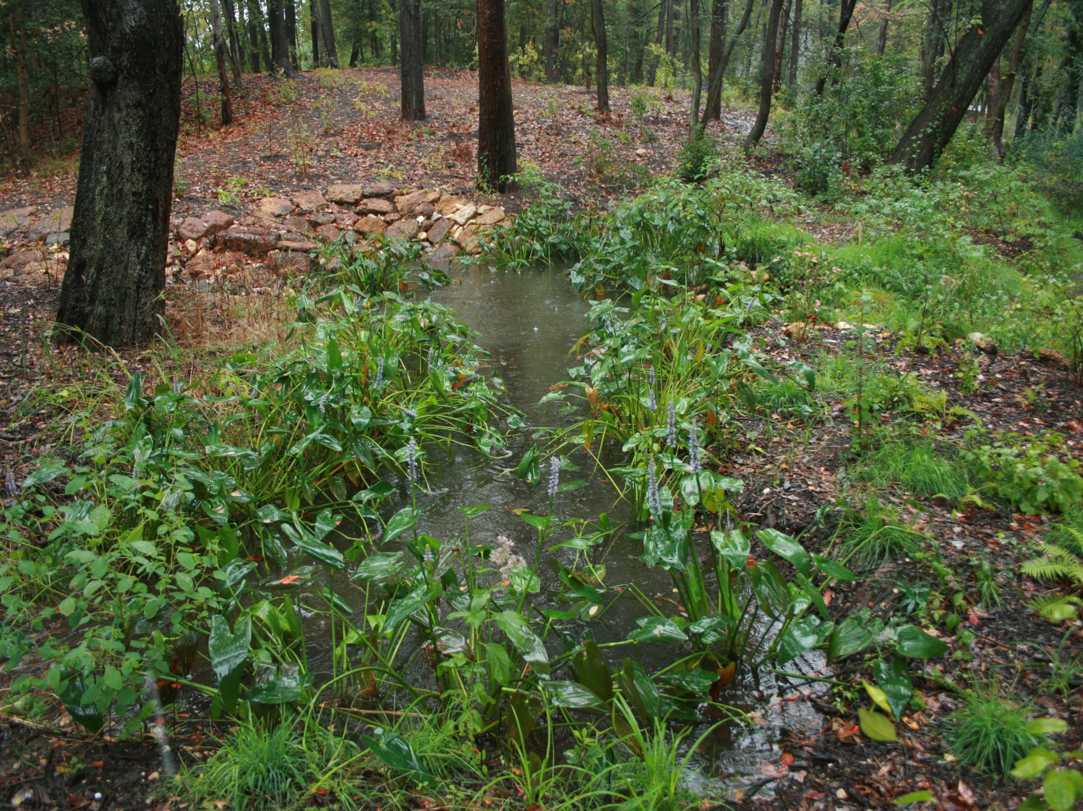
The middle reaches along the North Branch were excavated and filled to create floodplain wetlands. Broad landform type embankments were constructed to impound water in the wetlands. In addition, the old dam embankments were repaired and graded to impound water in the wetlands. Fine grading established islands, peninsulas, and micro-topography and produced a variety of hydrologic regimes within the wetland areas. Water is conveyed from one wetland area to the next via a single thread channel constructed through the wetland embankment.
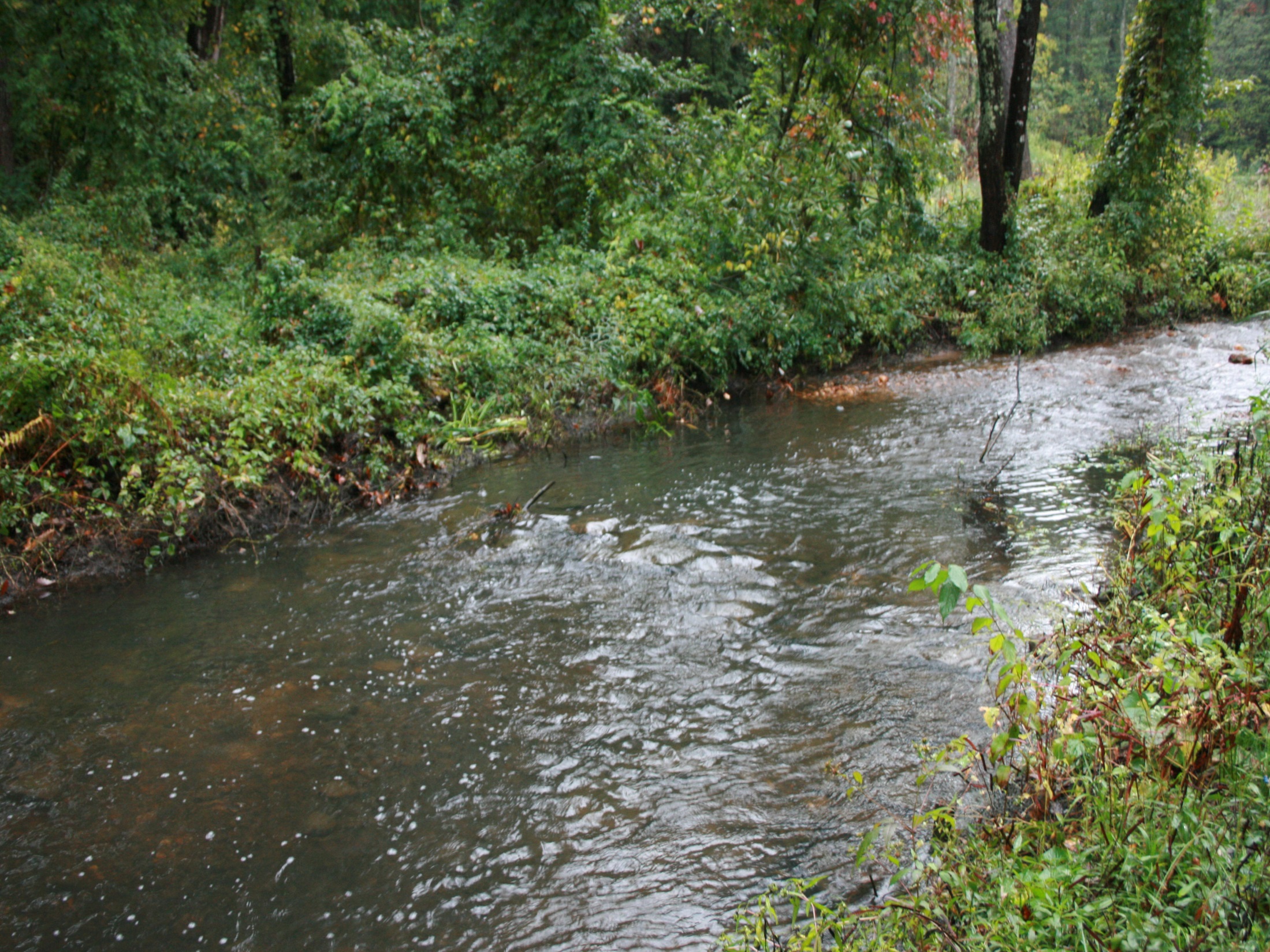
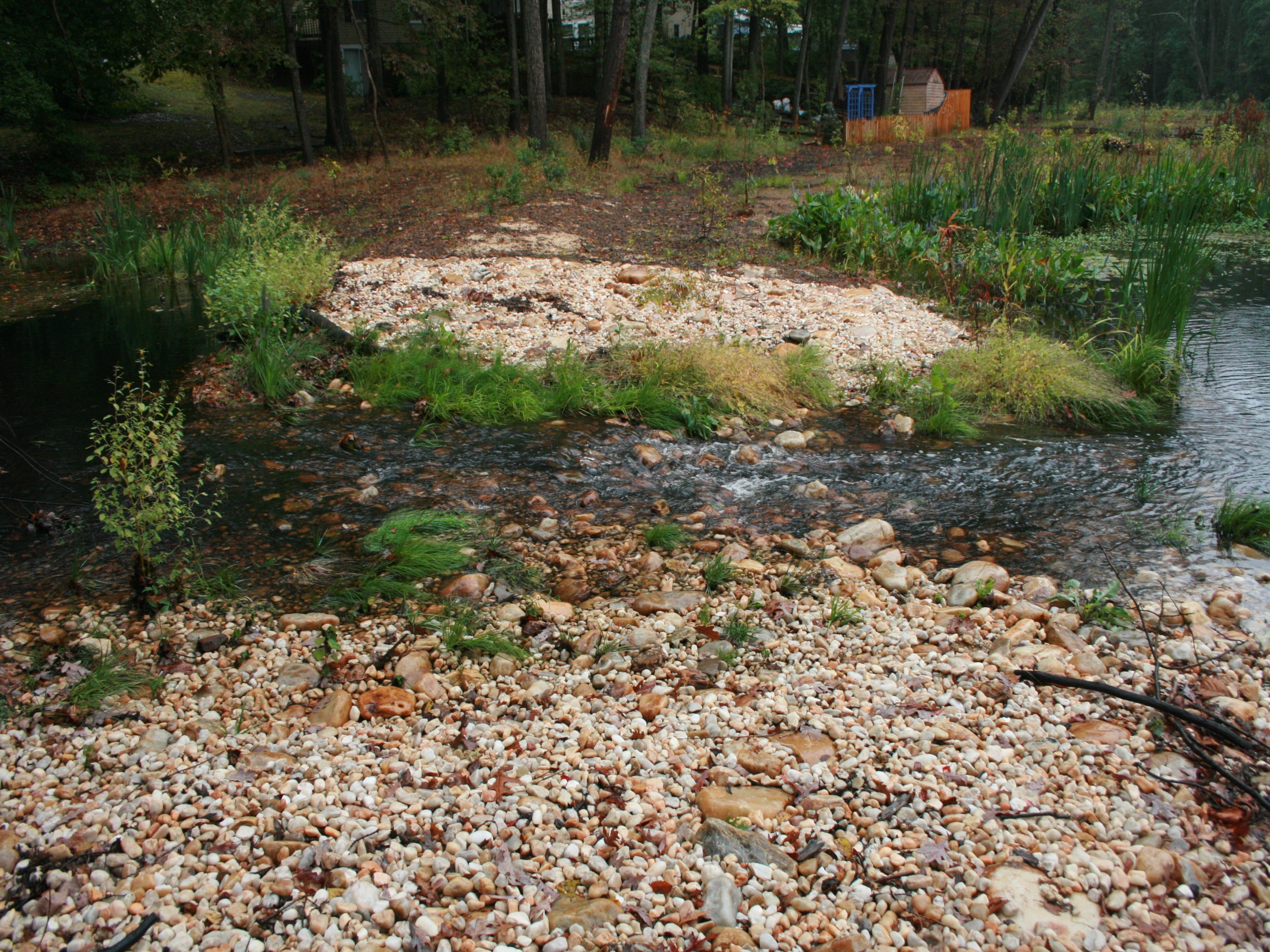
Single Thread Tidal Channel Section
The lower reach of North Cypress Branch, immediately downstream of the last floodplain wetland and upstream of the tidal area, was reconstructed as an E-type channel. Although the floodplain is very wide in this area the construction of the floodplain wetland embankments raises the floodplain several feet above the tidal area resulting in a local valley gradient that is relatively steep. The existing tidal channel section was maintained in its current alignment. However, the existing floodplain was filled and the existing tidal channel was raised by creating constructed riffles along the existing streambed. This flattened the overall valley gradient, providing a gradual transition from the crest of the last floodplain wetland embankment to the tidal area, reconnects the raised tidal channel to its floodplain, and allows for fish passage from the tidal area into the floodplain wetland impoundments.
Tributary and Stormwater Drainages
Storm flow from storm drain outfalls along the perimeter of the project and at the headwaters of tributaries is provided water quality treatment and conveyed in a non-erosive manner into the project area by utilizing Regenerative Step-pools.
Environmental Benefits
The environmental benefits associated with this project include:
- Provided 5.3 acre-feet Water Quality Volume – 60 ac of Equivalent Impervious Treatment with a subsequent reduction in sediment and nutrient loadings
- Created/Restored 7.4 acres of wetlands – Net Gain of 3.3 acres
- In-line headwater wetland
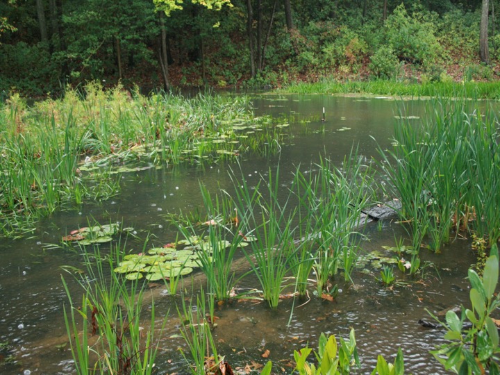
- Forested wetlands
- Emergent wetlands
- Tidal wetlands
- Seepage wetlands
- Creation of 4.5 acre riparian forest
- In-stream and riparian habitat Enhanced/Diversified
The North Branch of Cypress Creek Stream & Ecological Restoration Project was awarded 1st place in 2017 for Best Stream Restoration by the Chesapeake Stormwater Network for the Best Urban BMP in the Bay Award (BUBBA).