Monarcas Creek

Monarcas Creek Watershed and Stream Assessment
Winston-Salem, NC
Pilot View RC&D
Monarcas Creek is a tributary of Mill Creek and Muddy Creek in the Yadkin River drainage system. Clear Creeks Consulting was contracted by Pilot View RC&D to conduct an assessment of the 2.4 square mile urban watershed and a detailed geomorphic assessment of 4,200 linear feet of Monarcas Creek within Historic Bethabara Park . Mr. Powell served as Project Manager, Senior Scientist and Restoration Design Specialist. CNA Engineers and Consultants provided engineering support services.
A Report of Findings was prepared. The feasibility of implementing ten (10) regional SWM facilities and 17,300 feet of channel restoration was evaluated and preliminary design plans for the Regional SWM BMPs and restoration reaches in the Park were prepared. The fieldwork for this project was completed during Spring 2005 and the Findings Report and Feasibility Study were completed Winter 2005.
PROJECT OBJECTIVES
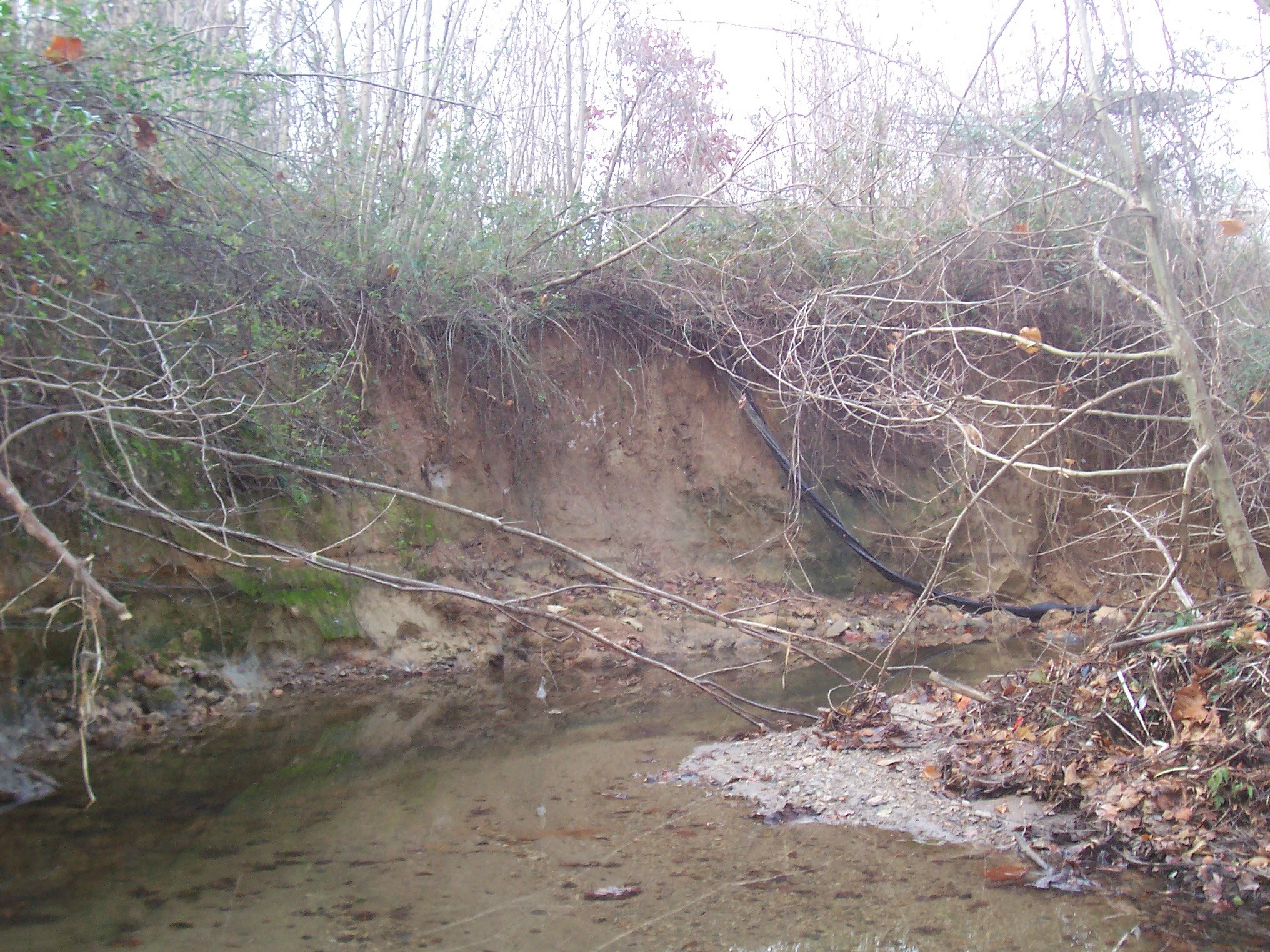
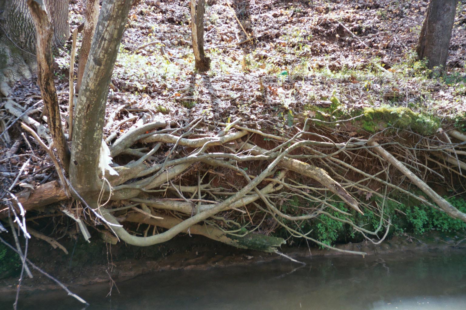
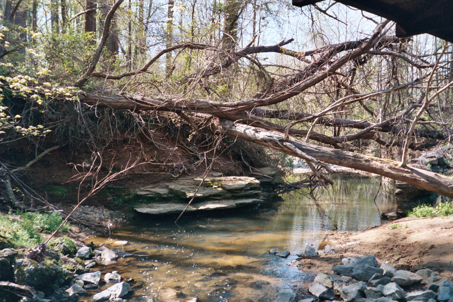
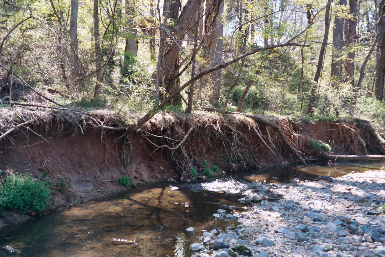
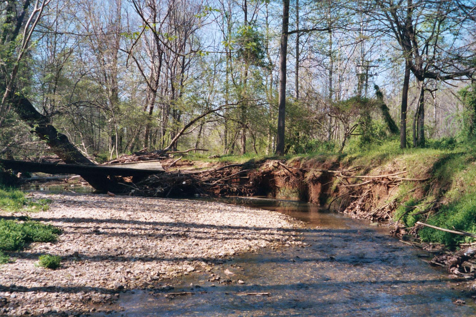
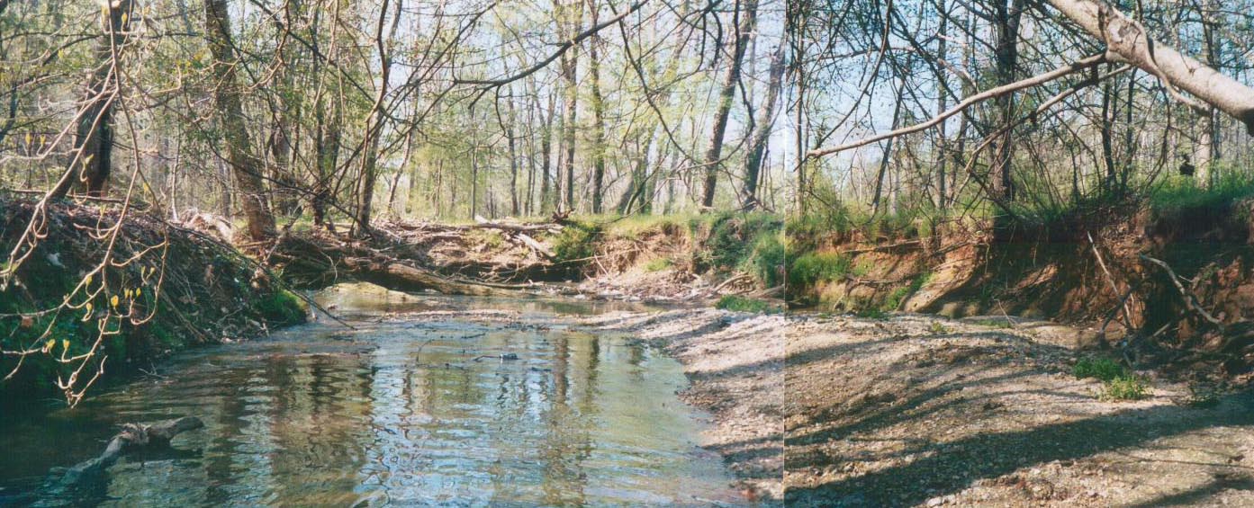
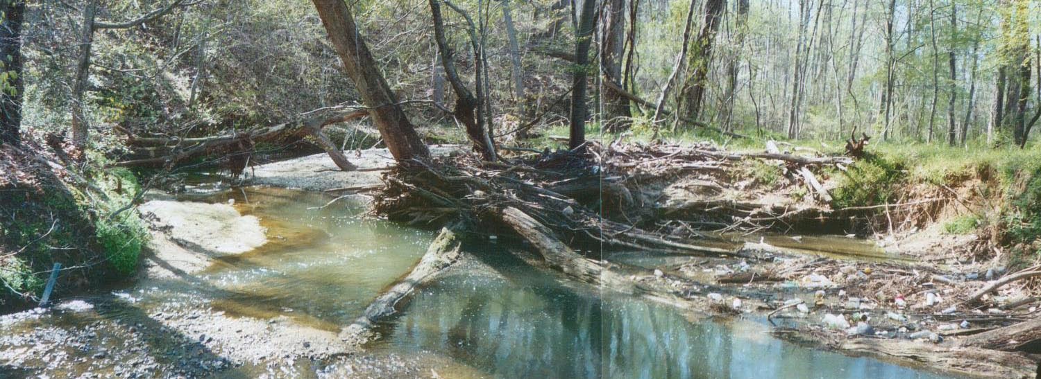
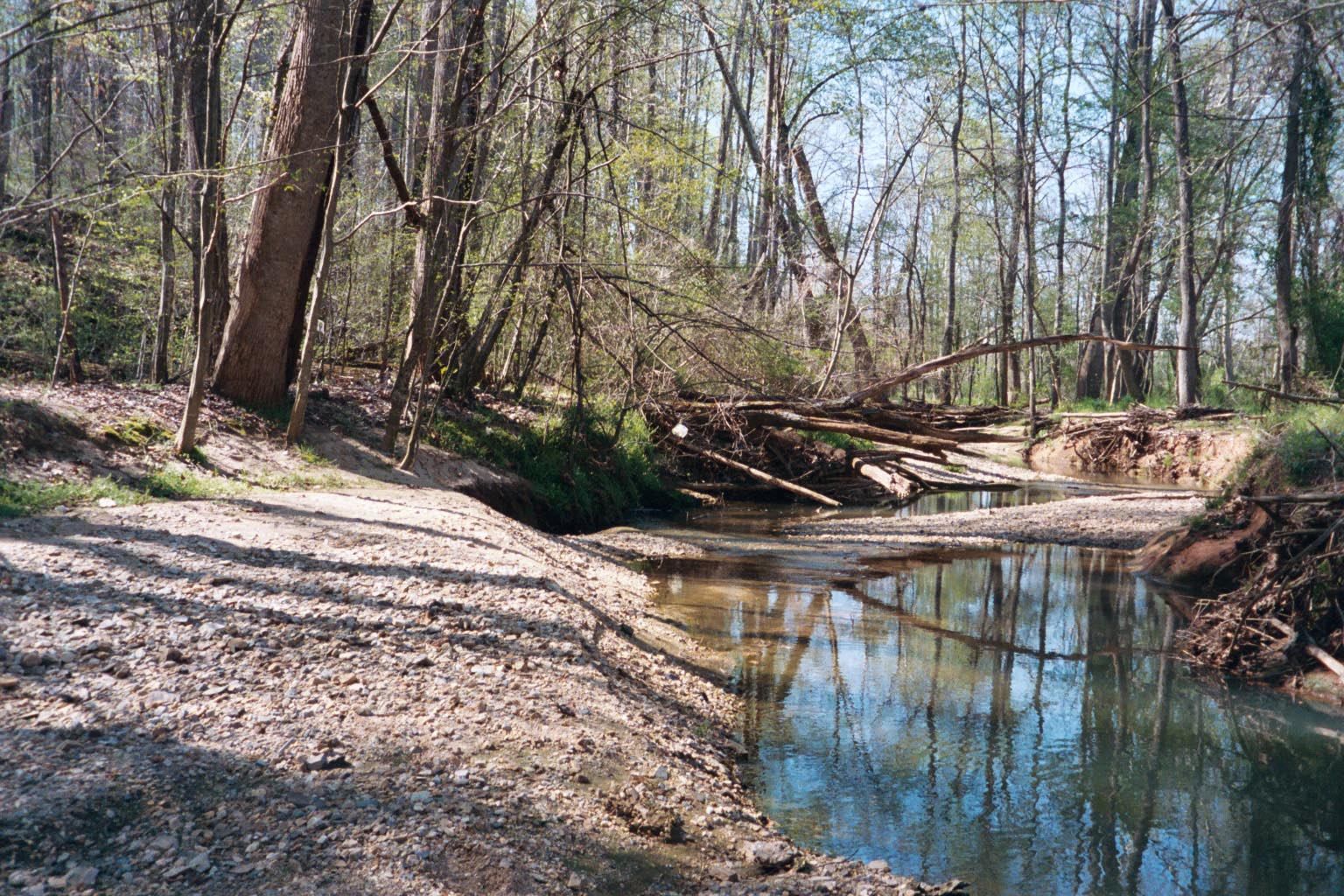
Historic Bethabara Park is situated along the banks of Monarcas and Mill Creeks in Winston-Salem, North Carolina. As the site of the original Moravian settlement of Bethabara, the creeks have been significant components of this community since the settlement was established in the 1750’s. The present day watershed only remotely resembles the land cultivated and carefully tended by the Moravians. Changes in the hydrologic and sediment regimes associated with clearing of forests and subsequent urbanization of the watershed in the 1960s, 70’s and 80’s have caused the creeks to undergo significant morphological changes. These changes included: down-cutting or degradation of the streambed, stream bank erosion, widening of the channel, significant aggradation and lateral migration. Due to this aggradation the channel lost its capacity to convey storm flows, causing adjacent lands to flood more frequently than they had previously done.
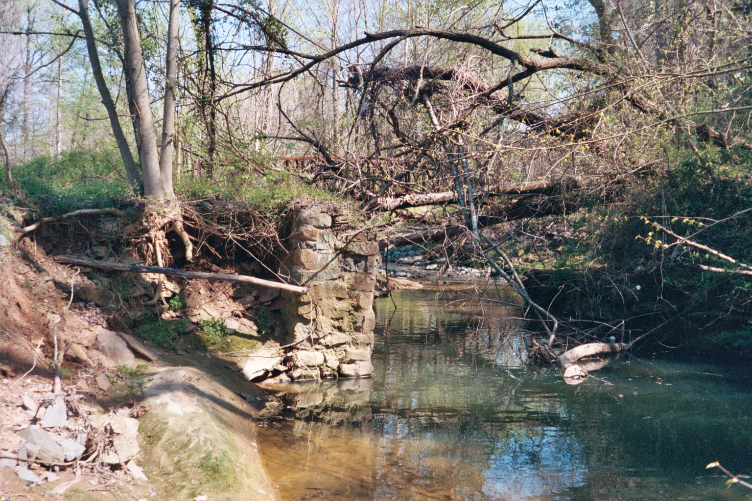
Well known to Park visitors are the modern facilities, such as the Visitors Center, Archeological Resource Center, and Natural History Resource Center; the historic structures , the reconstructed structures, the community and medical gardens, and the French and Indian War palisade fort. However, the results of an archeological assessment conducted by Wake Forest University in 2005 indicated there are also numerous archeological and historic resources along the floodplain and banks of Monarcas Creek that had not yet been recovered and preserved. Lateral erosion of the stream banks and scouring of floodplain sediments threatened to damage or destroy these important resources.
Finally, the stream is a central feature or focal point for various types of recreational activities (e.g., jogging, walking, biking, bird-watching, nature photography and historic tours). In its degraded condition it detracted from the aesthetic appeal of the natural setting the Park provides the citizens of this community.
As a site that has nationally significant archeological and historical resources, Historic Bethabara Park is working with Pilot View RC&D to restore Monarcas Creek and the adjacent floodplain ecosystem and to improve the overall conditions along the stream corridor within the boundaries of the park.
Assessment
- GIS Mapping and Analysis
- Evaluation of Historic Maps and Aerial Photographs
- Reconnaissance Surveys of the overall watershed including 5.7 miles (30,100 linear feet) of stream channel upstream of the Park
- Geomorphic Assessment of the 4,200 linear feet of Monarcas Creek that flows through Historic Bethabara Park
- Identifying and Surveying Reference Reaches in the Piedmont Region of North Carolina
- Geotechnical Studies
- Hydrologic and Hydraulic Analysis
- Estimating Sediment Loadings
- Historic Sediment Loading Estimates Based on Channel Adjustments
- Current and Future Sediment Loading Estimates Based on Near Bank Stress and Bank Erosion Predictions
- Identifying Opportunities for Stream, Floodplain and Wetland Restoration and Stormwater Management Retrofits
WATERSHED AND UPSTREAM REACHES
Until the 1950’s, Monarcas Creek watershed was predominantly forest and fields. Prior to this time period the headwater streams were probably fairly stable and sediment sources were probably limited to runoff from agricultural land. During the 1960’s, 70’s and 80’s forest and fields were converted to residential, commercial and industrial uses. The stream corridor along much of Monarcas Creek and its tributaries has remained wooded. However, the watershed has become highly urbanized. Single family residential and moderate to high density multi-family residential uses are typical of the neighborhoods adjacent to and immediately upstream of the Park. Commercial land uses (e.g., retail shopping centers, small businesses, car dealerships, gas stations, restaurants, etc.) and industrial (light manufacturing) are concentrated in the headwaters areas of the watershed and make up more than 40% of the overall land use.
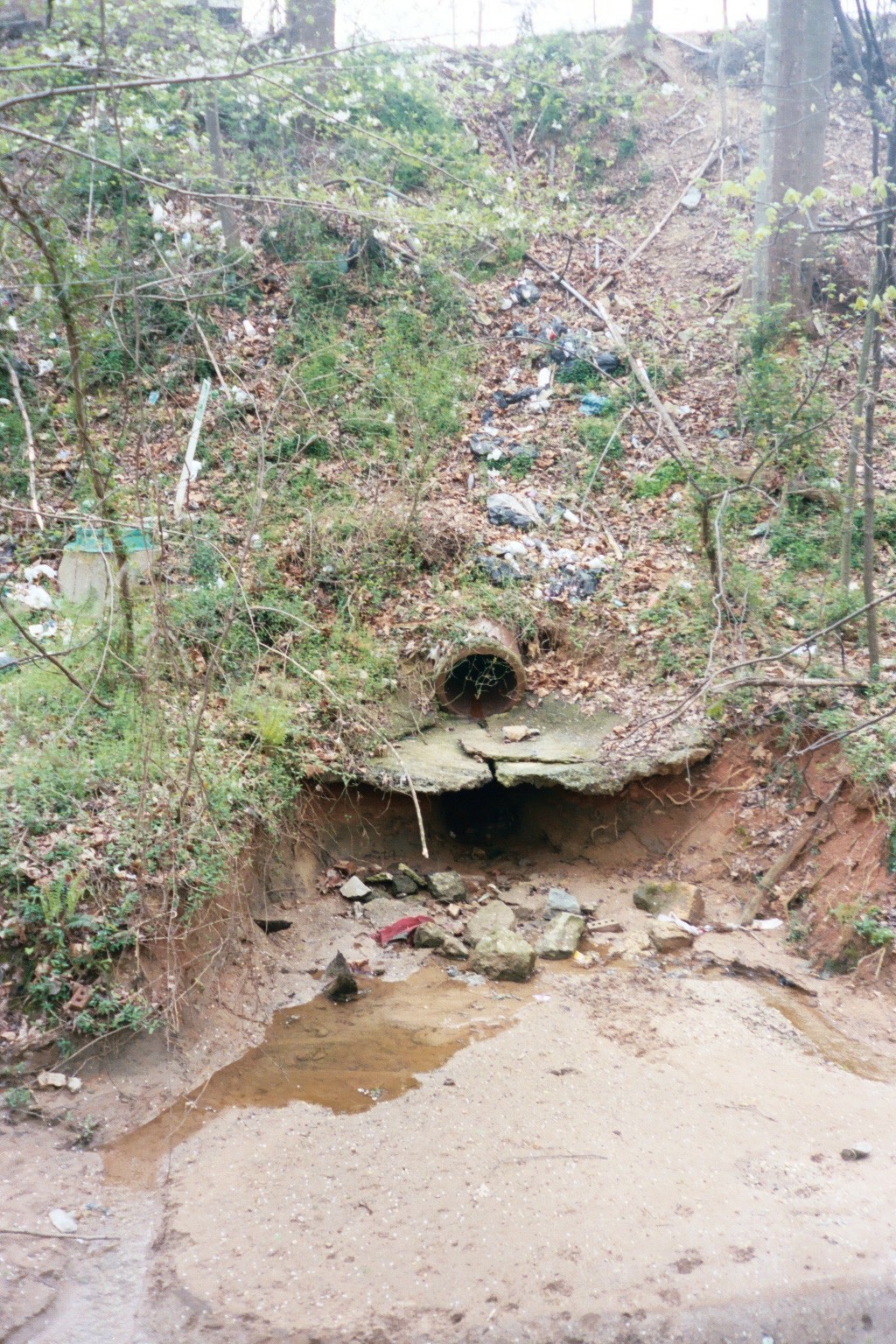
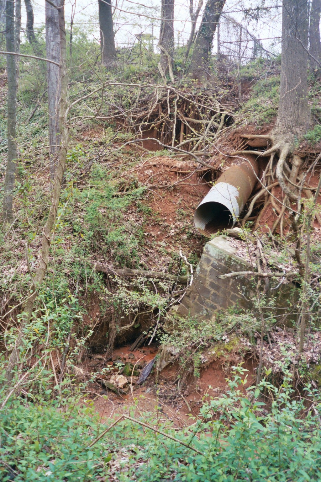
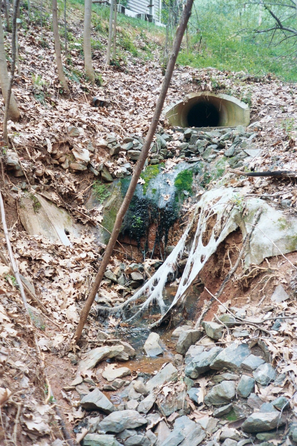
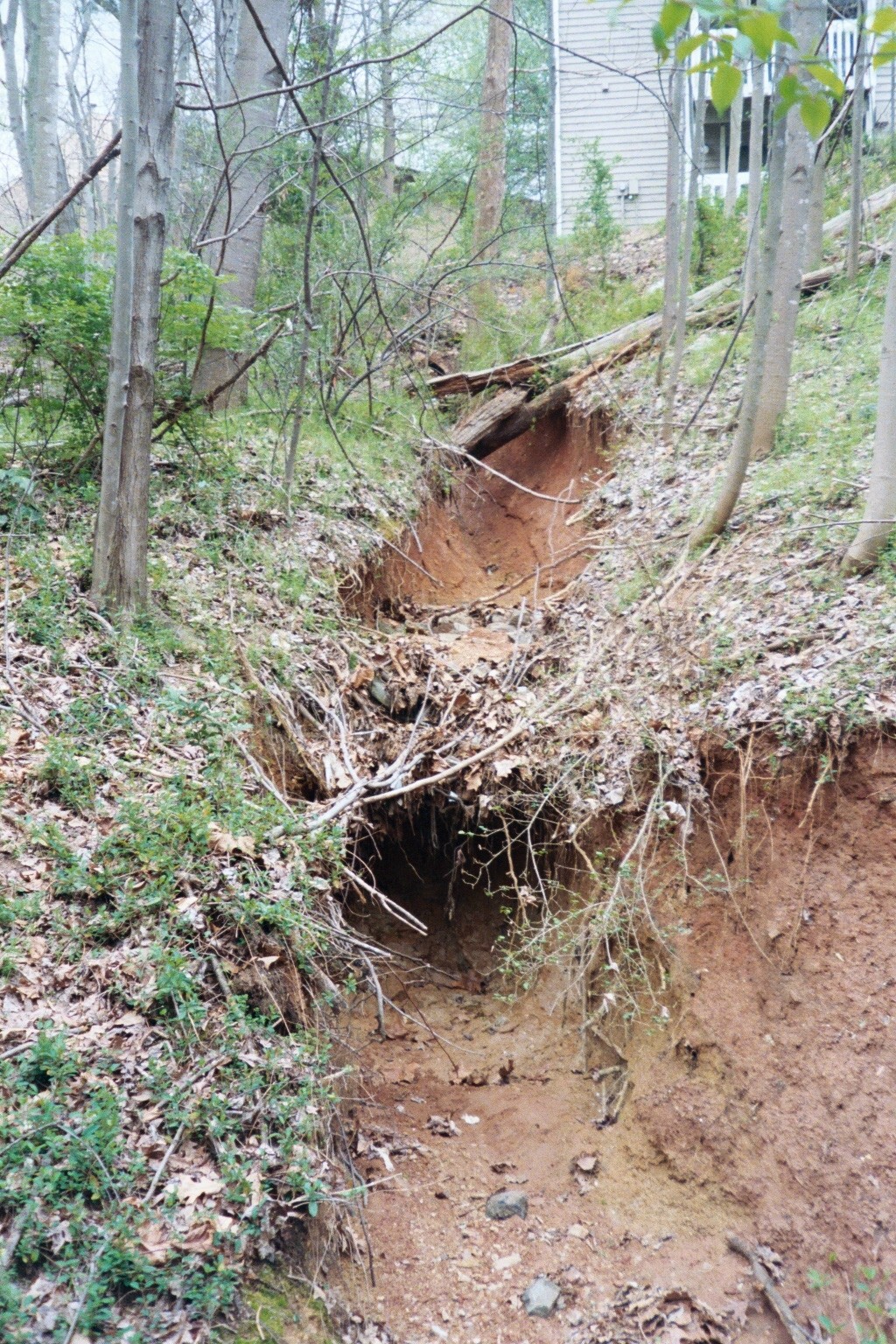
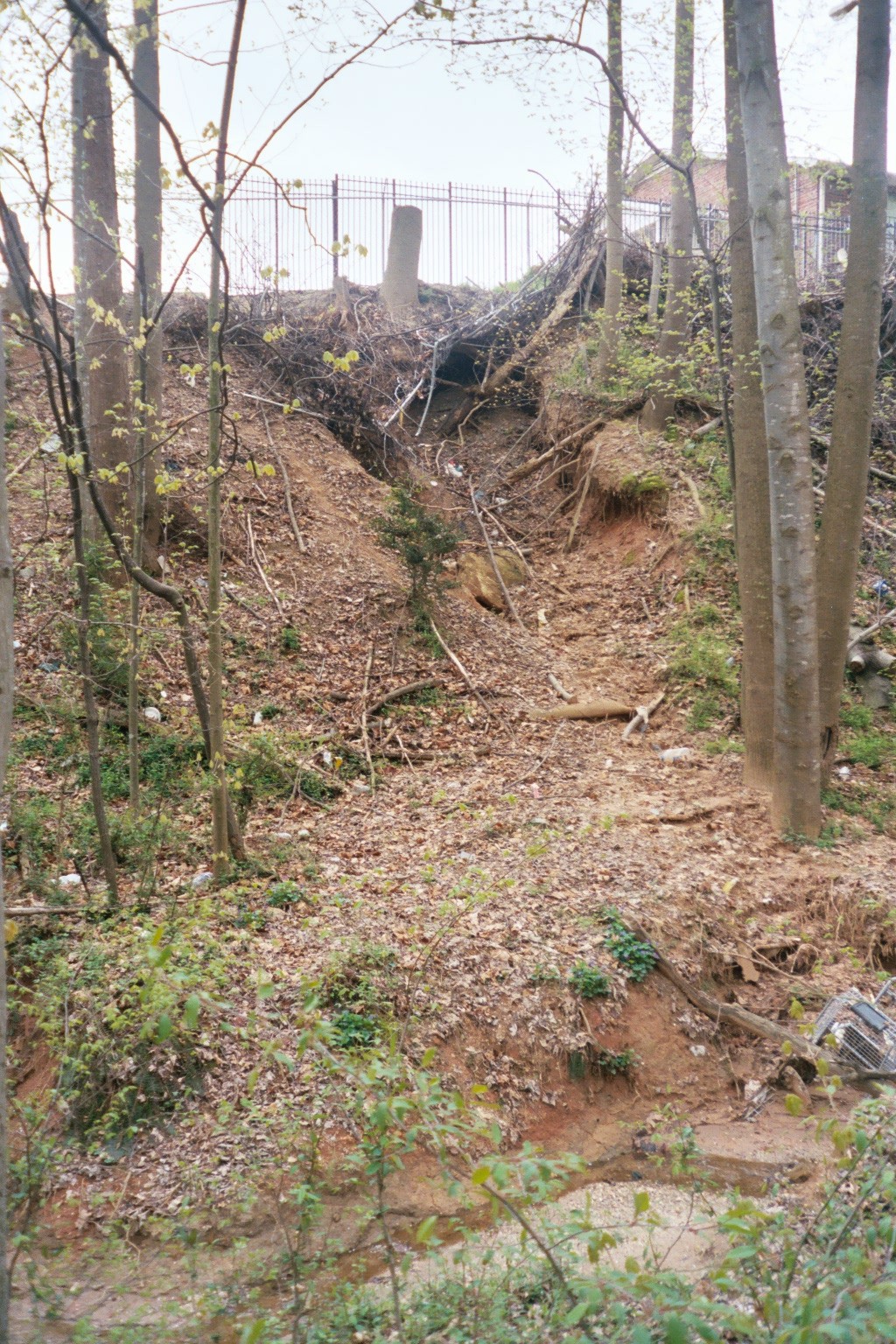
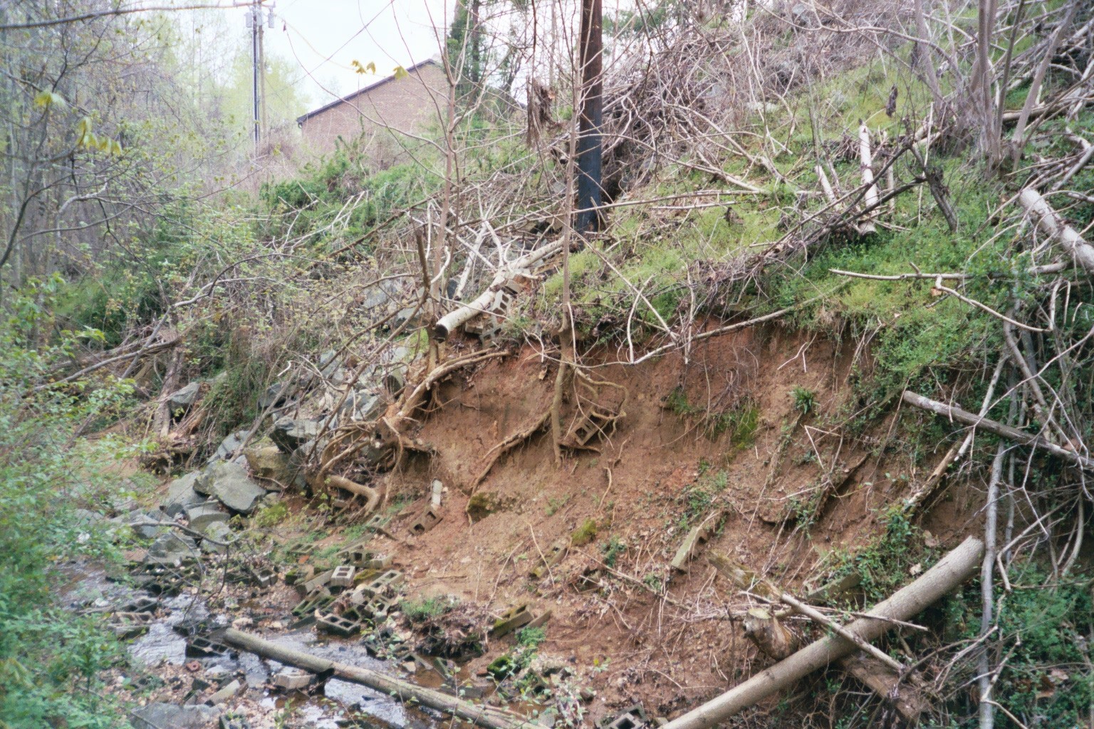
Because most of this development preceded stormwater management regulations,, the unmanaged runoff has caused significant channel instability along the stream reaches throughout the watershed. The current conditions in the Upper Monarcas Creek watershed are characterized as very unstable. Gully erosion, stream bank erosion and mass wasting of terraces and adjacent slopes are common problems along the tributaries draining subwatersheds where high percent impervious area and high density development are the dominant land uses.
Historic Bethabara Park Reaches
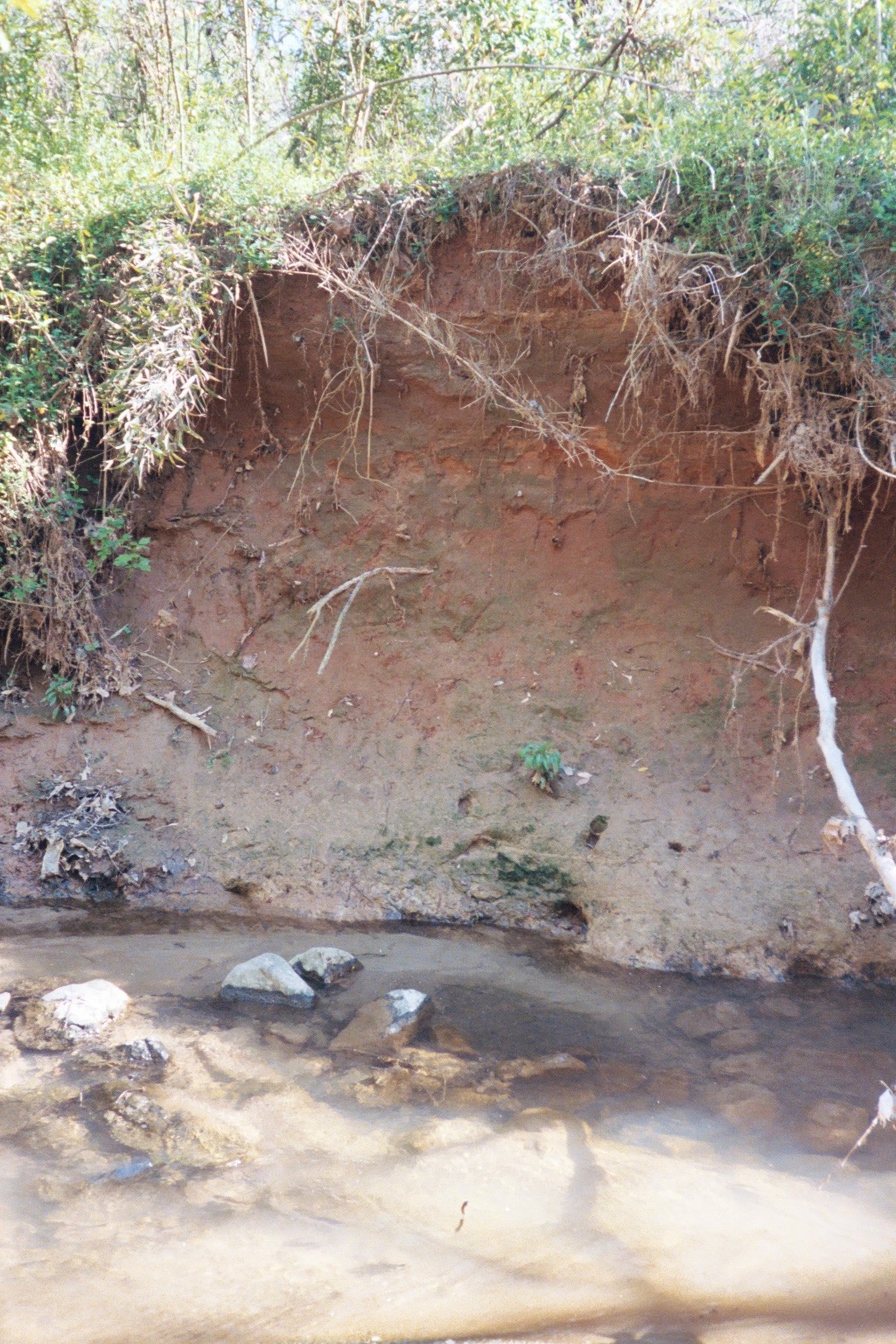
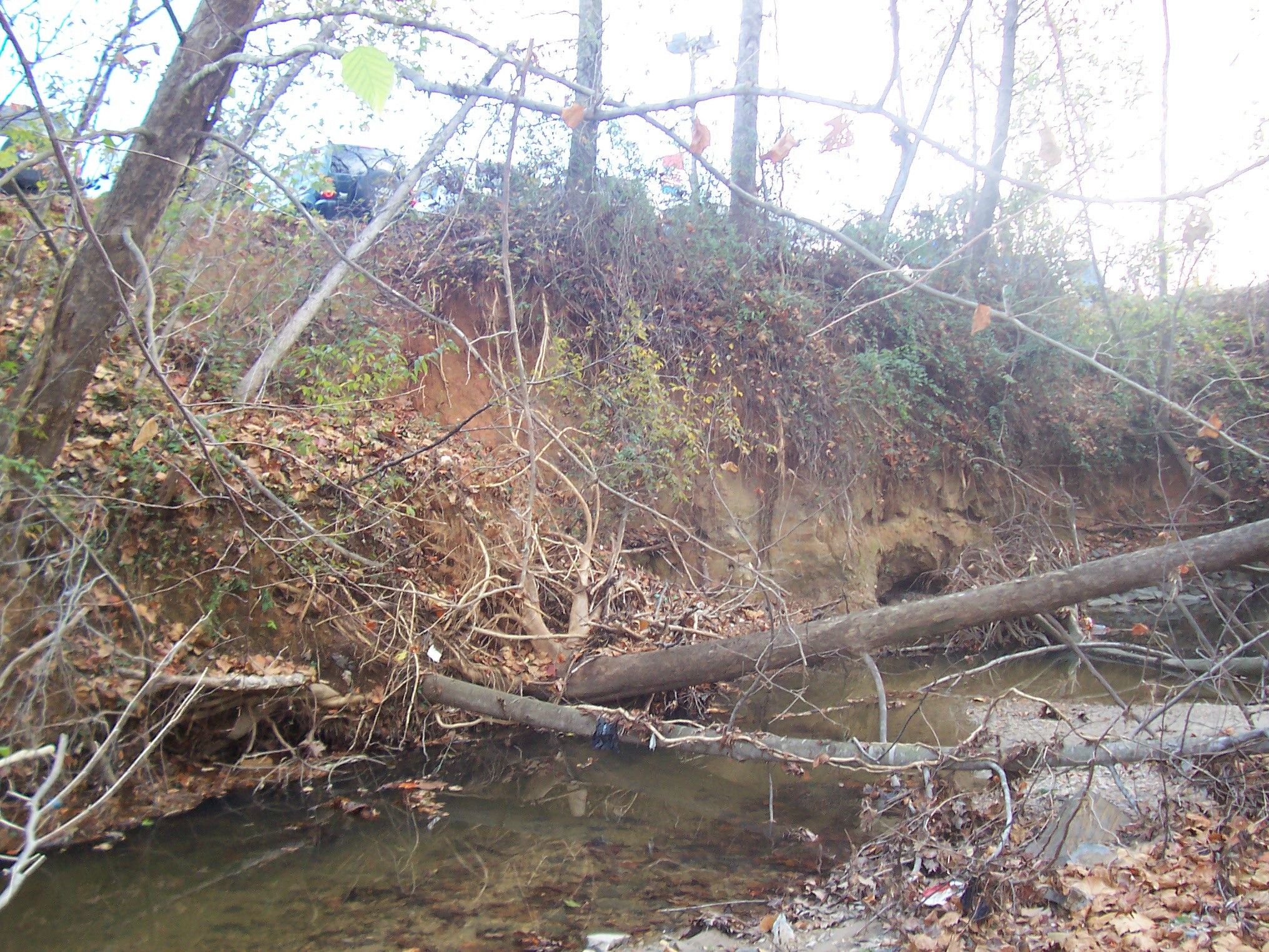
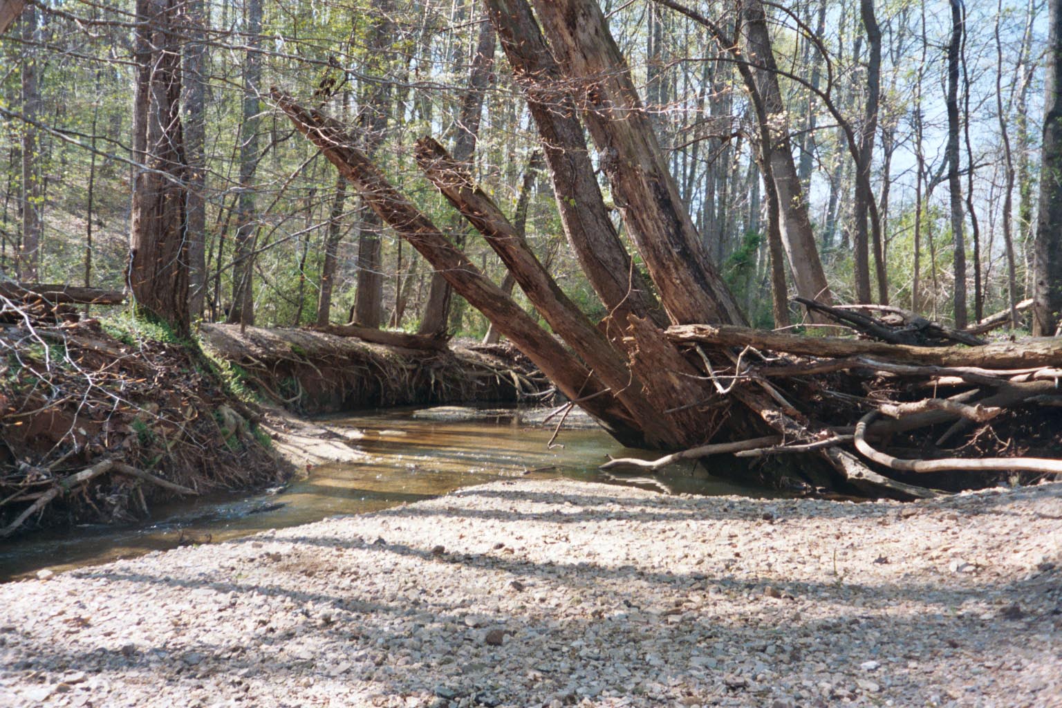
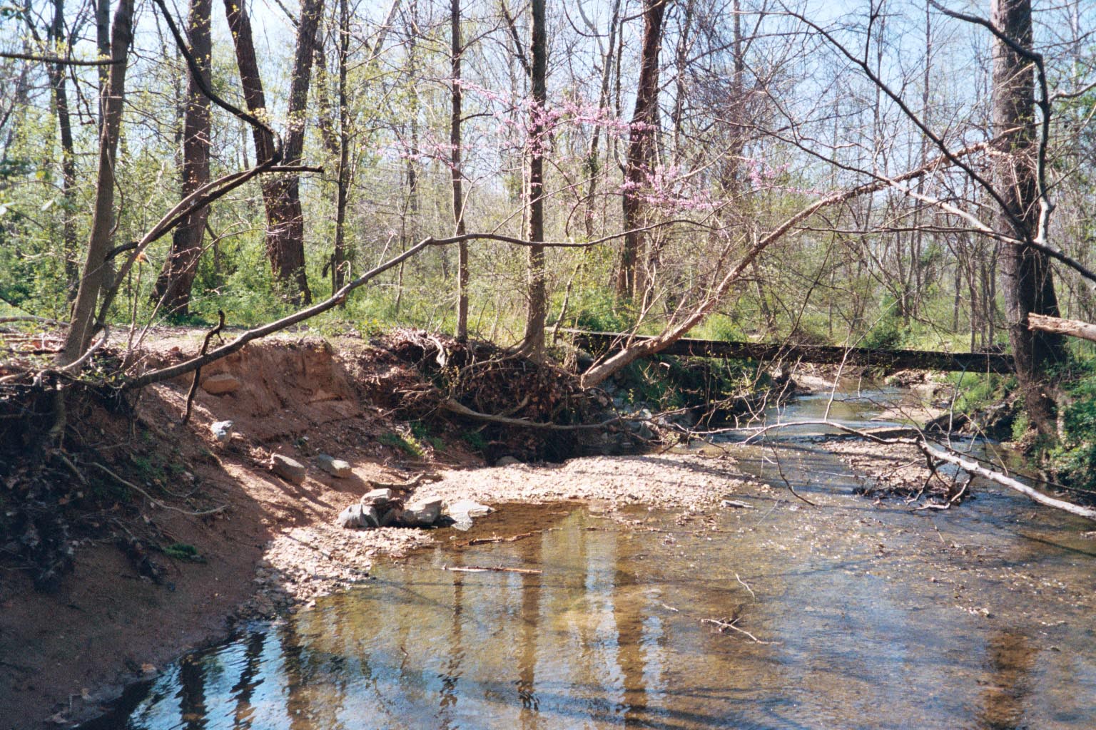
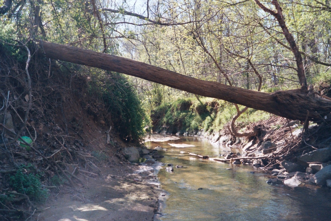
Monarcas Creek in Historic Bethabara Park, these reaches are characterized as very unstable. Stream bank erosion, lateral migration, channel blockages and debris jams, and streambed aggradation are common throughout. Although the bank and riparian vegetation along this reach is trees and shrubs, undercutting of banks, bank erosion, lateral migration, and toppling of trees into the channel is common throughout the reach. The potential for continued bank erosion, loss of trees and channel migration is high. Results of the stability assessment confirm that the banks along much of the project reaches have a high to extreme bank erosion potential.
The unstable conditions throughout the upper watershed and along Monarcas Creek in Historic Bethabara Park have severely degraded water quality and in-stream habitat and significantly altered the floodplain ecosystem within the Park. Public infrastructure has been damaged and nationally important archeological and historic resources are threatened with damage or destruction. Left uncorrected the stability problems in this watershed will continue to be a significant source of sediment to Mill Creek and Muddy Creek for decades.
RESTORATION AND MANAGEMENT PLAN
- Identification of Potential Stream Restoration Projects.
Potential projects were identified from a list of subwatershed and main stem problem sites identified during the assessment phase of the project. These projects were selected for their potential for correcting channel instability, reducing loadings of sediment and other pollutants, and reducing flooding problems in the Monarcas Creek watershed.
- Evaluating the Feasibility of Implementing Restoration Projects
The feasibility of implementing specific restoration and management measures at the selected problem sites was evaluated. This included a planning level, qualitative analysis used to screen the projects for ease of implementation, project cost and long-term maintenance, and landowner acceptance.
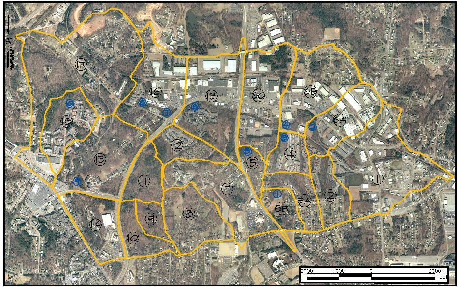
Those restoration and stabilization projects determined to be feasible were prioritized relative to the order in which they should be implemented. Thirteen stream restoration projects totaling 13,100 linear feet were identified in the upper watershed in addition to the 4,200 liner feet in the Park.
Based on the results of the assessment restoration conceptual design plans for the project reaches along Monarcas Creek in Historic Bethabara Park were developed. The concepts were modified to accommodate natural (bedrock outcrops, mature forest) and man-made (sanitary sewer, road crossings, greenway trail system) constraints. In addition, the Team coordinated with Wake Forest University Archeology Laboratories to avoid disturbance to the archeological and historic resources along the stream corridor.
Location of Stream Restoration Projects
- Identification of Potential Stormwater Management Measures for Monarcas Creek Watershed
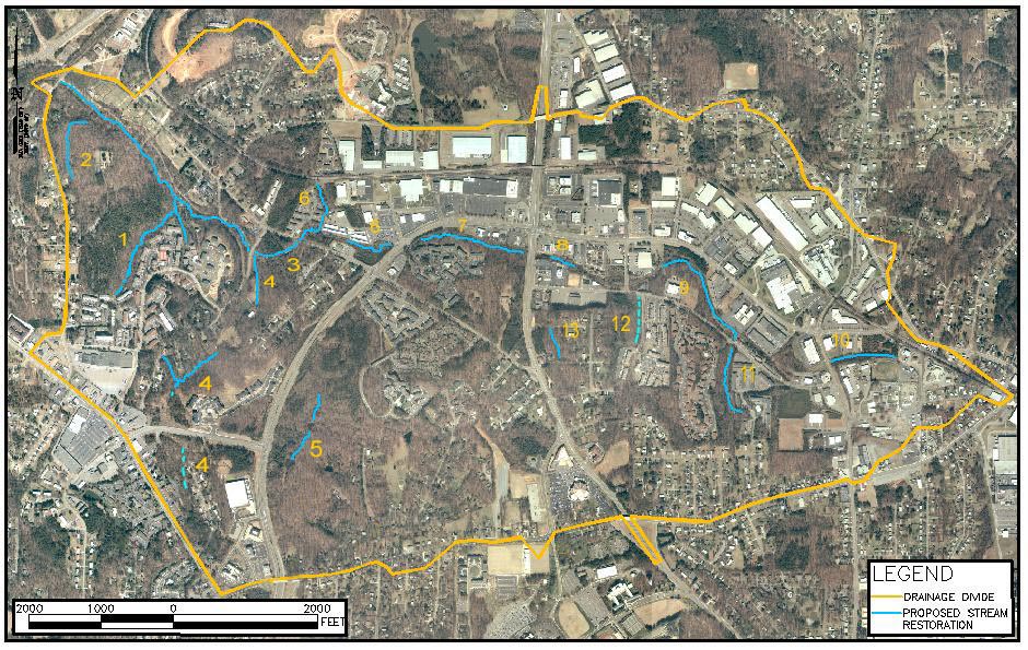
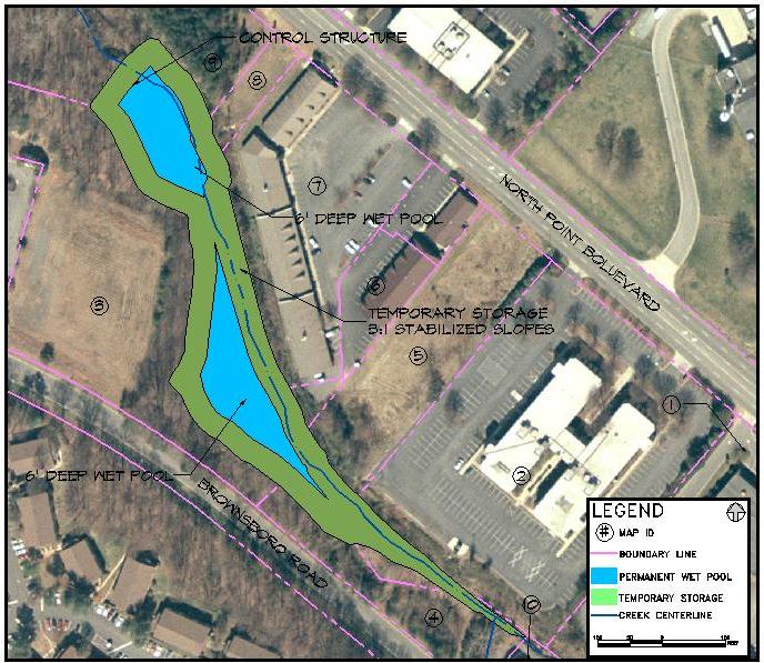
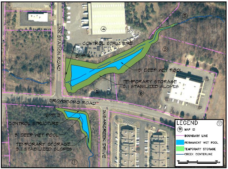
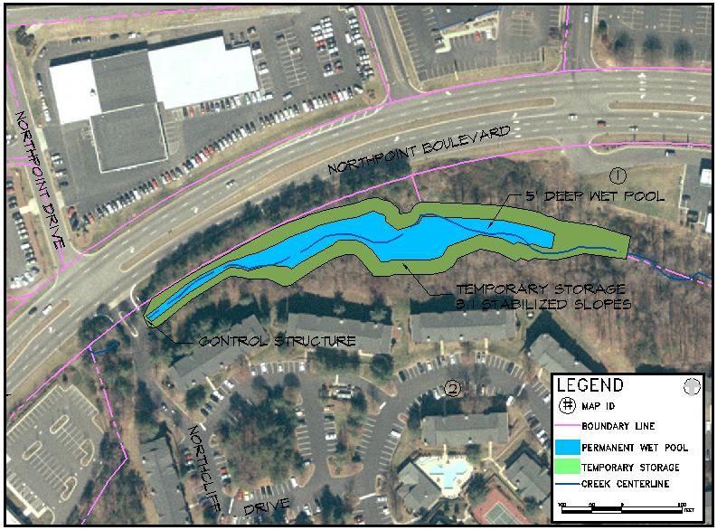
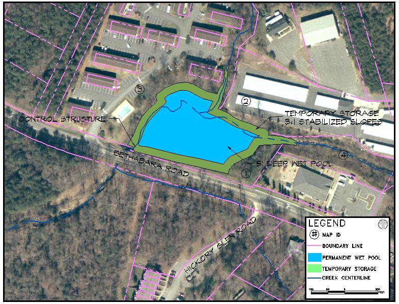
Ten (10) sites were identified for implementation of storm water control best management practices (BMPs) based upon field observations by CNA and Clear Creeks Consulting.
BMP’s include a wide range of structures and treatment options that can be used to control stormwater quality and quantity. For this study, BMP’s were analyzed based upon the ability to attenuate peak discharges while providing pollutant load removal for the lowest cost and lowest maintenance requirements over the life of the facility. The BMP that best obtains these goals is an extended wet detention pond.
Monarcas Creek Watershed Proposed BMP Locations
Preliminary Cost Estimates
Preliminary cost estimates for design, permitting and construction of the storm water wetland facilities and stream restoration projects were developed as a component of this study.
