Foster Branch
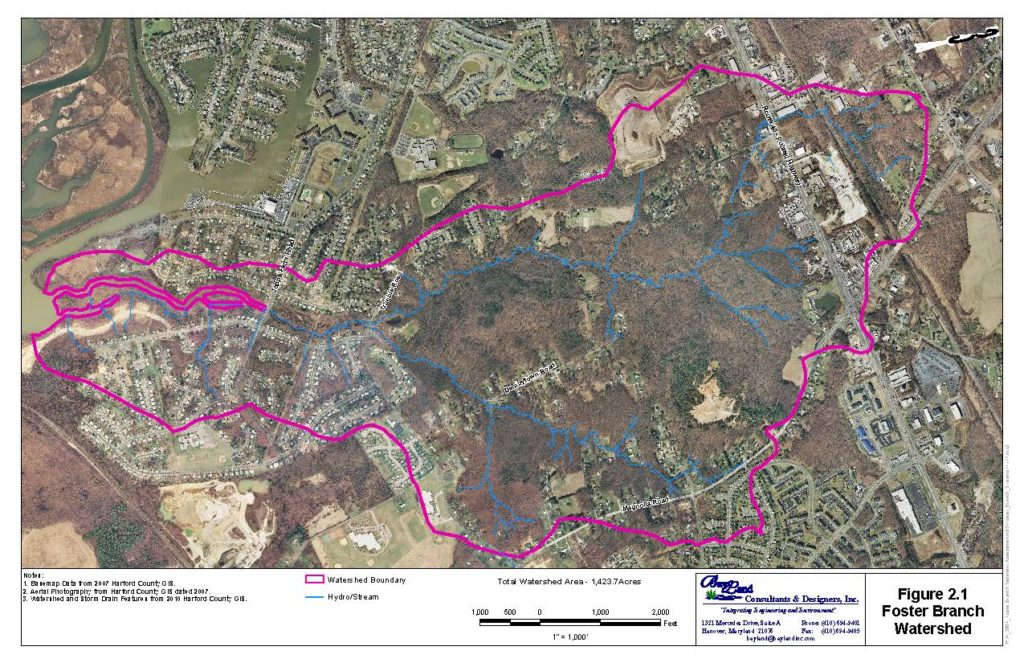
Foster Branch Watershed Assessment and Sediment Abatement Study
Joppatowne, MD
Harford County Department of Public Works
Foster Branch, a third order tributary to the Gunpowder River, is located in Joppatowne, Maryland. Clear Creeks Consulting teamed with BayLand Consultants and Designers to conduct an assessment of the 2.22 square miles (1,446 acres) mixed land use watershed. The focus of the study was to identify sources of sediment contributing to sedimentation in the tidal waters of the Gunpowder River. In addition, it focused on identifying opportunities for implementing stormwater retrofits, sediment retention facilities, and channel restoration projects. Mr. Powell served as the Senior Scientist and Restoration Design Specialist. He developed an assessment methodology specifically suited to the objectives of this study. He supervised and conducted the field reconnaissance, geomorphic mapping, stability assessment data collection, and developed estimates of sediment loadings by source. He identified and prioritized stream restoration projects and prepared cost estimates for those projects.
A Report of Findings and Recommendations for stream restoration, stormwater BMPs and other sediment reduction strategies was prepared. Design concepts, and preliminary cost estimates for design and construction for stormwater retrofits, sediment retention facilities, and channel restoration projects were developed. The field work and report were completed in 2011.
PROJECT OBJECTIVES
Over the last four decades the Joppatowne area, as well as Harford County in general has experienced a rapid growth in population that has transformed this once rural area to suburban, residential and commercial land uses. These changes have had a tremendous effect on the natural resources of the County. In particular, increased sedimentation from construction activities, stream channel erosion in response to increased storm water runoff, and an overall increase in pollutant loadings due to the conversion from forest and cultivated land to residential and commercial uses have significantly degraded the water quality, reduced flood storage capacity, and damaged public infrastructure as well as public and private land along the County’s stream corridors. Of particular concern is the contribution unstable headwater streams make to sedimentation problems in tidal creeks that necessitate costly maintenance dredging.
In response to these concerns, the Harford County Department of Public Works, Water Resources Engineering have focused their efforts on identifying water quality problems and developing strategies for correcting those problems. In addition, the Department of Public Works initiated capital improvement programs focused on remediation of erosion and sedimentation problems caused by uncontrolled or inadequately controlled stormwater runoff.
It is the intention of the Harford County Department of Public Works, Water Resources Engineering to control runoff from developed areas, to correct stream channel instability problems, to reduce sediment loadings, and to improve the overall water quality of Foster Branch and the Gunpowder River.
Assessment
- GIS Mapping and Analysis
- Evaluation of Historic Aerial Photographs
- Field Reconnaissance and Geomorphic Mapping of 8.64 miles (45,610 LF) of stream channels
- Level II Morphological Survey and Level III Channel Stability Assessments along representative reaches
- Sediment Loading Estimates Calculated for Sources by Subwatershed
- Ranking of Subwatersheds, Stream Reaches and Stream Sections
- Preliminary Hydrologic Analyses
- Identification of Opportunities for Potential Stream Restoration Projects and Potential Stormwater BMPs and Sediment Retention Facilities
Evaluation of Upland Conditions
- The Foster Branch watershed is characterized by rolling to steep topography and highly erodible soils.
- High percent of imperviousness in headwaters and along the eastern tributaries
- Most development predated stormwater management regulations, little control of runoff
- Former sand and gravel mining areas still evident.
Evaluation of In-Channel Conditions
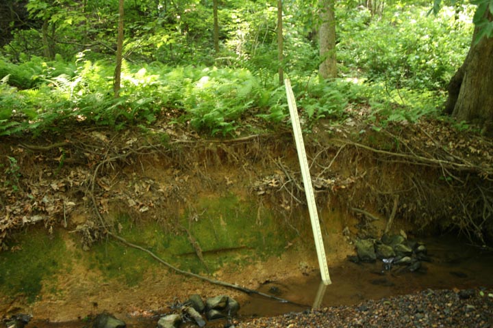
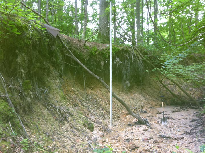
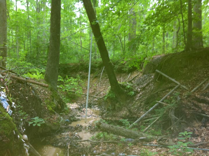
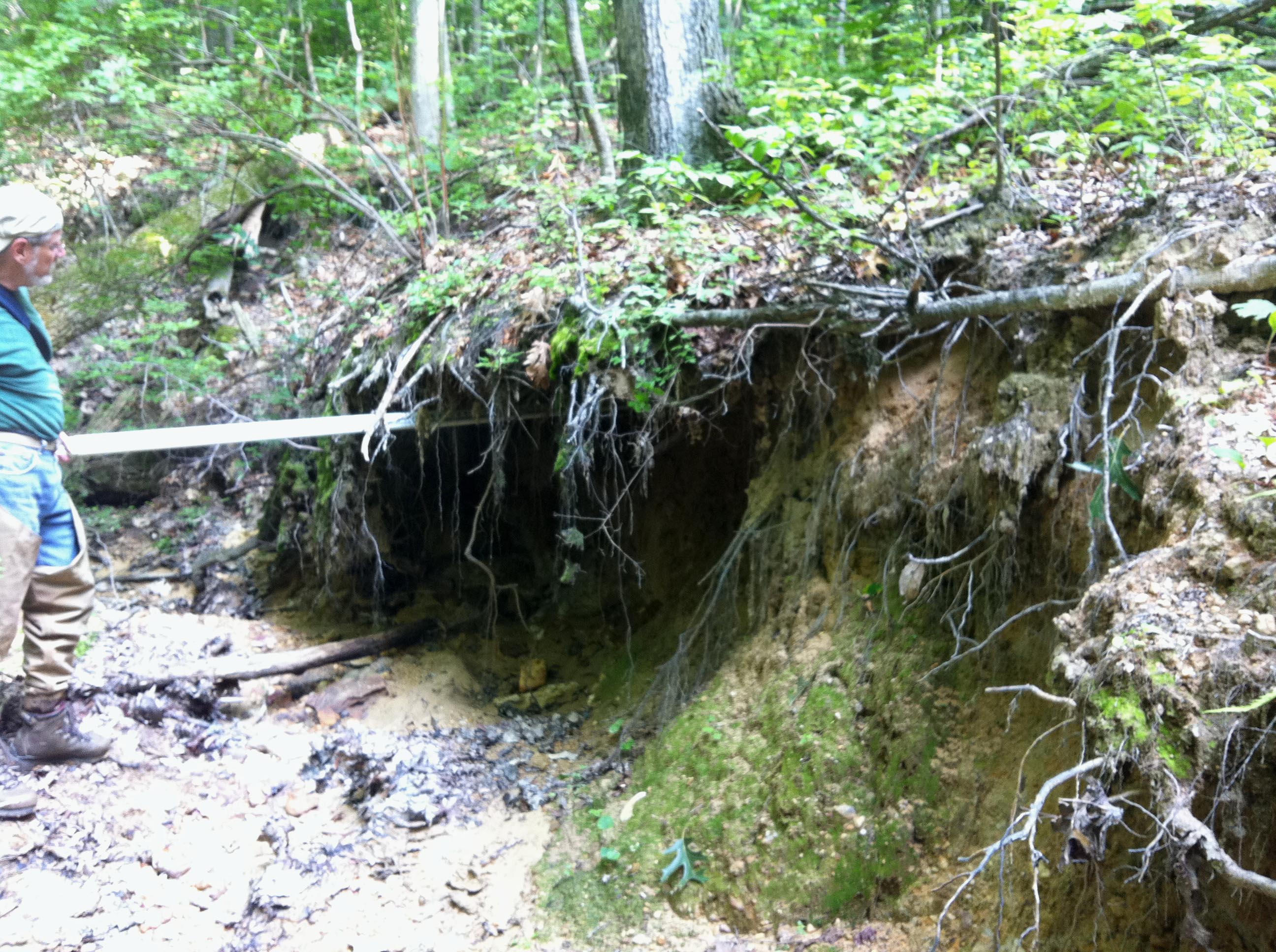
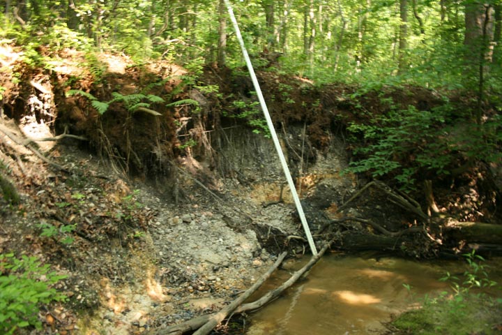
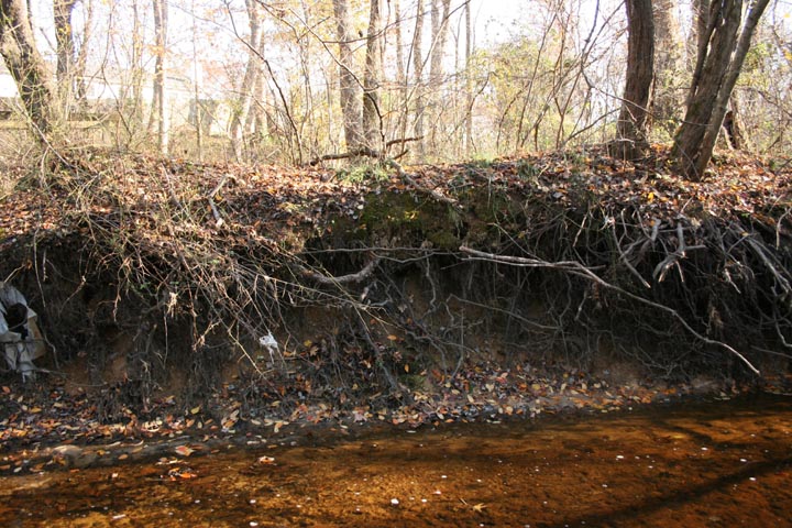
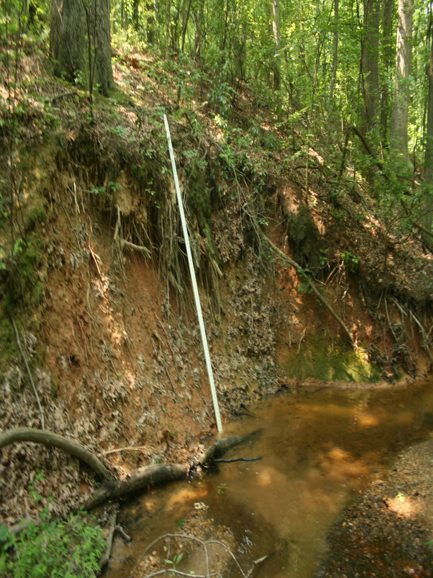
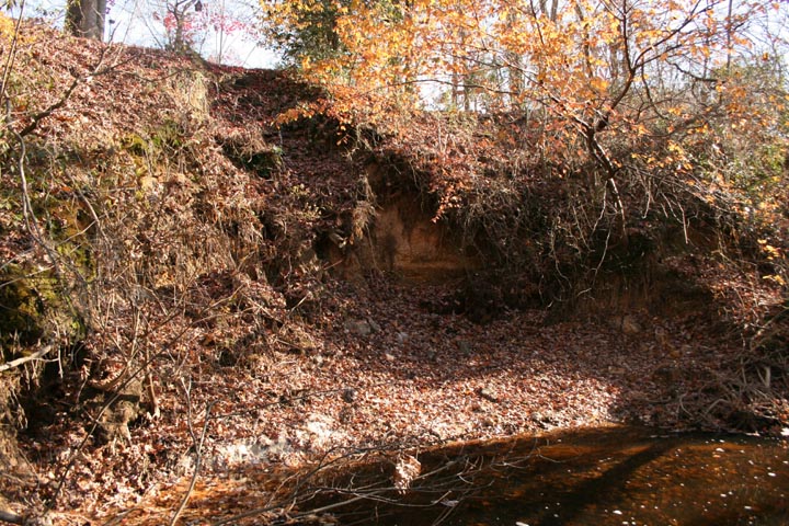
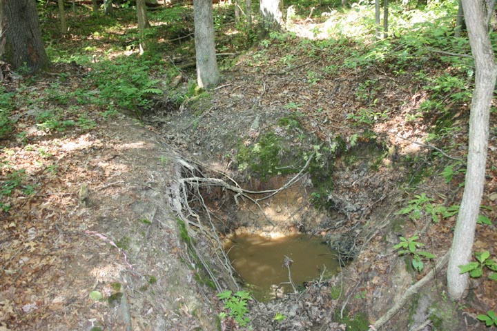
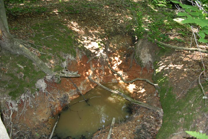
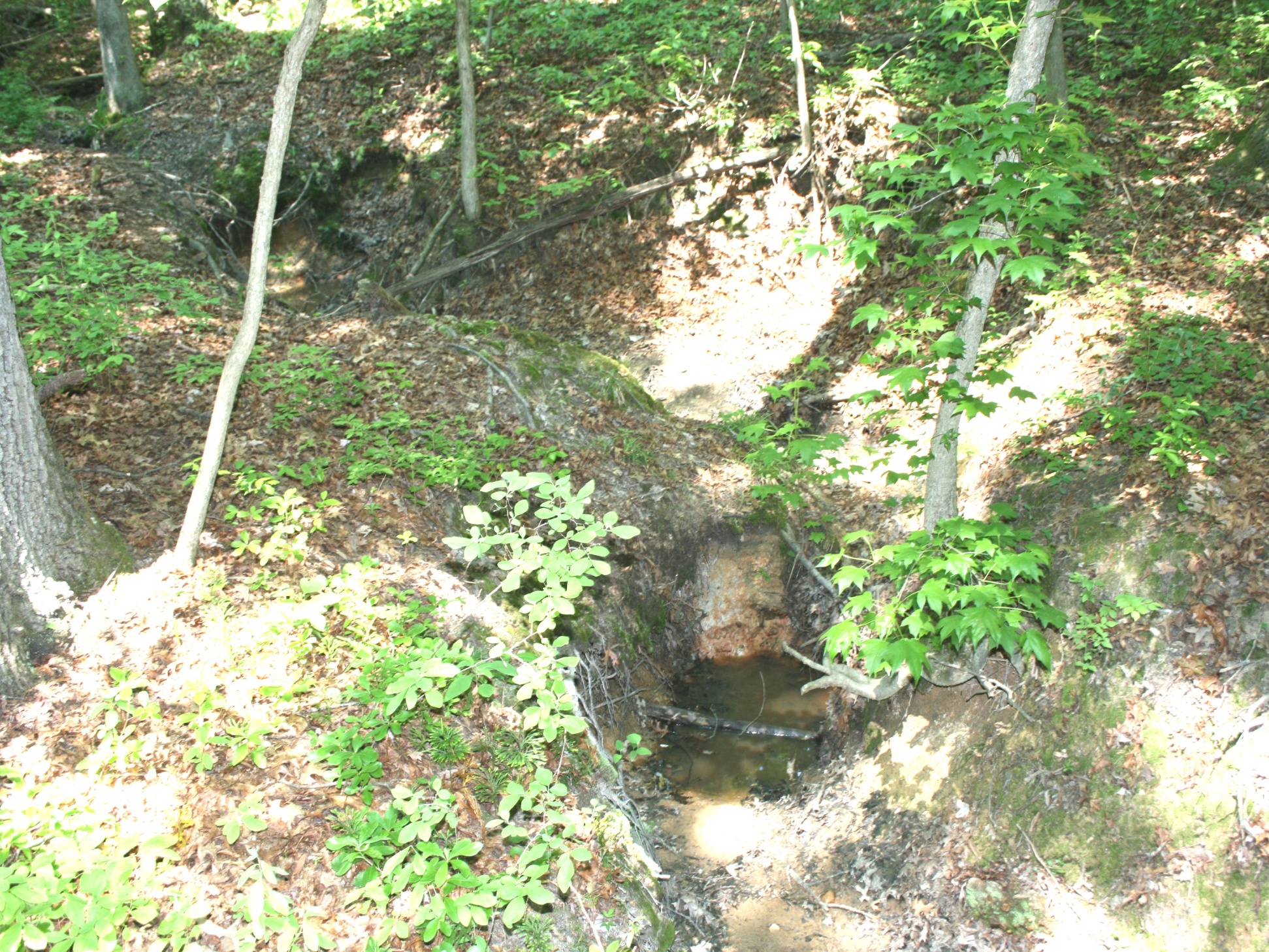
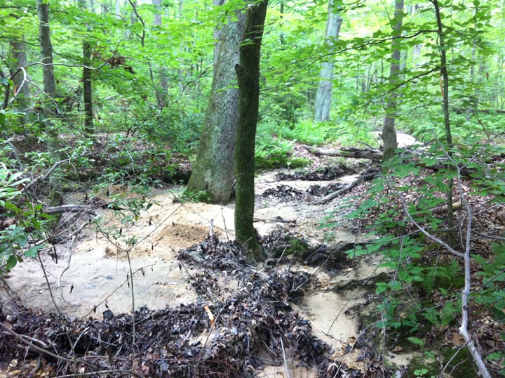
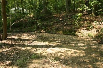
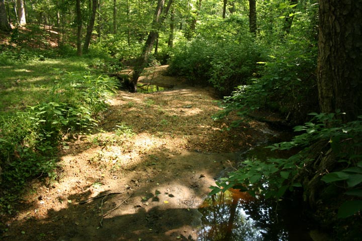
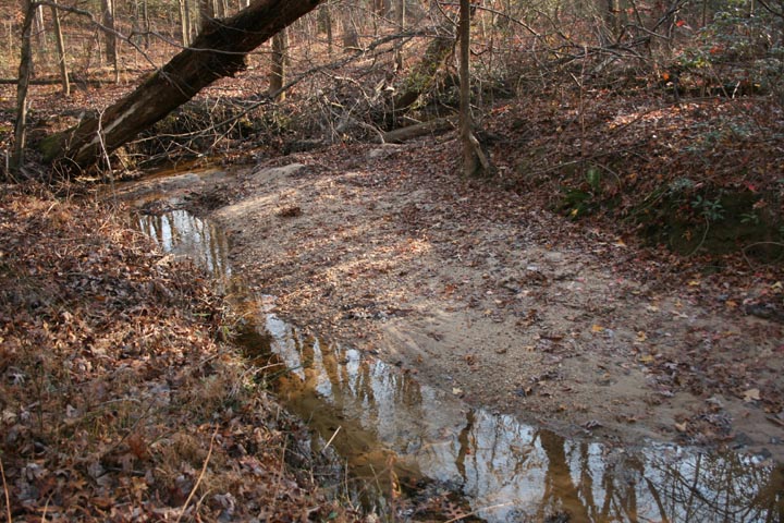
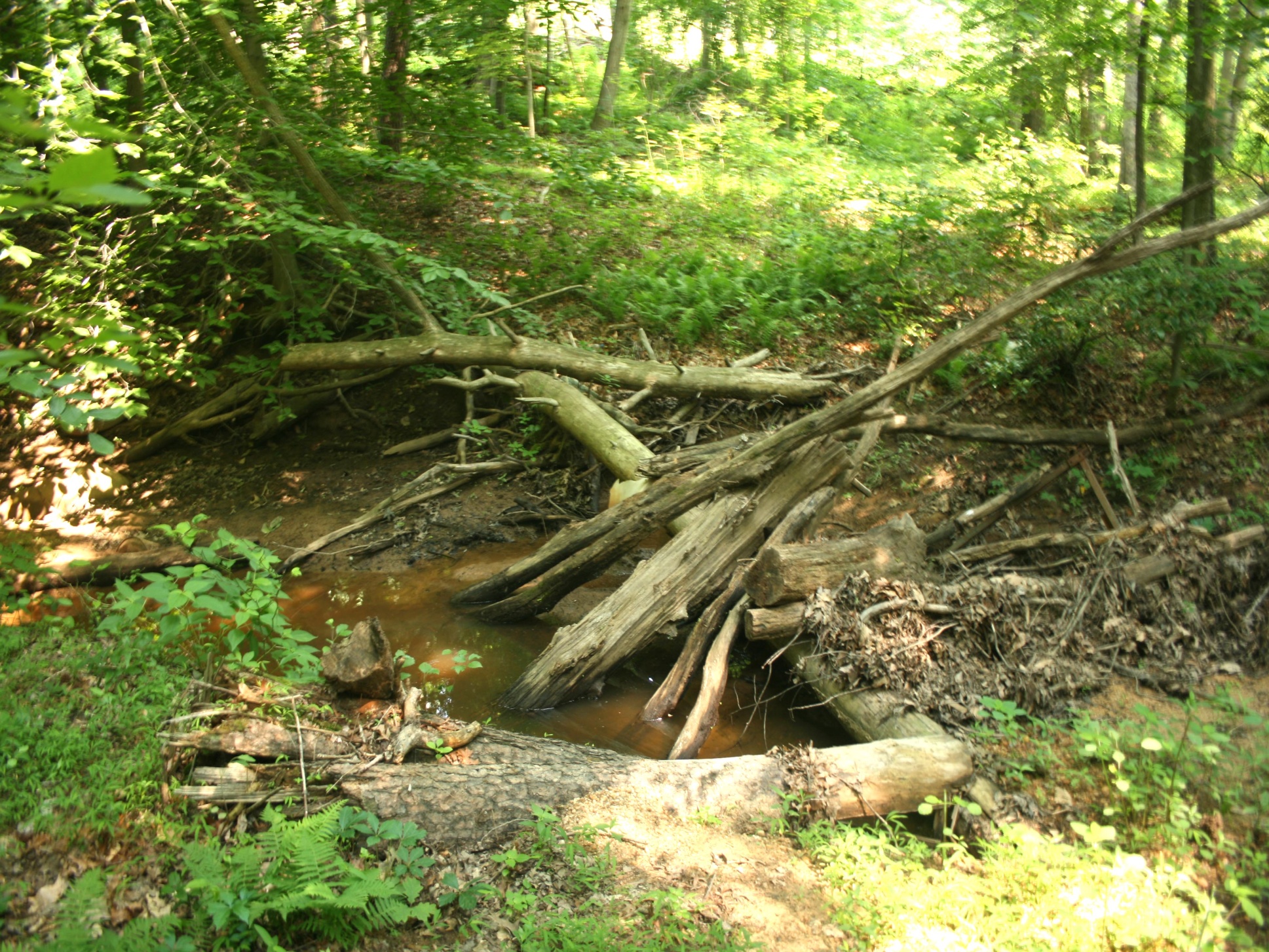
- In-channel erosion most significant source of sediment to the tidal portion of Foster Branch.
- Majority of the stream channels throughout the watershed are unstable characterized by extensive streambank erosion, sediment deposition, debris jams, and active head-cuts.
- Detailed geomorphic assessment approach utilized for this study provided a cost-effective and reasonably reliable method for identifying sediment sources and estimating sediment loadings.
Pollutant Loading Analysis
- The assessment methodology utilized in this study involved the collection of data along all stream reaches in the watershed, thereby ensuring that the sediment load estimates developed represent the conditions throughout the Foster Branch Watershed.
- The results of the study indicated that a total of 6,090 cubic yards of sediment is contributed annually from in-channel sources (i.e., stream bank erosion, slope failures, head cuts, and remobilization of sediment bars ). Equates to 1,025 cubic yards of bed load material moving into the tidal creek each year.
- Bank erosion contributes the largest volume of sediment, 5,673 cubic yards of sediment annually.
- Head cuts, remobilized sediment bars and slope failures contribute an additional 417 cubic yards annually.
- Pollutant Loading Reductions were calculated for the restoration projects and SWM BMPs.
- Implementing all of the identified projects would results in TN, TP and TSS reductions of 14%, 27% and 47%, respectively.
Identification of Sediment Abatement Strategies
Identification and Prioritization of Channel Restoration Projects
- Identification and ranking of projects was based on the sediment loadings analysis.
- The evaluation included tabulating the contribution of sediment from individual eroding banks, slope failures, head cuts and bar deposition within a given reach.
- Those stream reaches determined to be the most significant contributors were flagged for further evaluation and ranking. Those stream reaches determined to have smaller contributions were not evaluated further.
- Ranking flagged stream reaches involved two major criteria: Proximity to the tidal creek; Channel evolution model determined current stage of evolution relative greater or lesser instability.
- The unstable stream reaches were ranked in descending order from highest to lowest degree of instability.
- The feasibility of implementing specific restoration projects at the selected problem sites was evaluated.
- Nineteen (19) stream restoration projects were determined to be feasible, totaling 11,000 LF.
- Preliminary cost estimates developed for design and permitting, as well as construction.
Stormwater Best Management Practices
- Results of the stormwater investigation determined management approach should focus on upstream areas particularly in the largest sediment producing subsheds.
- Stormwater facilities to be sighted immediately upstream of severely degraded stream reaches to attenuate peak flows and reduce erosion and downstream sedimentation.
- Five sites were identified for SWM BMPs.
- Preliminary cost estimates were developed for design and permitting, as well as construction.
Sediment Collection and Retention Facilities
- Two In-Line facilities were evaluated. Significant area exists within the floodplain to construct in-line retention facilities. However, stream slope, local topography and site restrictions limited the magnitude of sediment storage available without significant excavation, cost and impacts to forest. The in-line sites were eliminated from further study.
- Two Off-line facilities were considered in the downstream portion of the watershed where they would have the greatest opportunity to capture bed load sediment prior to entering the tidal waterway. An existing man-made pond located on the West Branch and a similarly situated site on the East Branch. Both locations had favorable access and topography along the stream to allow placement of an off-line facility.
- The project team had experience with development of a highly successful off-line sediment entrainment system designed to capture bed load for a stream restoration project in North Carolina. The system incorporates a sediment vortex device installed in an upstream bed location allowing bed load transported during storm events to be captured and carried to an off-line pond. Concept Plans were prepared for these facilities.
- Preliminary cost estimates were developed for design and permitting, as well as construction.
